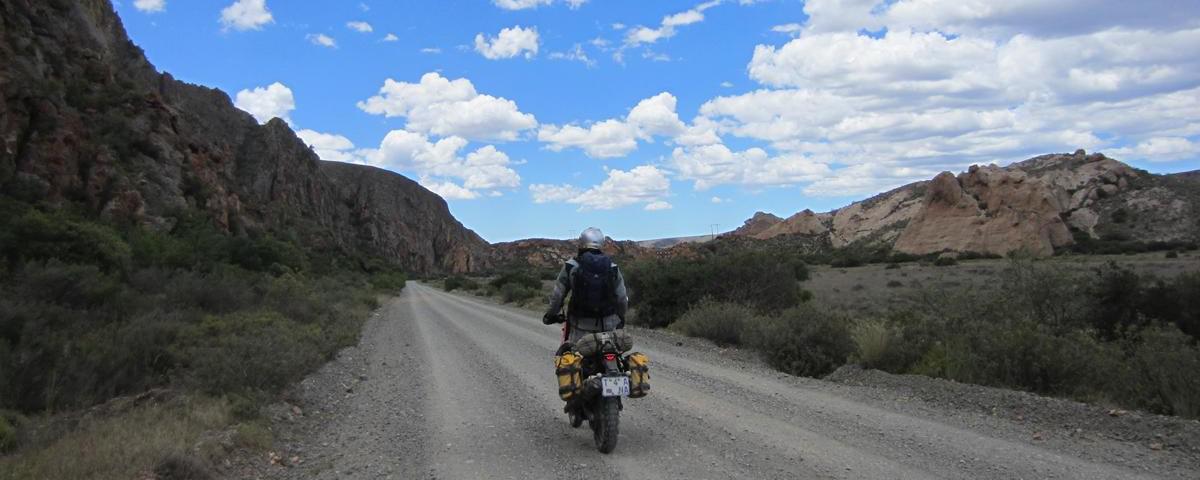
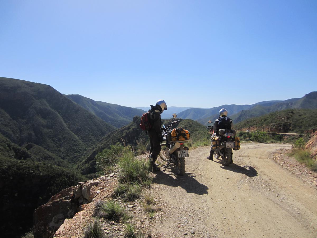
My heart is pounding in my ears, softening the hoarse roar of the second gear of the 250XT underneath me. My hands are sweating in the gloves and my arms aching from clutching to the steering. I have to open up in order to have enough momentum to get the bike to the top of Baviaanskloof but at the same time I have to manoeuvre short, sharp curves with a towering mountain face on my right and a steep abyss to my left. To a novice rider this is nerve wrecking stuff! By Karin Theron
Also read: The right GPS for navigation with Tracks4Africa maps

The sense of achievement when I get to the top is almost overwhelming. The road is marked on the Tracks4Africa map as serious 4WD, and with good reason. This is day three of our trip and by this time I am mentally and physically well prepared for the challenge of riding Baviaanskloof.
After this hectic ride out of Baviaans, I was christened at a low level bridge in the Witrivier River by my experienced fellow riders for losing my status as a novice rider. They reckon that I am now ready to do their next Kaokoland trip with them. They rate Baviaans 6/10 compared to 8/10 for Van Zyl’s Pass in Kaokoland in terms of technical riding skills required to do the route.
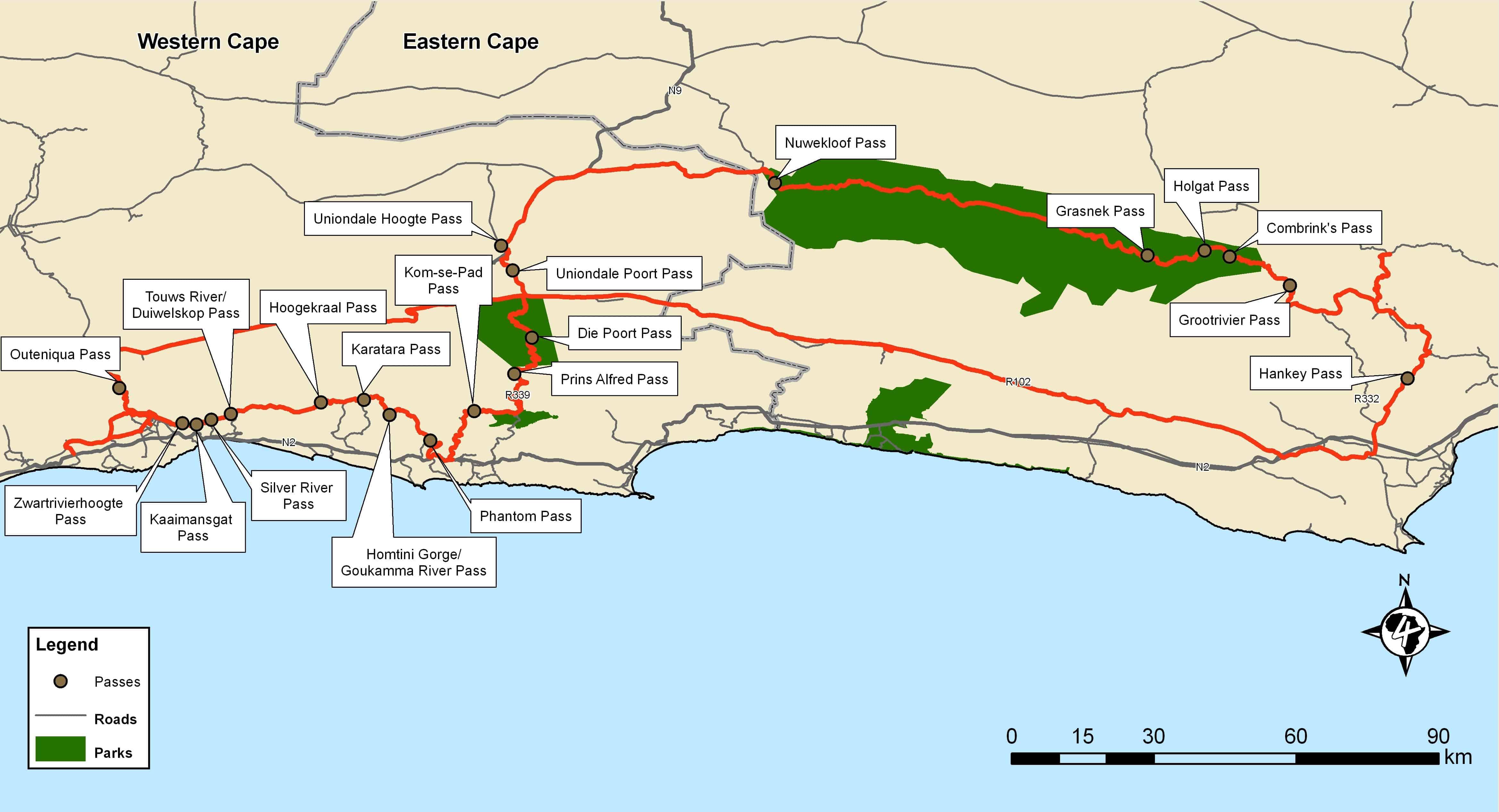
Seven passes between George and Knysna
I joined a group of experienced rider friends on their trip which started out in George. The main aim was to ride scenic backroads to Baviaanskloof that include a total of 20 passes!
From George we travelled the Seven Passes road to Knysna, which is the scenic old road between George and Knysna. It is a beautiful road that winds underneath a canopy of dark green trees.
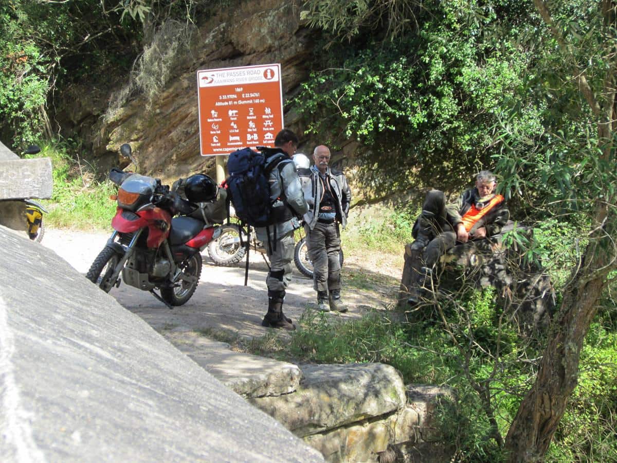


This stunning route, which is mostly gravel, in fact includes eight passes: Zwartrivierhoogte Pass, Kaaimansgat Pass, Silver River Pass, Duiwelskop Pass, Hoogekraal Pass, Karatara Pass, Homtini Pass and then the route ends with Phantom Pass just outside Knysna. You cross seven bridges on this route; maybe that is why they call it the Seven Passes road. At Karatara we enjoyed ice cold drinks at the Highland Home and Liquor Store.
Riding through the Tsitsikamma Forest
After a late breakfast at the Simola Hotel, we travelled the R339 towards Uniondale. We rode mostly through forest area, which reminds one of the stories of Dalene Matthee. In Toorbos, Kom-se-bos and Diepwalle giant ferns line the road and ancient trees like Camdeboo, Yellow Wood and Candle Wood form a canopy over your head. This gravel road is beautiful but at some places quite tricky with loose sand and loose rocks.
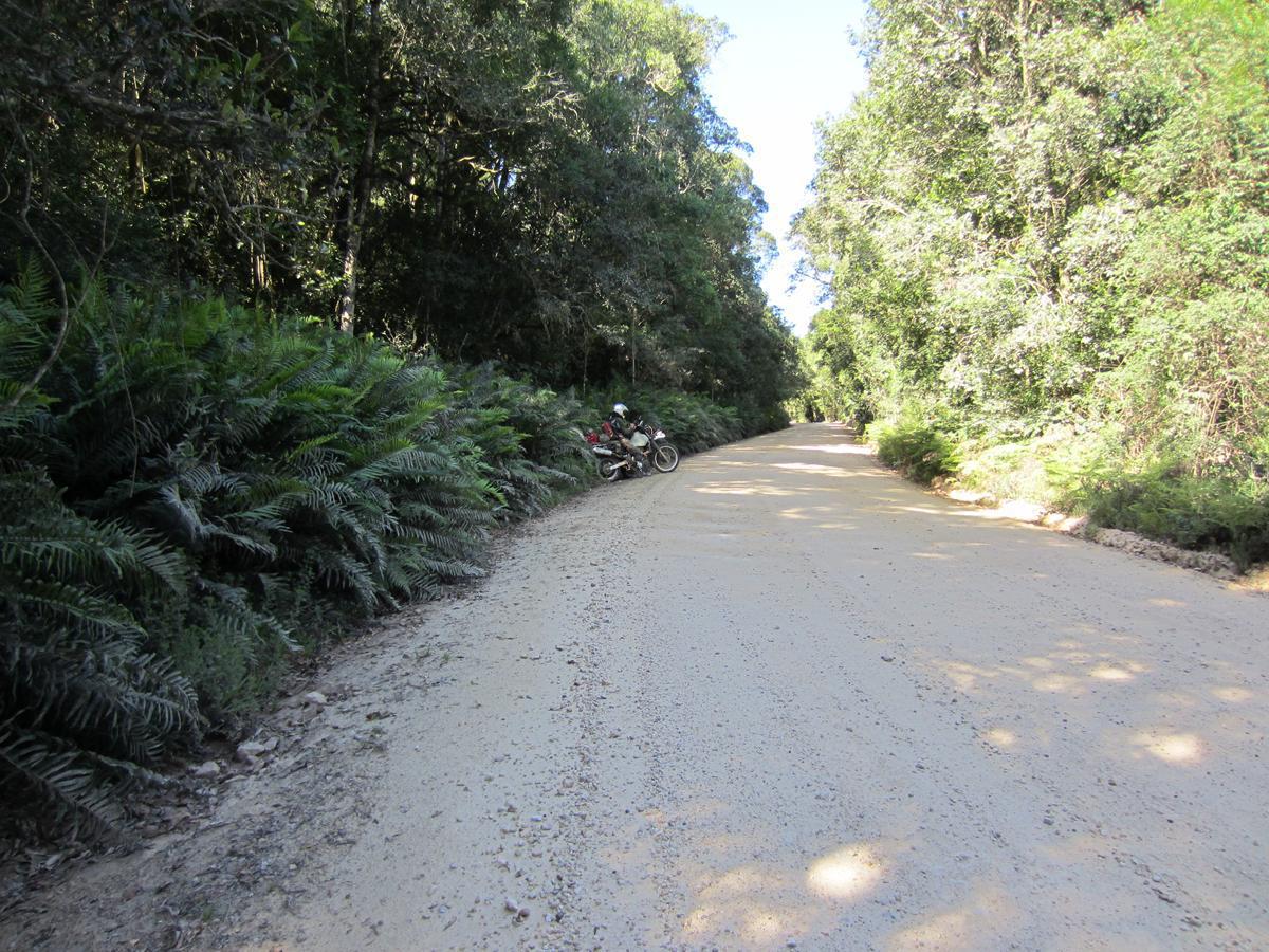
This forest reminds so much of Matthee’s stories that one almost expects to see an elephant in the road at any minute. When you stop and switch off the bikes, you can hear the birds above the quiet whisper of the forest.
From Diepwalle the Prince Alfred Pass leads to De Vlugt where we camped at Angie’s G-Spot. Angie offers rustic rooms and campsites, a bar and restaurant. This is a beautiful setting in the Middle Keurbooms Conservancy.
Also read: All you need to know about the Otter Trail
Baviaanskloof Nature Reserve
The next morning we stopped for a nice brunch at Uniondale en-route to Baviaanskloof. The Baviaanskloof Nature Reserve covers an area of approximately 200 square kilometers and has more than a thousand different plant species. You can read more about Baviaanskloof at http://www.baviaanskloof.net/index.htm
The kloof offers a beautiful landscape and a true wilderness experience. Braam Ellis, who is from Oshakati in the far north of Namibia, enjoyed the magnificence of the Baviaans so much that he is determined to return. “It is extremely beautiful and a very enjoyable route to ride with a motorcycle,” he says.
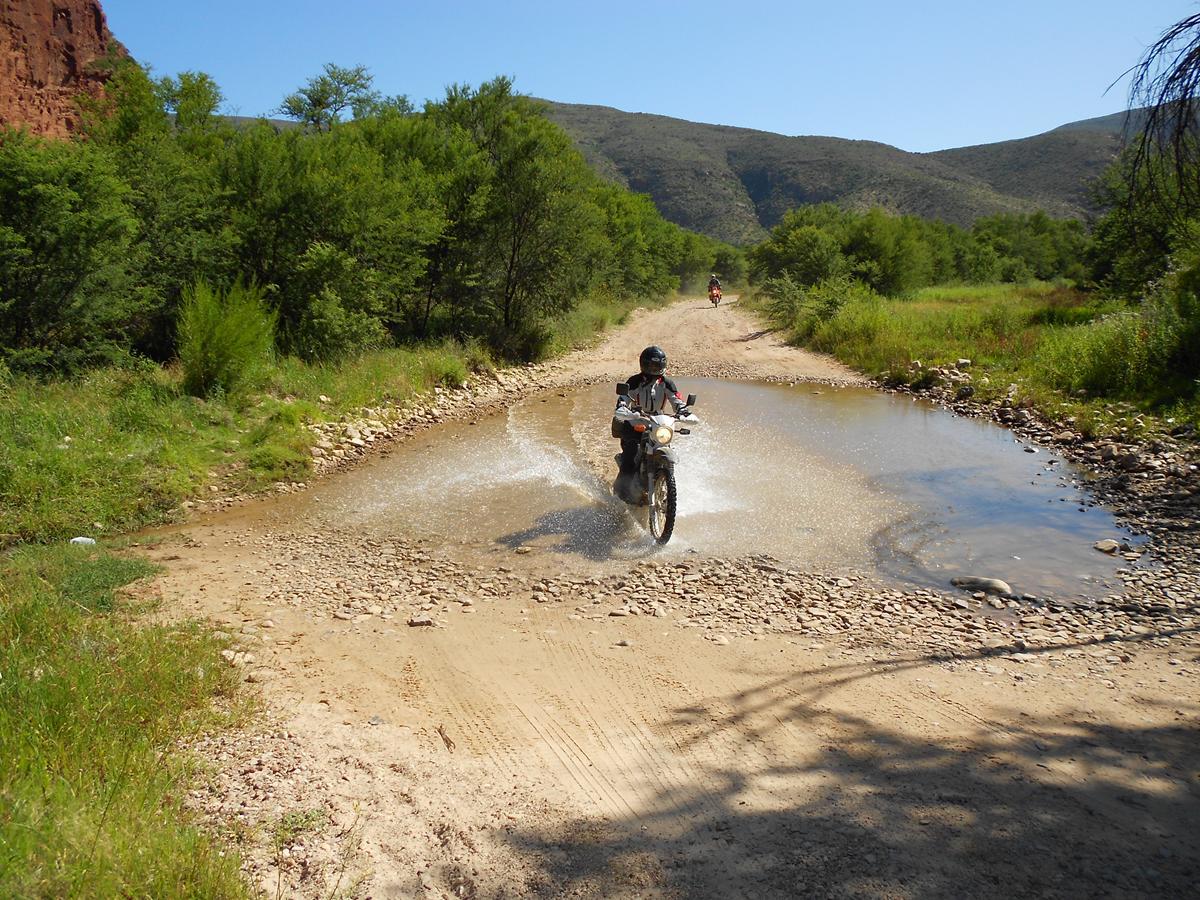
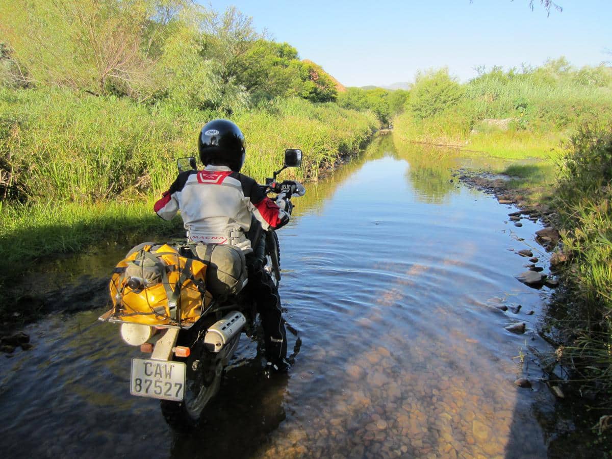
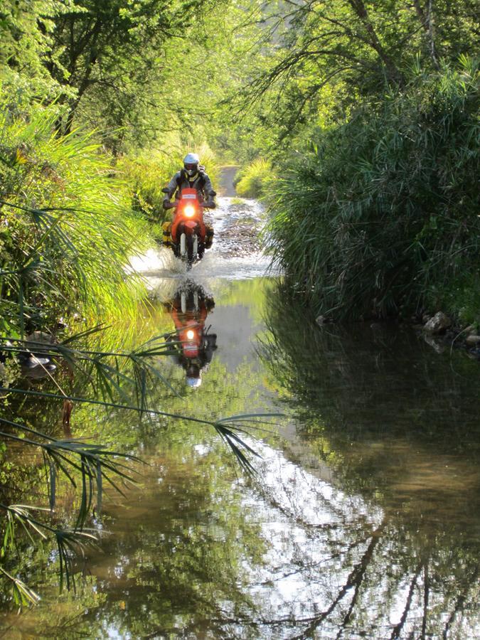
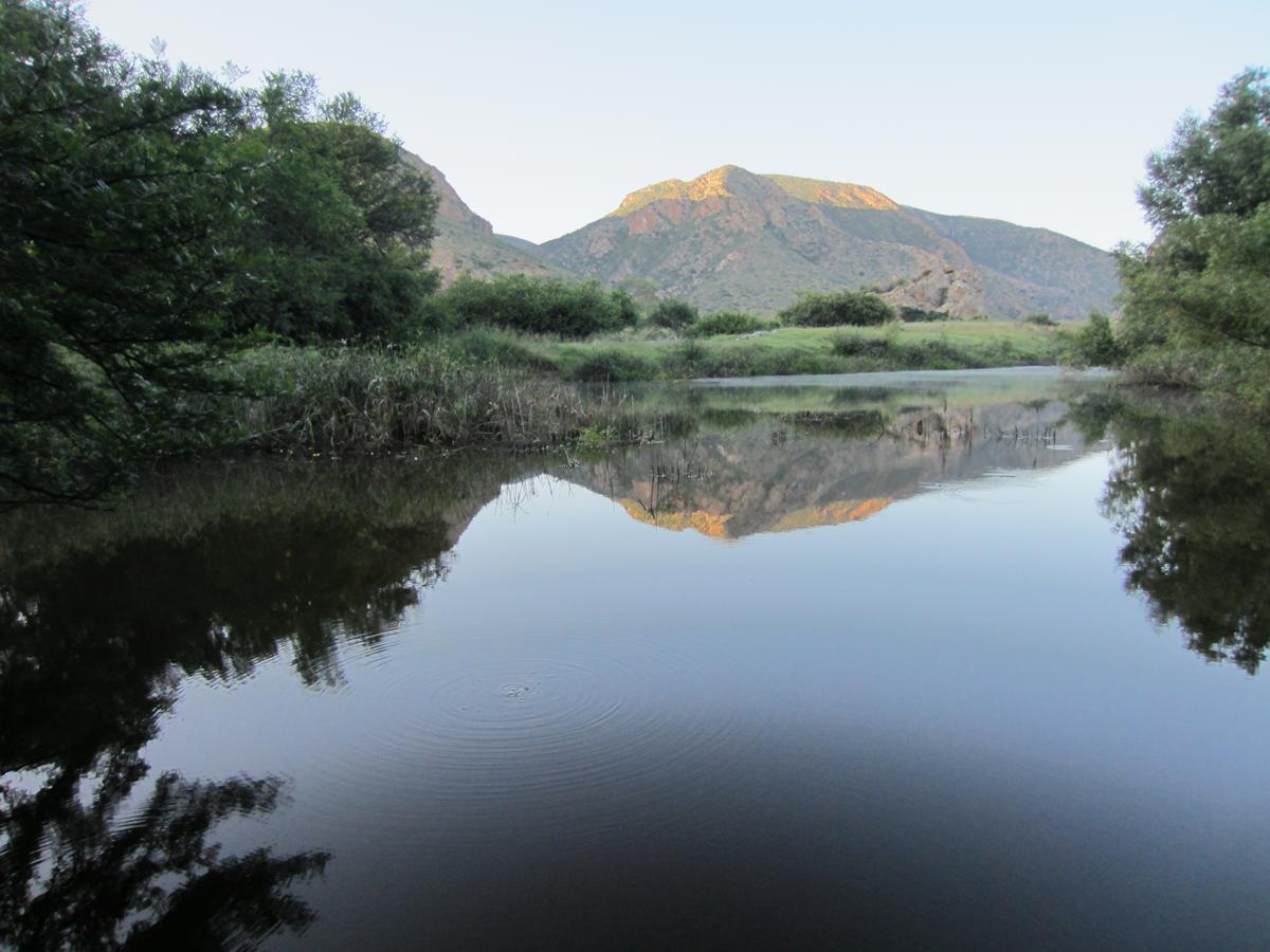
The gravel road runs mostly along the Baviaanskloof River, resulting in many low level bridges and in some places deep crossings over the Baviaanskloof River. These offer ample opportunity to cool down.
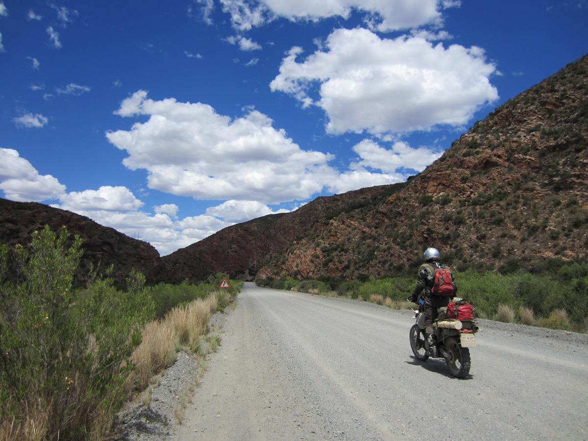
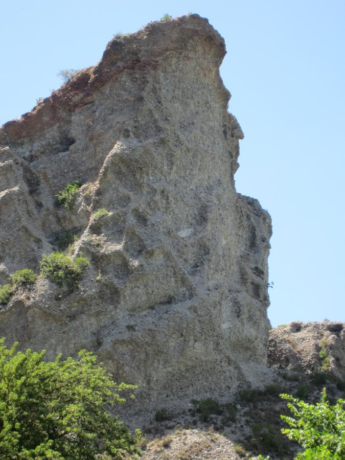
The first section of the kloof is good gravel road with a few sections with loose stones. At some places the kloof is wide and at others very narrow with beautiful rock formations. The yellow flowers of the Acacia Trees are so bright against the brilliant blue sky, that it almost hurts your eyes.
The second half of the kloof towards Doodsklip Restcamp becomes technically more challenging with the Smitskraal deep water crossing being the most difficult part. This was my first deep water crossing and after Frank took his bike through safely, I decided to brave the crossing myself. Some riders would speed through a crossing like that, but I was advised that the safest way is to literally walk the bike through with just enough power to keep it going at a steady pace.
The Doodsklip Restcamp has a stunning setting on the bank of the Kouga Dam. In spite of there not being ablutions (only a long drop toilet) this camp is highly recommended because of the sheer beauty of the campsites. We had a lovely swim in the surprisingly warm river.
Baviaanskloof is also known as the ‘Valley of baboons’ and these friends indeed entertained us with their barking and playing in the nearby mountains while packing up our camp.
The short ride out from Doodsklip is by far the most challenging section of Baviaanskloof. This is where I lost my status as novice rider! Once you are on top of the kloof, it is a scenic and easy road down Baviaanskloof towards Patensie, the main town of the Gamtoos Valley.
The Gamtoos Valley
The Gamtoos Valley is mainly a citrus farming area. The R332 turns into a tar road as you exit the Baviaanskloof. Not far from Patensie a beautiful sighting is a natural rock with the profile of Queen Victoria looking in a southerly direction.

The Langkloof
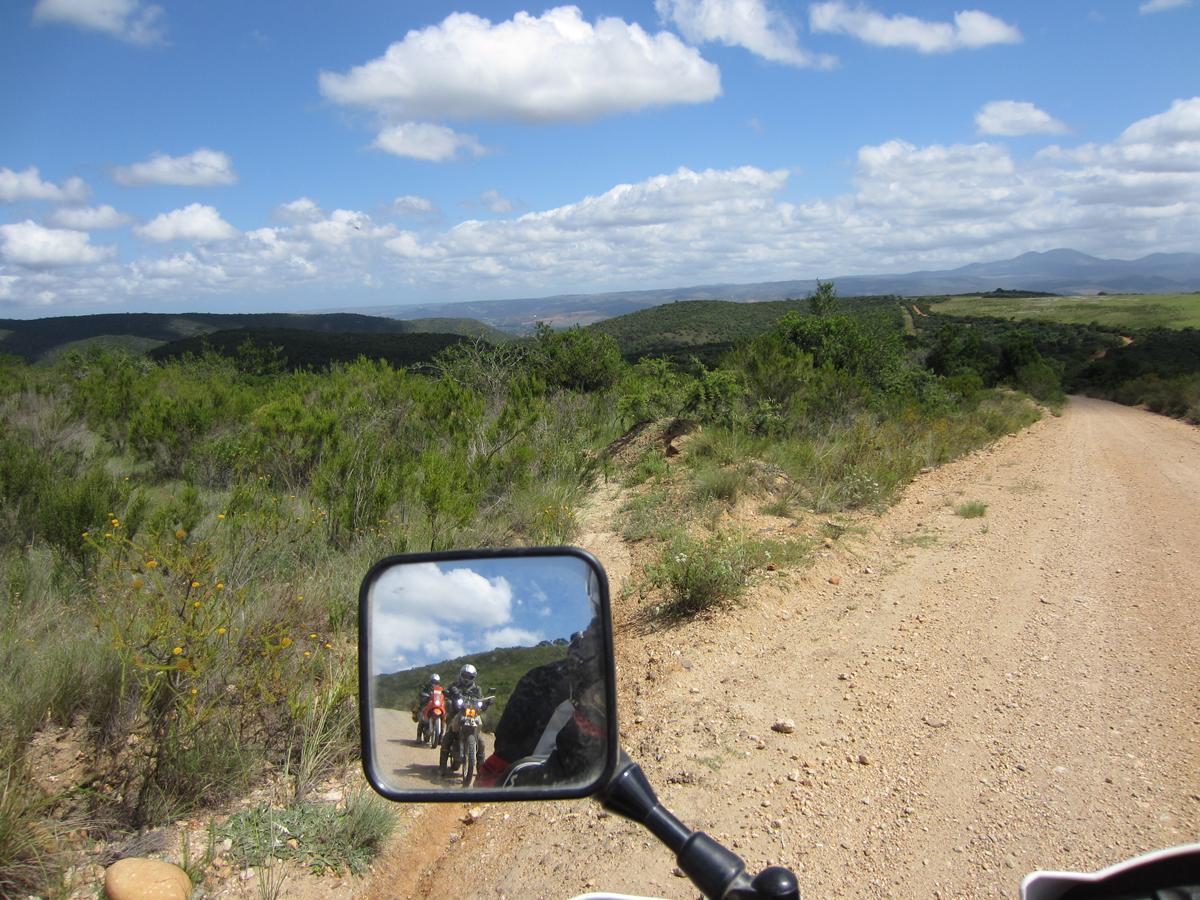
Our original plan was to ride via the Osseberg 4WD trail to Steytlerville but the road was just too bad, so instead we turned south towards Humansdorp. From there we took the scenic R102 through the Langkloof, passing through towns like Kareedouw and Joubertina, down the Outeniqua Pass back to George.
Why I love travelling by bike
When you travel by motorbike, you become part of your surroundings. You smell Eucalyptus tree next to the road, feel the hot or cold air through your riding gear and get wet when you have to cross a river. When the road condition is bad, you have to work hard to stay on your bike. You really experience your surroundings, instead of just moving through it like an outside observer. That is why I am hooked on travelling with a motorbike!
Fact sheet
Total Distance: 798 km
Number of days on the road: Four days
Overnight stops: Angie’s G Spot at De Vlugt, Doodsklip Restcamp in Baviaanskloof, Ripple Hill Hotel in Patensie.
Riders: Wouter Brand on a Suzuki DR650, Braam Ellis on a KTM690, Frank Swan on a BMW GS650 and Karin Theron on a Yamaha XT250L.
Permits for Baviaanskloof: Day visitors need to buy permits @ R20 pp (R10 for children u/12) at the western or eastern entrances to the Baviaanskloof Nature Reserve. Smitskraal has been upgraded and is the official day visitor’s area.
Camping and lodging in Baviaanskloof: There are quite a few private options available. See www.baviaan.co.za or www.baviaans.co.za for more information.
Three campsites (Komdomo, Doodsklip and Rooihoek) as well as the Bergplaas Mountain Hut, are run by Eastern Cape Parks. Reservations for these can be made at www.nature-reserve.co.za/baviaanskloof-nature-reserve_accommodation, or you can phone the Eastern Cape Parks reservation office at o43 701 9600.
Best time of the year to visit Baviaanskloof: All year round is good in Baviaans, but you have to be aware that it might be difficult to traverse the kloof after heavy rains in summer. We were there in December which was a good time.
Shop: Get the latest Tracks4Africa GPS and Paper Maps
Did you know that all Tracks4Africa Africa GPS Map owners get one free update to the latest version, and 50% off any subsequent updates purchased? Go exploring with the most up-to-date map at your fingertips. Visit our online shop for our latest guide books, paper maps and GPS navigation.

I havent ridden this particular route yet but I am hoping to give it a go next year when covid calms down.
need to get this route into my gps thanks again for the article and taking the time to write it