T4A is launching an iPad app on 27 March 2015 which is a complete traveller’s guide. It has the look of a paper map combined with loads of important traveller information. We’ll tell you more about the app itself in later articles, but for now we want to share the process of developing the map and its special features with you.
We went through a huge learning curve to create a brand new set of maps, based on the same look and feel of our very popular paper maps, but optimized for use on an app.
When we set out to build a guide app we knew that the maps had to be superb. We had to seriously consider various issues like the user experience, the look and feel as well as the level of map detail.
Tracks4Africa has a host of detailed information, based on the collective travel experience of travellers who contribute their GPS tracks, waypoints and other information to us. In return we collate and verify this information before we build it into our maps and content database.
A paper map that can zoom
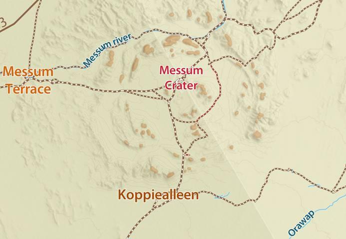
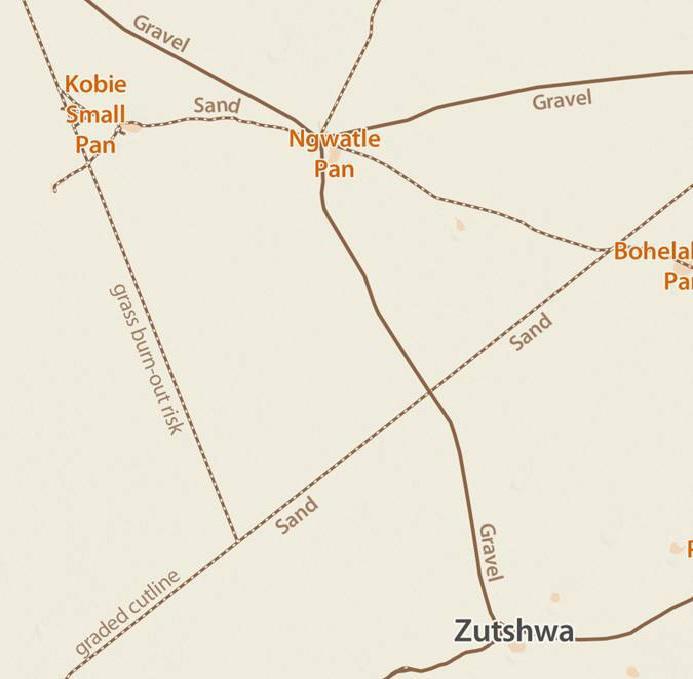
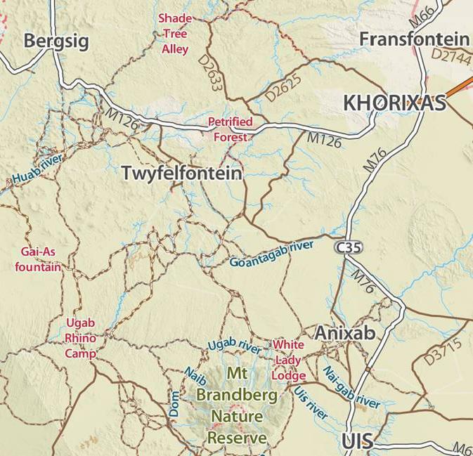
We used the same cartography as our popular paper maps for the new app which gives a very nice look and feel but we felt that this cheated the user of the ability to zoom into the map, as you can on a GPS. Our paper maps are published at a scale of 1: 1000 000 and it provides for a great overview of the country but we wanted to take advantage of the electronic platform and offer greater zoom levels.
At the same time we wanted to retain the positive attributes of a paper map, like seeing all the detail we can possibly fit in on the map. This is in contrast with a normal GPS where we do not have full control over how the information displays. The GPS renders the map from vector data which means it is largely left to the GPS to decide what and what not to show.
We overcame this challenge by creating a raster map which is similar to a web map. However, our guide’s map has to work offline which means all the zoom layers on the app are installed on the device.
The end result is a great looking map which gives you the same feel as the paper version but with the ability to zoom more than six times greater than the paper map, all the way down to 1:150 000.
We would have liked to give you even more zoom power but are restricted by the memory on the device so we decided to limit the size of the guide to max 300Mb. With every additional zoom level the map size grows by 60% to 70%, thus adding a lot more detail will exponentially increase the size. We would like to learn from the app users if they want further levels at the expense of an increased size of the guide.
Click on the link below to view the demo area of the map and get a feel for the zoom levels of the app.
Map features
We have striven to create a map that really speaks to the self-drive traveller. Our cartographer, Bessie Brand, is very experienced and understands the needs of self-drive travellers for trip planning and navigation. She also has an intricate knowledge of the Tracks4Africa data, which allows her to create a truly unique map of Africa.

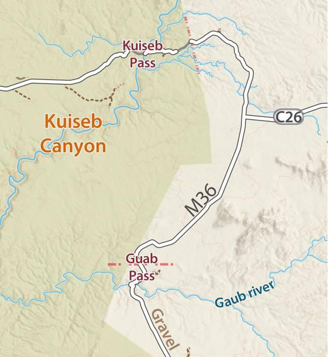
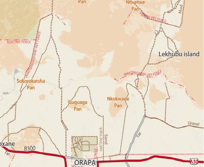
See our article on veterinary fences for more information.
If you have any feedback with regards to the maps please feel free to drop us a mail.

Looks great!!
can it be used in the ipad in areas where there is no mobile signal? What is the price?
Hi Breidert, yes that was one of the key features for the app – to use it offline, i.e. without internet connection. As a result you would download and install the country guide of your choice. Namibia for instance will be in the region of 250Mb which includes maps and points of interest. Cost for Namibia is set at R199, same for Botswana. Initial app download however is free, so you can try it out. The guides will be in-app purchases.
That sounds GREAT! As we are planning to go to Uganda; Rwanda; Tanzania and Malawi when will this app for the iPad be available??
Breidert, we are launching the app on 27 March but initially we’ll only have Namibia and Botswana. More countries will become available soon, but it is difficult to say when we’ll have Uganda, Rwanda, Tanzania and Malawi.
So what will it cost? As a current T4A customer would we have to pay again to be able to view it on IPad?
Looks great though.
Andrew, as mentioned in the other reply, the guides will sell at R199 each. This is a brand new product and is in no way replacing any of our other products. It slots in somewhere between your GPS and a paper map and guide book – a digital guide with a great map that will show your location as you drive.
Great choice of font type and color mix. Easy to read and vivid. Will sure look great on the iPad. Well done!
Great to get your feedback Erick since you are in the mapping business yourself.
Thanks Erick, CartoCSS (Mapbox) was used to achieve this.
Your new map app looks great…please tell me it will also be for android type devices??
We’re glad you like it, Cecil. The current app will launch on iPad only. If it proves to be the success we think it will be, we’ll start development for the Android platform.