Are you a self-drive enthusiast itching to explore Africa’s wilderness, popular tourist attractions and the road less travelled? Tracks4Africa’s brand-new Traveller’s Africa GPS Map Version 18.10 promises exceptionally detailed GPS maps that will never leave you stranded.
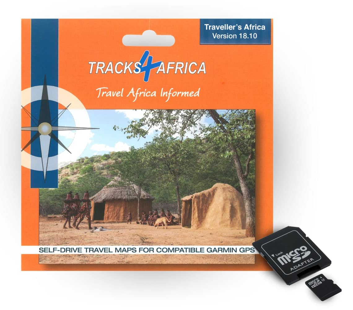
Tracks4Africa’s Traveller’s Africa GPS Map Version 18.10 comes preloaded on a micro SD card with standard adapter, ready for plug & navigate. The SD card can be used on most map-capable Garmin units and has been tested with the latest Nuvi models. Take note that this product is not compatible with iGO in-car navigation systems, Android or iOS devices.
Free upgrade included
When you purchase T4A’s GPS Maps on SD card, you will be entitled to ONE free upgrade on T4A’s next SD card GPS Maps version only. But that’s not all. You will also enjoy a further 50% discount on purchases of new SD card versions or subscriptions for a complete set of downloadable GPS Maps. Find out more about our upgrade policy.
The SD card contains installation files for PC as well as Mac users – install the maps on your computer for informed trip planning or transfer maps to older Garmin units (276c, 76csx, previous generation eTrex).
Map coverage
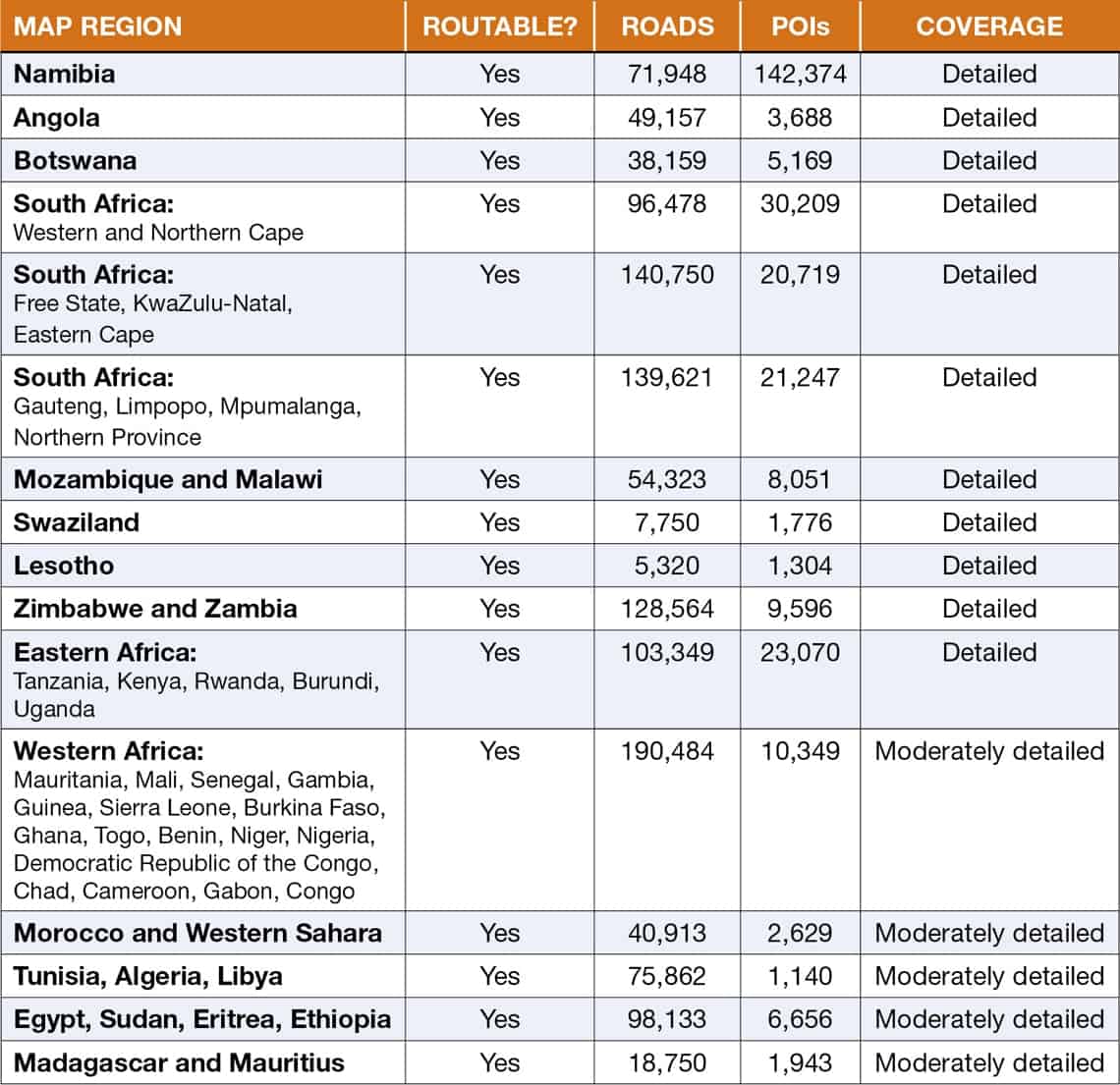
With organic growth at the heart of T4A’s GPS map offering, 305 data submissions were processed for version 18.10. New data submissions mean more roads, Points of Interest (POIs) and an overall improvement of the quality of existing data by means of corrections. Overall road coverage has increased by 2.5% from the previous 18.05 version.
The new version includes:
- 1,260,211km of roads, detailed tourist coverage and fully navigable
- 161,920 POIs (1.5% increase from 18.05)
- Most complete and detailed mapping of protected areas in Africa – 2,360 parks in total
- 15,390 accommodation listings (up 4.5% from 18.05)
- 4,139 campsites – the most complete camping database in Africa (up 3.2% from 18.05)
- 6,411 places to eat or drink (up 4.7% from 18.05)
- 11,041 fuel stops (up 0.9% from 18.05)
About the South Africa paper map
Everyone at T4A is hard at work finalising the latest paper map offering: South Africa Second Edition. T4A co-founder Johann Groenewald says the project prompted a lot of research into basic services relating to smaller South African towns. “As a result, we added a lot of new POIs. Our task to clean up the map and remove redundant POIs still continues. Most of this work was reflected in version 18.05 already, but you should notice more of this in the latest version. The previous version saw a decline in the number of POI as a result of this project, but for version 18.10 the number grew by 1.5% again.”
About Zimbabwe
“Our Zimbabwe project still continued well into 2018 and had a noticeable effect on road coverage in this country. You may recall that we started to look for missing secondary and minor roads in Zimbabwe and that road coverage increased by 6% in the previous version. The project, now completed, contributed a whopping 27% more in the latest release and added more than 30,000km of new roads in Zimbabwe,” Johann explains.
Specific updates
Hiking and MTB trails
- Wannabees Somerbosch Mountain Bike Trail updated
- Mountain bike trails and POIs added for Oakhurst Farm
Protected areas - Blaauberg Private Game Reserve added
- Kwantu Private Game Reserve added
- Tracks and new POIs added around Hardap Game Park
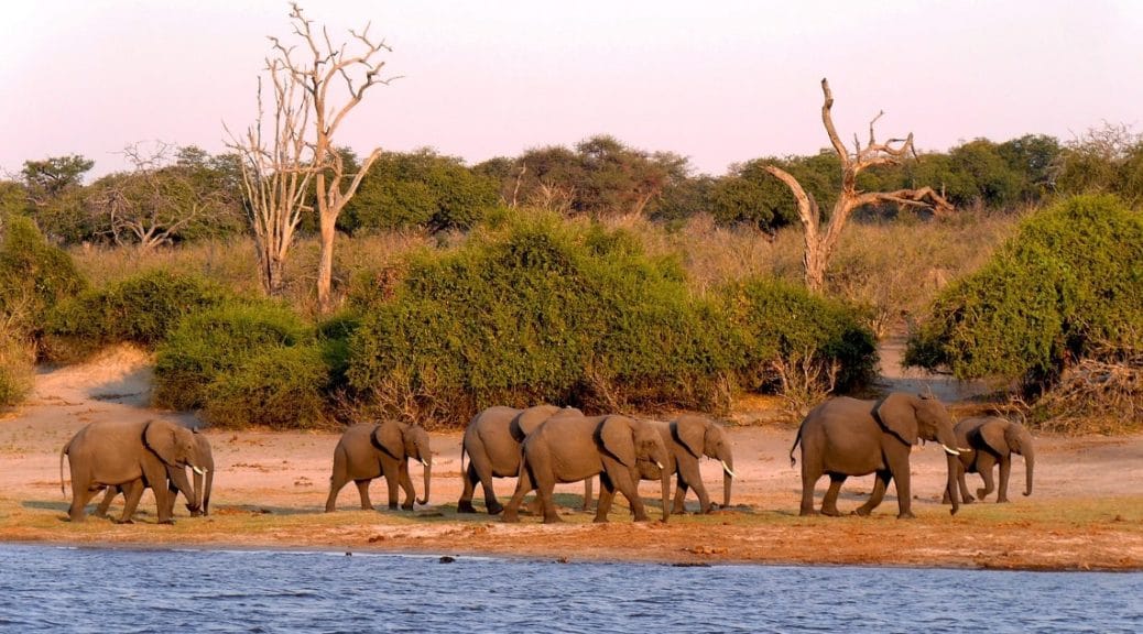
- New POIs added in Chobe National Park
- New POIs added in Nossob
- Zandkraal Private Nature Reserve added
General
- All towns in South Africa updated with available services in preparation for the new South Africa paper map release
- Outjo street names added and updated
- Port St Johns street names added and updated
- Chizumuli Island and Likoma Island tracks updated and ferry from Nkhata Bay added, including two backpacker lodges on the islands
- Zanzibar tracks added and updated including various new accommodation options
- Pearson Park Resort on the banks of the Sundays River was updated
- Mount D’Urban Campsite added in Namibia
- Shanyane Guest House moved to correct position
- New POIs added at Victoria Falls
- The Grove Mall updated
- Aub Guest House in Mariental added
- Mariental street names added and updated
- Nkasa Lupala Tented Lodge updated
- New POIs added in Katima Mulilo
- Road surface conditions updated in South West Zambia
- New secondary and minor roads added throughout Zimbabwe
- KwaZulu-Natal minor route names added and road conditions updated
- Road names in Elgin Valley updated
- Kenya major route names updated
- New tracks and POIs added to southwestern Madagascar
- The Western Cape region has been divided into two new regions: Western Cape Metro and Western Cape Surrounds

How do I upload it to an iPad?
Hi Terrence. Our Garmin GPS Maps will not work on an iPad, and our iPad navigator app will not work on a Garmin GPS Device. They are all separate and unique platforms.
Have a look here at our Navigator App for iOS – its basically our GPS Maps – but on an App on iOS.
Good day, Has the problem with loading to your Garmin Nuvi been resolved with the new release.
I still cannot get my version 180901 to work on my Garmin Nuvi 2689 LMT. I use all the various options available like “Mapinstall or Basecamp. The software says it has been installed. But when I check the maps on the device, the Tracks for Africa set of Maps is not there.
I am very frustrated
Hi Rob – our new release ver 18.10 has resolved the problem.
You can either try again with your version 180901 and see FAQ number 1 on our faq page for instructions.
Or else contact our sales office and ask the girls to generate you the same link, but for version 18.10.