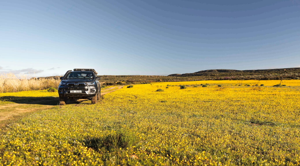
Last spring, with a small window of opportunity to go in search of flowers, Mariska Bartlett hit the jackpot. From fields of yellow to tiny blooms in the deep desert, Namaqualand and the Richtersveld delivered heart-stopping beauty and unrivalled solitude. This is why you should start planning now.
It was almost that time of the year again. We were fast approaching August last year when I realised I had not planned a flower trip! Ever since moving down to the Cape 22 years ago, I have tried to see the flower display every year. I’m usually quite on the ‘nectar ball’ and start my planning in autumn. Over the years, I have covered every inch of Namaqualand and beyond in search of flowers. I have seen the Cederberg draped in purple from the top of the mountains down into the valley. I have seen the West Coast putting on her most beautiful dress in white and yellow, from down at Langebaan all the way up to the northern exit of Namaqua National Park. We have traversed the interior of Namaqualand on bicycles, soaking up all the colours and fragrances that characterise this arid landscape for two months of the year.
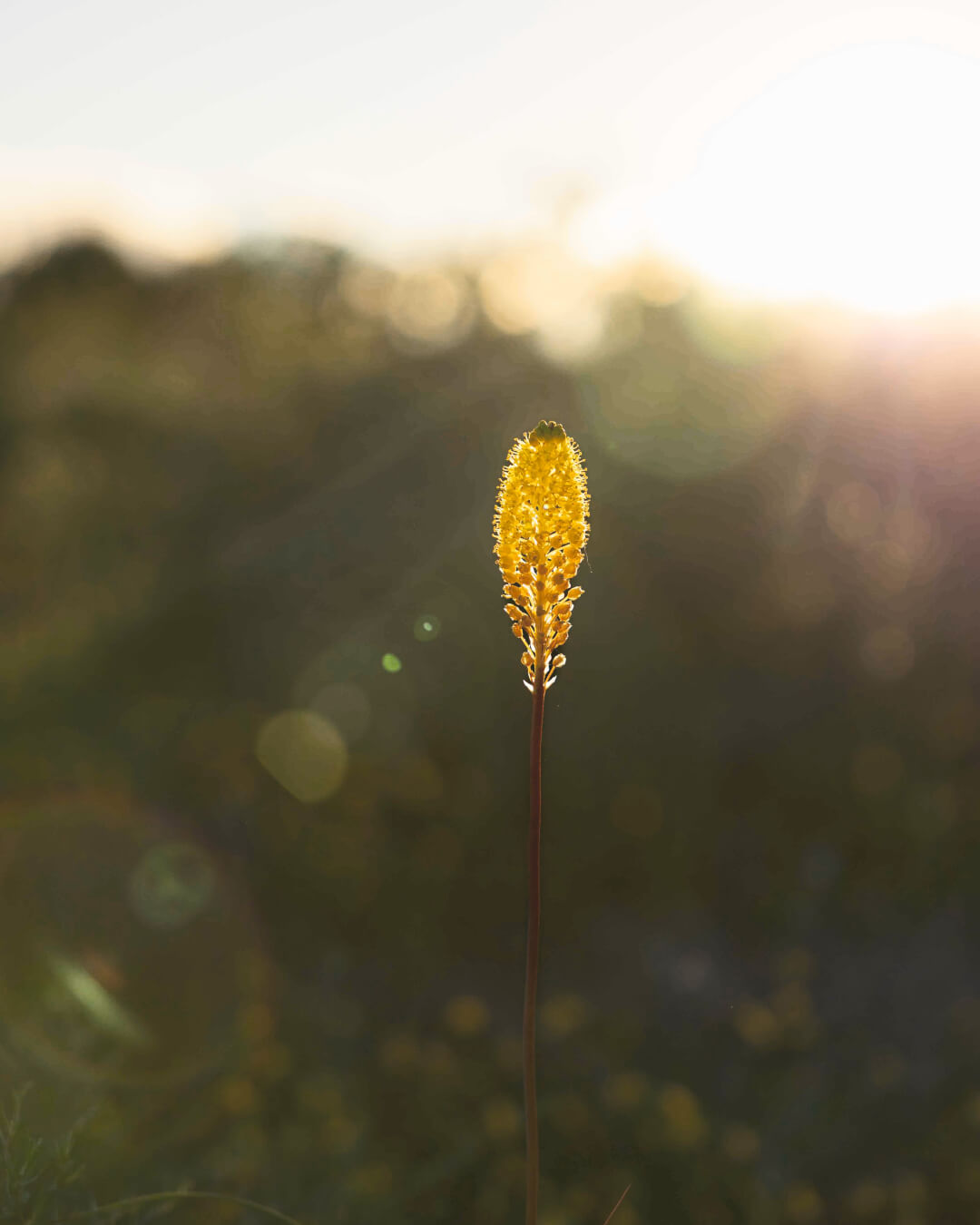
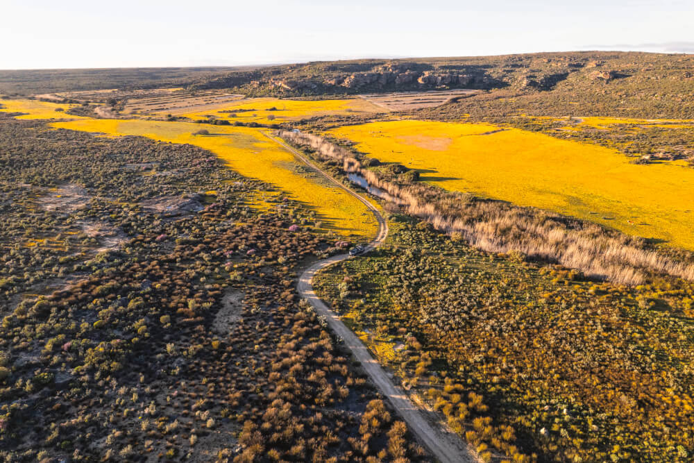
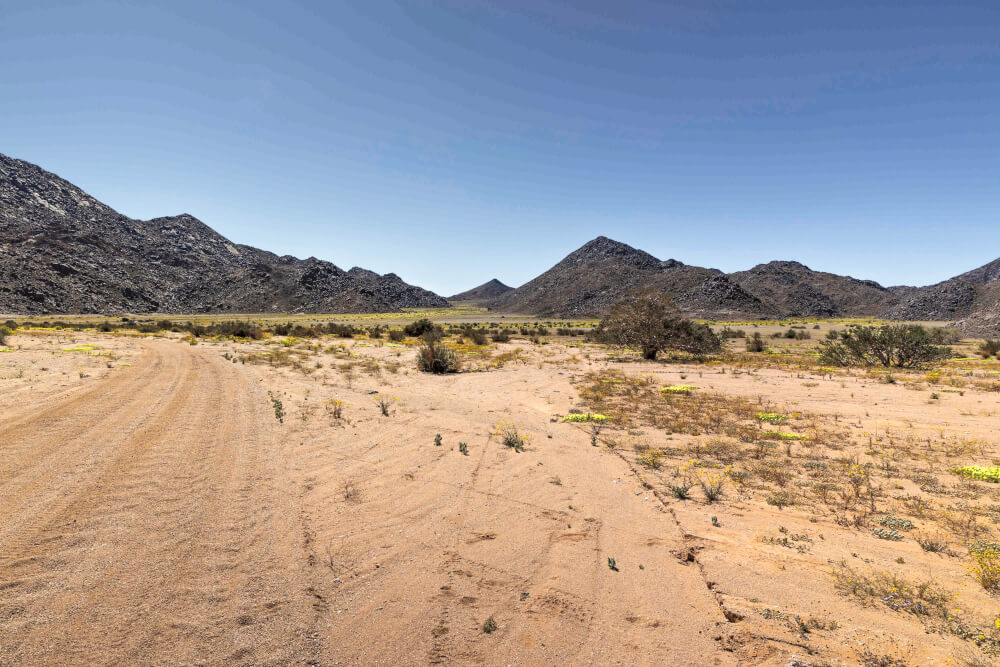
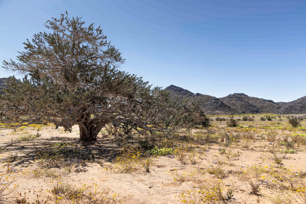
This is the phenomenon of it all: one of the most arid, dry and desolated places on earth completely transforms. For just two months of the year, it turns into a natural display of colour and vibrancy of which artists can only dream. This is why I go every year. I love deserts, I love the Northern Cape and its desolation. For it to burst into splendour from the little water it receives makes it even more of a special place to visit.
One shot at seeing flowers
But now I was in a pickle, because as every flower aficionado will know, you don’t book your flower trip at the beginning of August… I had been dreaming of doing the Namakwa Eco Trail for four years but something always got in the way. I thought this would be the perfect time! We could drive through Namaqualand to reach Pella, camping and flower spotting on the way up. After spending a few days on the Eco Trail, we would pop out in the Richtersveld, which also has beautiful flowers during spring. I emailed Wilma from the Namakwa Eco Trail and Alri at Papkuilsfontein about availability in two weeks’ time with one eye closed. Since we already had other trips planned in September and my husband didn’t have oodles of time, we had one shot at it.
Lo and behold they both came back with a yes! It was settled: we would leave on the Wednesday and return on the Monday. We left Wilderness early in the morning to reach Papkuilsfontein that evening. Travelling via Fraserburg and Calvinia, it was about a seven and a half hours’ drive. We reached Papkuilsfontein just in time for the golden hour to see the flowers before they closed for the night.
Nieuwoudtville’s gems
Nieuwoudtville is typically the hub for the area’s flower tourism. It is here that you will find most accommodation, with beautiful day drives to reach places like Loeriesfontein, the quiver tree forest, the waterfall and Nieuwoudtville’s own botanical garden. This area is also famous for its katsterte (cat tails) – once you see them, you will know. And then let us not forget about the most important gem found in this area. No, I am not talking about diamonds, I am talking about skuinskoek! When you enter town, you should head straight to any of the little stalls next to the road on the way in to buy some skuinskoek. If you are lucky, the skuinskoek will be freshly fried. Think of it as a marriage between a vetkoek and a mosbol, with skuinskoek being the perfect child. (Although Skuinskoekpaleis is closed, Die Spens farmstall is a popular pitstop for overlanders. – T4A)
The next morning, we had a five-hour drive to get to Pella and from there another three hours to our campsite at Ramansdrift. First, we headed to Loeriesfontein, then took a gravel road that comes out on the R358. The first sign of civilisation was Pofadder. Here we filled up on diesel and some provisions before heading west on the N14. Technically the Eco Route starts just before the turnoff to Pella. Normally you would spend night 1 at Hartbeesmond near Witbank, night 2 at Melkhoutboom and night 3 at Ramansdrift. However, due to the short notice, the first two campsites were full. Since there are main roads that run parallel to the Eco Trail, we could cut it short and head straight to Ramansdrift.
A roundabout way to Ramansdrift
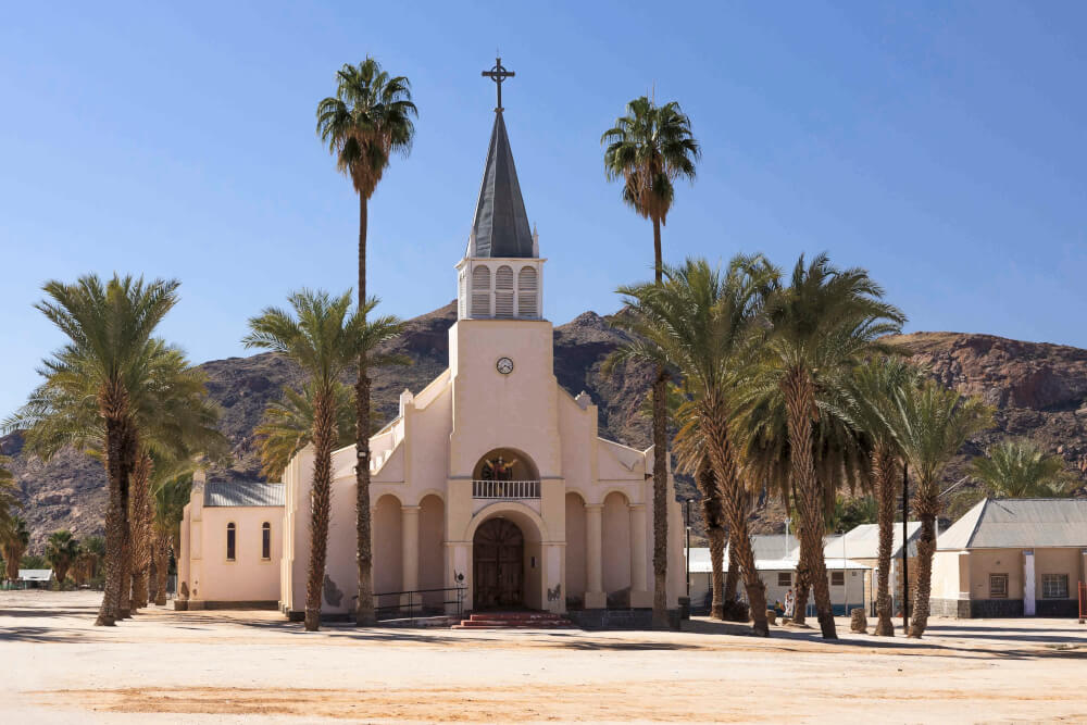
As we were making good time, we first went to see Pella – I wanted to show my husband the old missionary church. The plan was to take the main road via Klein Pella to the Ramansdrift turnoff. But, believe it or not, we got lost in Pella and ended up on the Eco Trail itself! You’ve got to understand, this is the Wild West (or North) of South Africa. There are no unnecessary signs or tar roads; all around you, all you see is desert and date palms. So it was perfectly normal for us to think that we were on the “main” road to Klein Pella. At least until it got gnarly. I had another look at the GPS and realised we were definitely on the 4×4 route! However, I am very glad we made this mistake as this stretch of road was one of the most beautiful we have ever travelled. On the other hand, it did take us two and a half hours, so our time frame was in its “peetjie” (completely shot), as my ouma would’ve said.
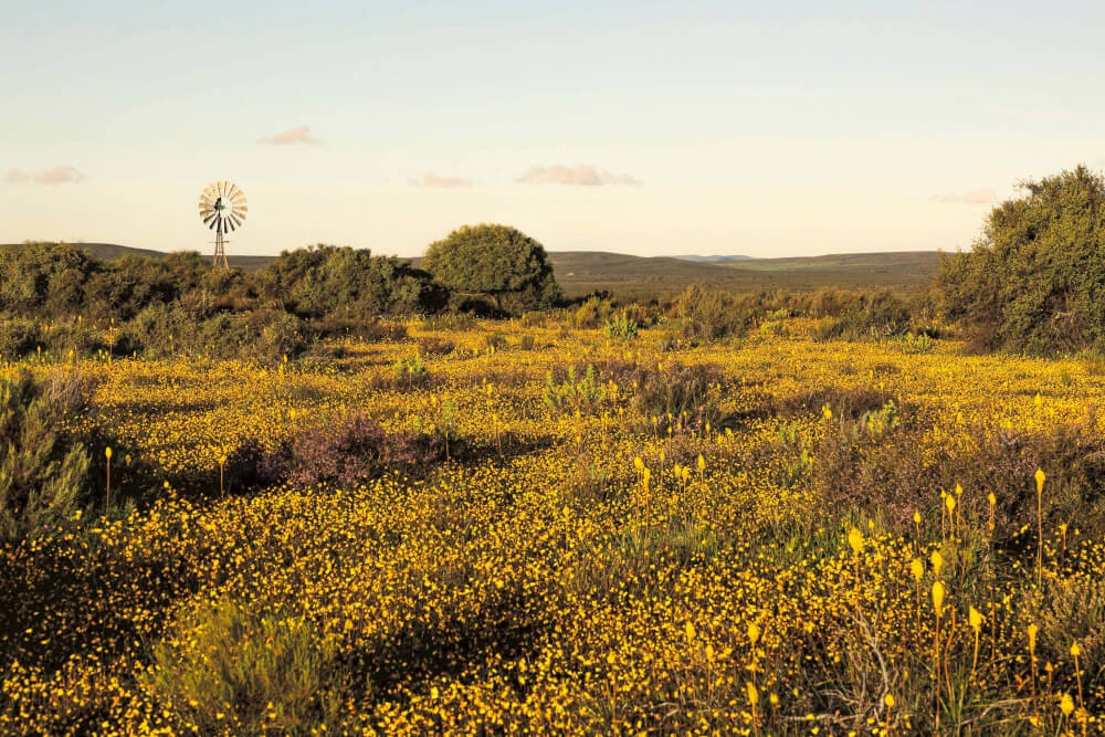
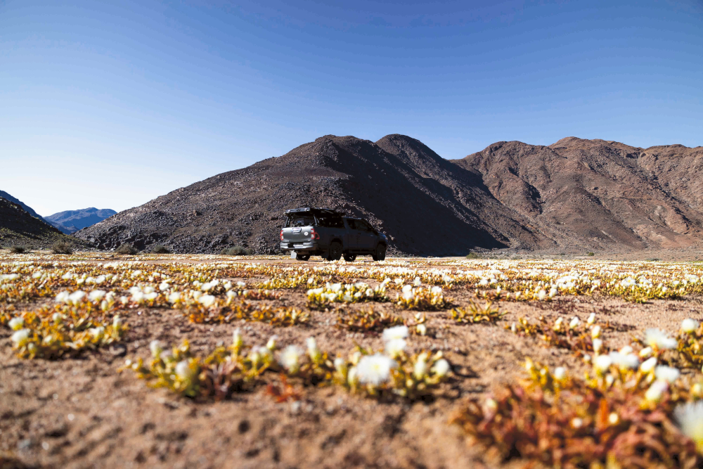
By 15:00 we still had a good way to get to Ramansdrift. But, man, was it beautiful. The light became softer and softer and the flowers were everywhere. Huge yellow patches in the distance surrounded by koppies of big boulders. As with most of the campsites on the Namakwa section of the Eco Route, Ramansdrift sits right against the Orange River. By the time we got there, the sun was low in the west.
Fly-fishing on the Orange River
A big reason why this Eco Route was so attractive was the chance to catch yellow fish on fly. Early spring next to the river can still be pretty nippy and the temperatures were starting to drop. I jumped into my waders, rigged my 5-weight rod and headed to the water. I have never fly-fished for yellows, only trout. But I had asked a couple of guys beforehand what to do and so I was DIYing it to the best of my ability. I could see the fish rise around me. In hindsight I should have put on a dry fly but I was keeping to the recipe of squirmy wormies and nymph style flies. I must’ve done something wrong because I didn’t catch a single fish over three days and not for lack of trying. I was in the water before sunrise and fished in the evenings until I couldn’t see anymore.
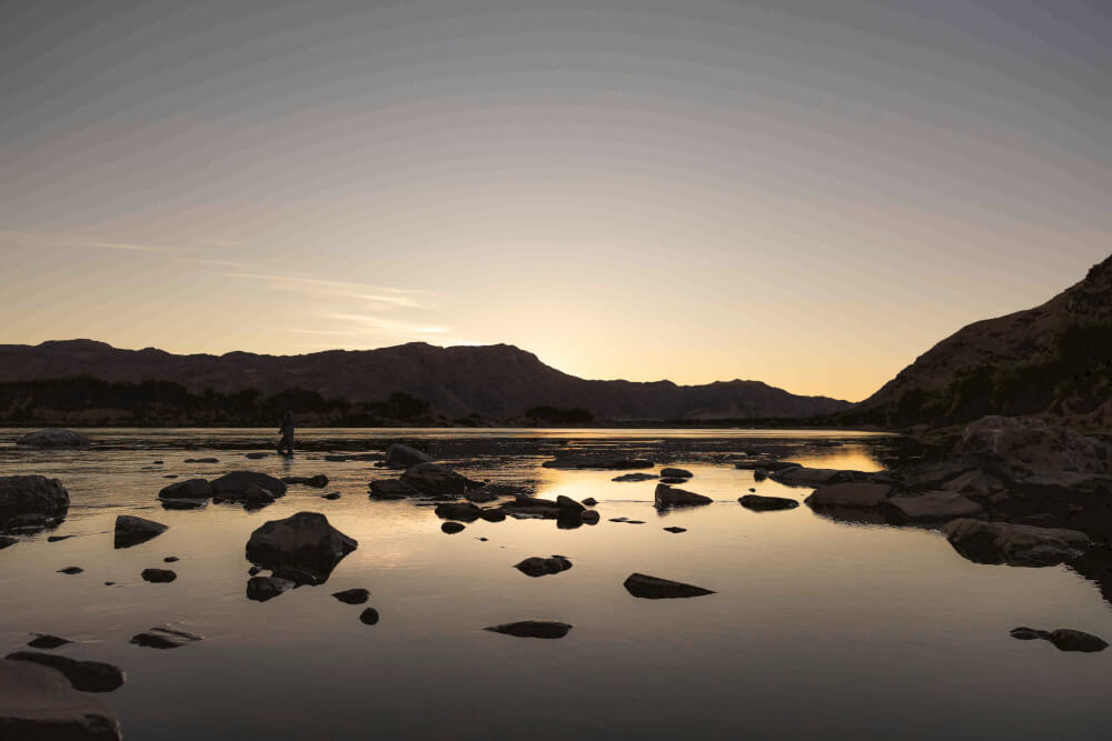
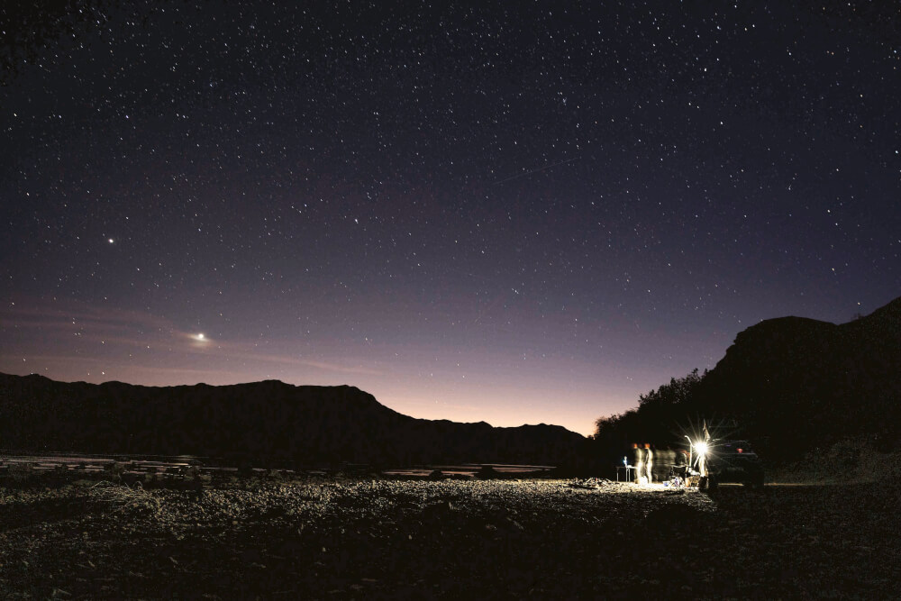
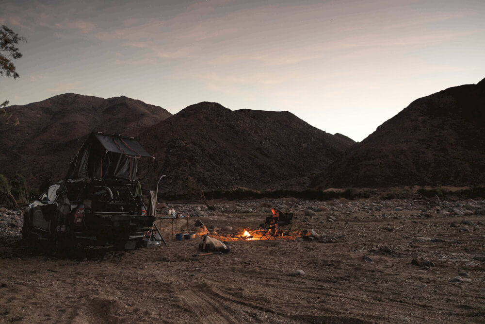
Ramansdrift is one of the most beautiful campsites you will ever see. And that is the beauty of this route. You have the campsites all to yourself. No neighbour blowing up his mattress or that dude who carries a leaf blower to take the dust of his precious bakkie. Have I mentioned I like solitude? Just me, my hubby, the fire and the mountains.
Out-of-this-world landscapes
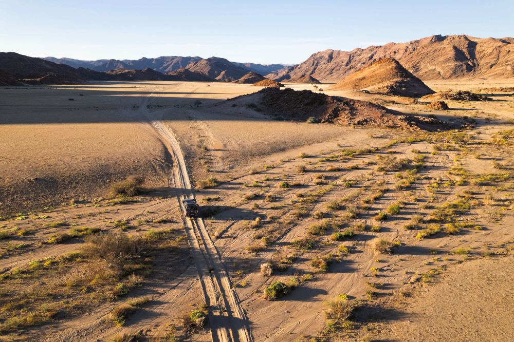
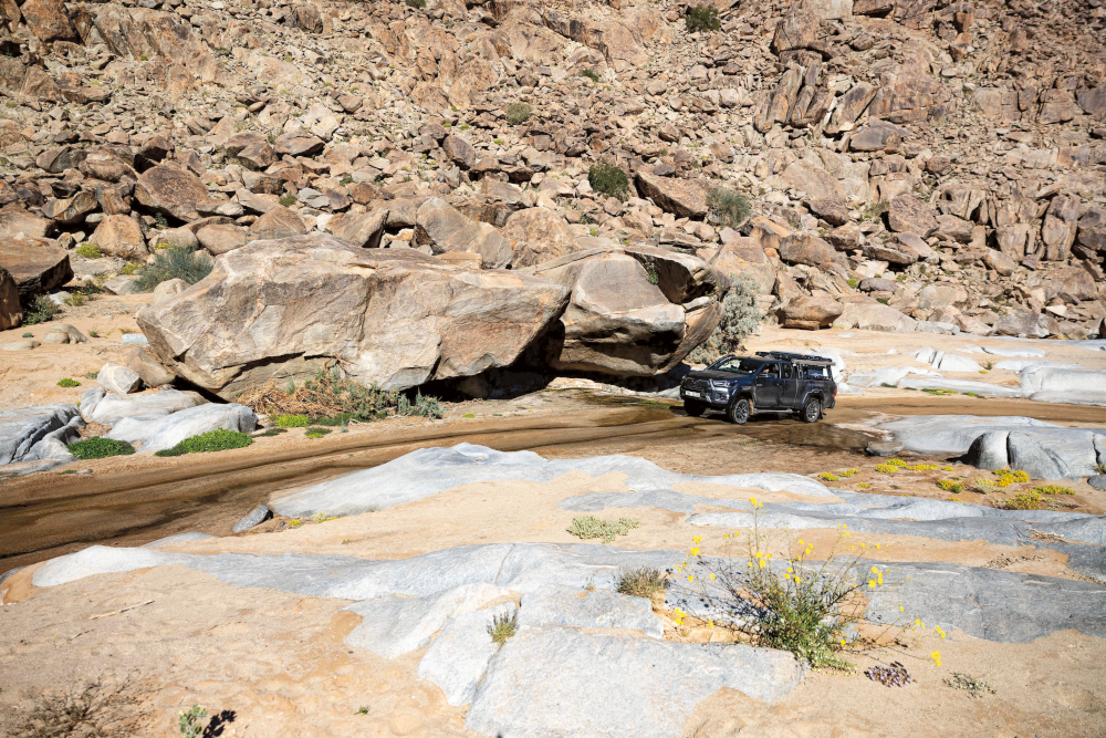
After one of the most spectacular sunrises, fishing and brunch, we set off on the next section of the route. On our second day, we could take it slow and soak up the landscape. And, wow, what a landscape! The route is absolutely stunning and there were also flowers! Be warned that August is muggie time – midges abound. Whenever we stopped, we were attacked by hundreds of muggies going after the moisture of our eyes and nostrils. That night we camped at Kamgab. The drive in through a narrow gorge is something out of this world. In fact, a lot of the landscape reminded us of Namibia’s Damaraland – it totally feels like you have left South Africa. There was still a lot of water in the gorge and the boulders made for a fun 4×4 drive. However, I would discourage taking a trailer. Although Kamgab is a pleasant campsite, it is a little less spectacular and wild than Ramansdrift.
The next day we left the Namakwa section behind and headed for the Richtersveld section of the route. This takes you through a moon landscape before you pop out on the N7. From there you head north to the Vioolsdrift Border Post. Just before the border’s entrance gate you turn left to meander all along the Orange River in an easterly direction until you reach the Nababiep Nature Reserve. Again a completely different and out-of-this-world landscape with protruding black rocks all around. You can even see ancient petroglyphs in one place. Driving through the reserve you start to climb up towards the Richtersveld escarpment. People have decided to stack piles of rocks on this small pass, I hope this fashion dies out. It seems us humans have an inherent desire to want to leave our mark in places.
Flowers in the Richtersveld
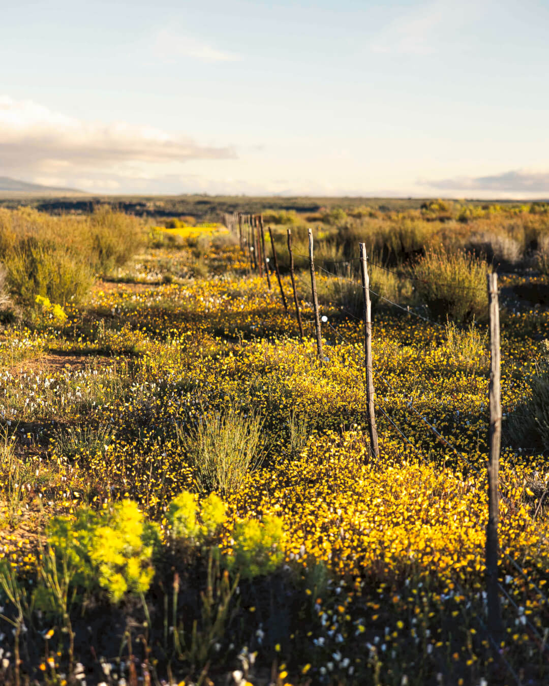
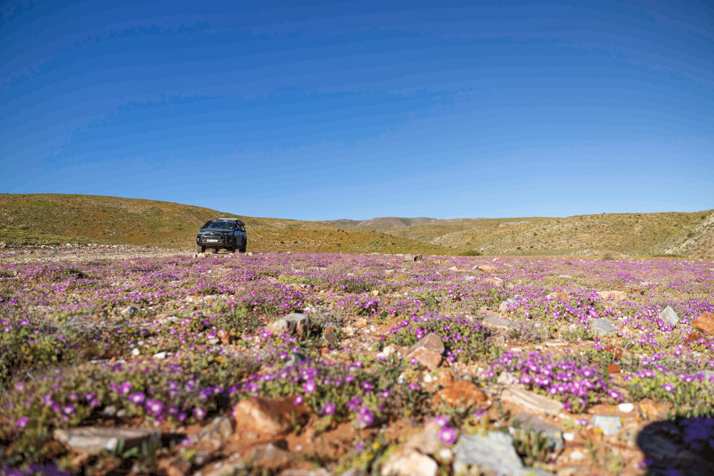
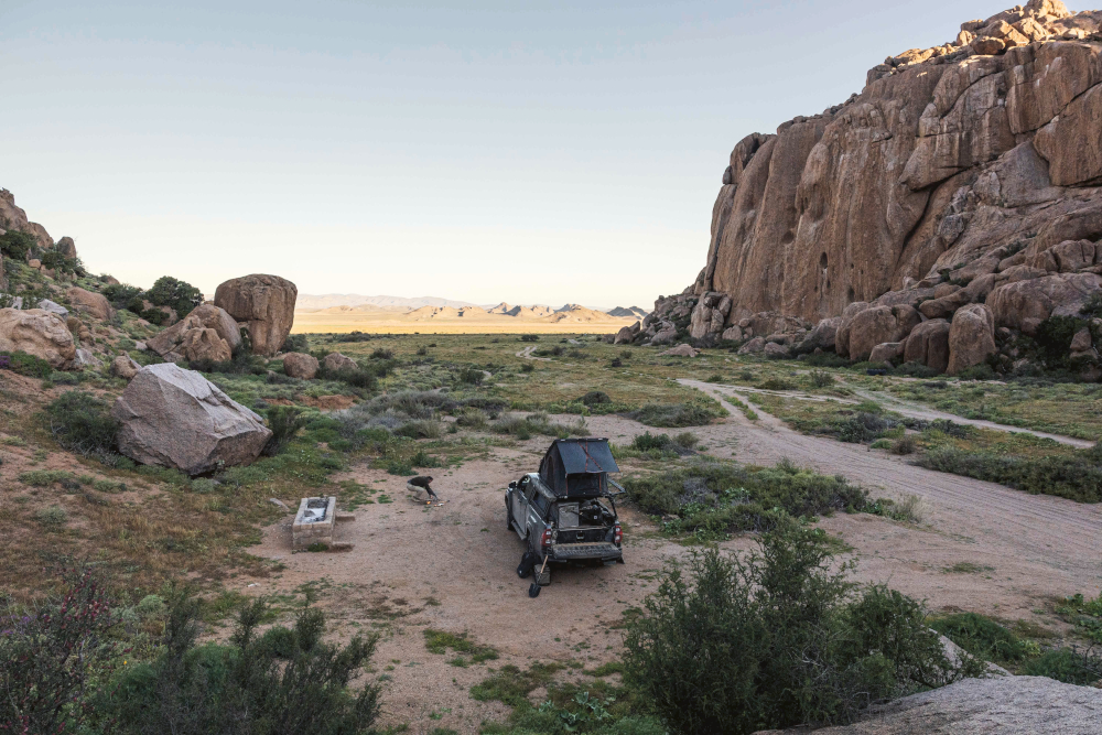
Once we exited the reserve, the landscape changed into rolling hills with some of the most abundant flower displays we’d seen. The route from Eksteenfontein to Tierhoek felt very remote and the flowers were in full display, but the going was slow since the track is challenging in places. Just as we thought darkness was going to catch us, the track suddenly became a wide gravel road. We couldn’t believe it! From this point on, it was faster going until the enormous mountain that marks the Tierhoek Campsite reared up. We couldn’t believe our eyes when we got there: what an amazing place and we had it all to ourselves again! The stars that night amongst the giant boulders were spectacular.
At first, we had planned to camp at Bakkrans the following night but we realised we had quite the journey home and my husband’s work was calling. So the next day we packed up and headed down to Steinkopf, which in itself also made for a beautiful route. From there we took the N7 down to Porterville and headed home via Worcester. Never again will I drive the N7 if I can help it. We encountered a hundred trucks and lots of roadworks, reaching Wilderness at 8pm that night. An express flower trip to the furthest corners of our country!
Doing the Namakwa 4×4 Eco Trail
The Namakwa Eco Trail has two legs: a Namakwa section (Pella to Vioolsdrift) and a Richtersveld section (Vioolsdrift to Alexander Bay). They can be booked separately or combined into one epic 4×4 trail. For bookings, call +27 (0)81 873 9043 or email info@namakwa4x4.co.za. Visit the website namakwa4x4.com for more information.
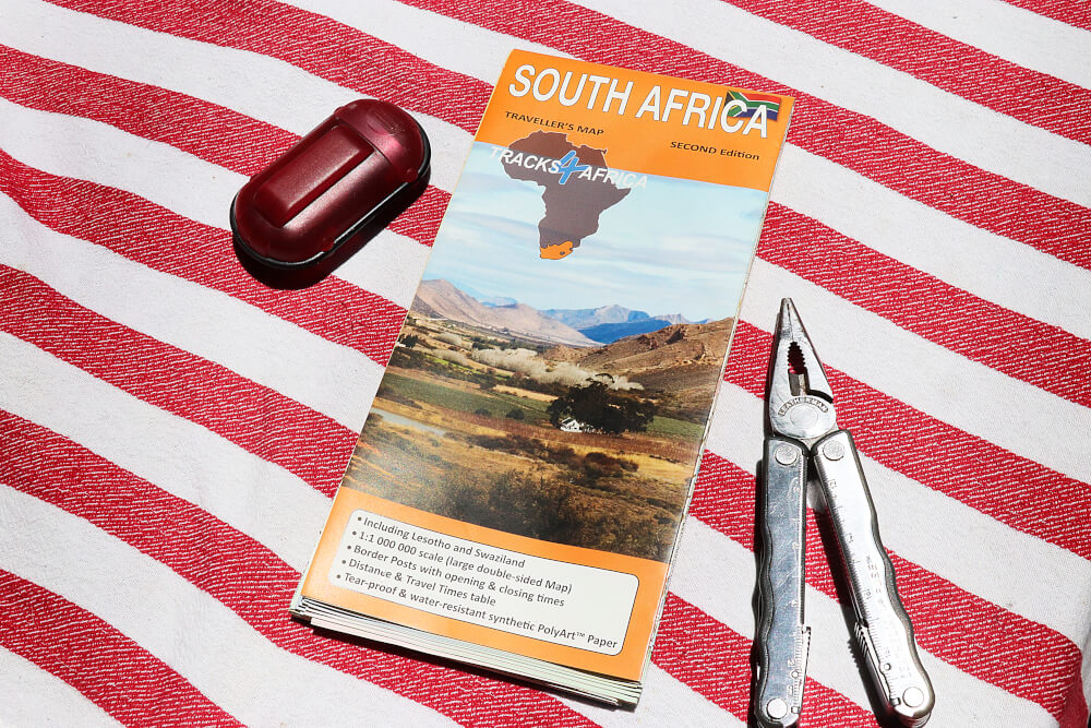
From the arid Richtersveld and Namaqualand in the west to the tropical East Coast, the South Africa Traveller’s Paper Map has you covered. This large, double-sided map shows distance and travel times to make trip planning easy. It is printed on tear- and water-resistant paper so it is tough enough for overlanding adventures.
About the overlander
Mariska Bartlett is one of the pair known as Safari Susters, sisters who lead photographic safaris in the continent’s wild and beautiful places. They love overlanding as a way to connect with the wilderness and explore new destinations. Follow @safarisusters on Instagram for a look at their travels.
