For dramatic scenery and the chance to safely wild camp, Angola isn’t easily topped. Photographer Paul Godard shares his impressions and spectacular images following a recent trip.
Angola has long been one of the less explored countries in Africa. For 27 years, a civil war kept visitors at bay. Then the country closed its borders during the COVID-19 pandemic. So when Angola began welcoming visitors again, photographer Paul Godard immediately started planning a four-week expedition. In November 2022, Paul and his partner, Lisa, set off, along with two friends from Cape Town.
They started by exploring the southern parts of Angola, travelling along the Kunene (Cunene) River and then heading up the coast to Namibe. From there their route led to the interior and iconic sights like Tundavala Gap. The spectacular Pedras Negras drew them north, after which they again made for the coast just south of Luanda and followed the shoreline towards Namibia.
Tracks4Africa got the lowdown from Paul about must-see sights and what it is like overlanding in Angola.
What is the Angolan landscape like?
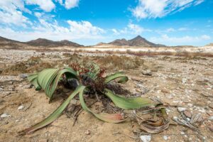
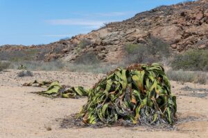
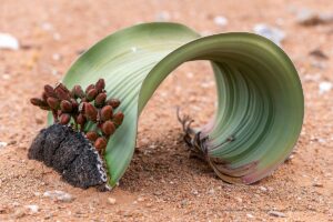
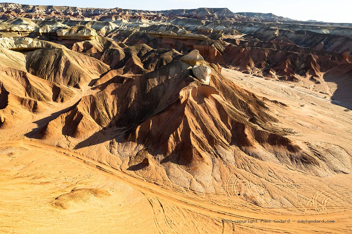
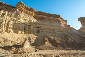
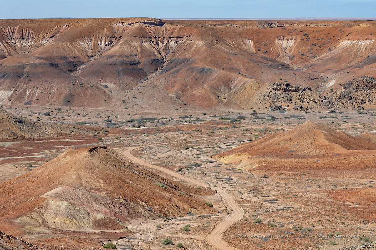
The south has large arid sections with amazing rock formations in places. In the moonlike landscape of Iona National Park we came across masses of huge welwitschia plants, most of them in flower. We could not believe our eyes when we approached the red rock formations of Colinas Vermelhas (aka Colinas do Curoca), a tip from one of the rangers at Iona NP. We also passed sculptural sandstone cliffs, which contrasted with the deep blue ocean, on our drive up the coast to Namibe.
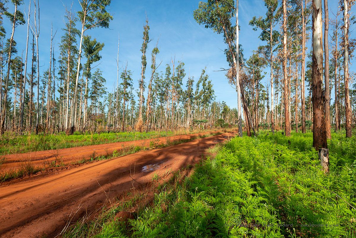
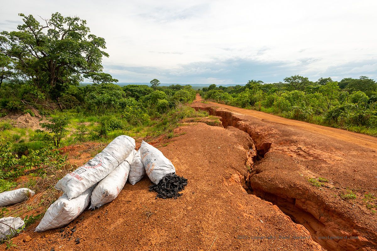
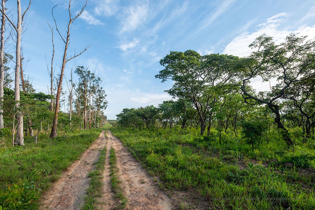
Once we passed Lubango, our route road north led through countryside that grows ever greener. But the landscape is marked by slash and burn, a common practice for local farmers. They produce charcoal to sell along the road and grow maize, manioc and cassava on the cleared land. Sadly, there is little left of the indigenous Gobi Forest, just a few patches between eucalyptus trees and newly ploughed fields. On the whole, Angola’s indigenous forests and national parks aren’t adequately protected. Beautiful natural areas are making way for low-yield farming activities. We felt there were more people than wildlife in many of these places.
What were some of the highlights of your trip?
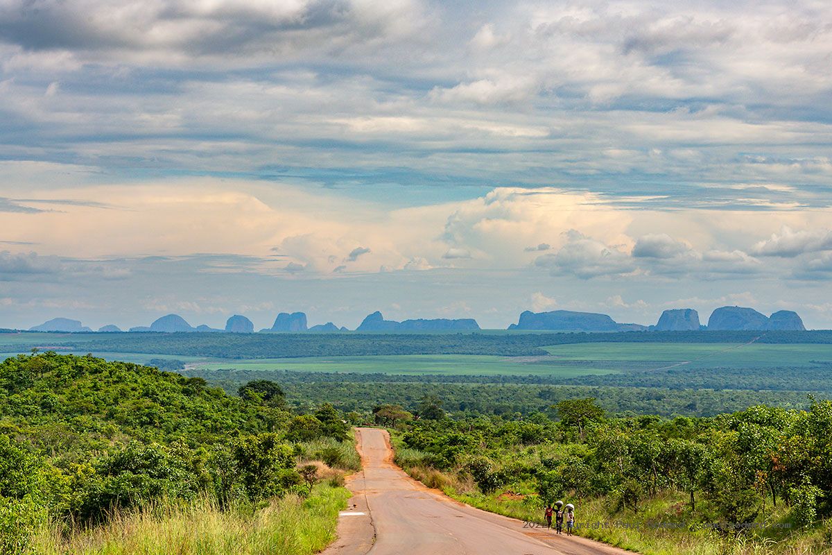
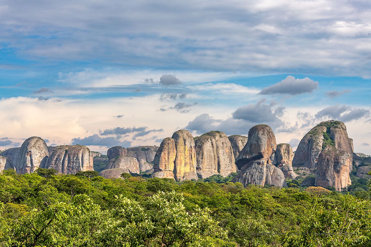
Long before departing for Angola, I knew I wanted to visit the immense granite boulders of Pedras Negras (Black Rocks). From 50km away, we could already see their massive shapes rising from the green savannah. Close up, we discovered lichens of various shades covering the boulders. Tall trees grow among the rock formations and various plants take root in available cracks and gullies. We found the absolute best wild camp at the foot of a huge boulder next to a clear stream. I want to go back for a week!
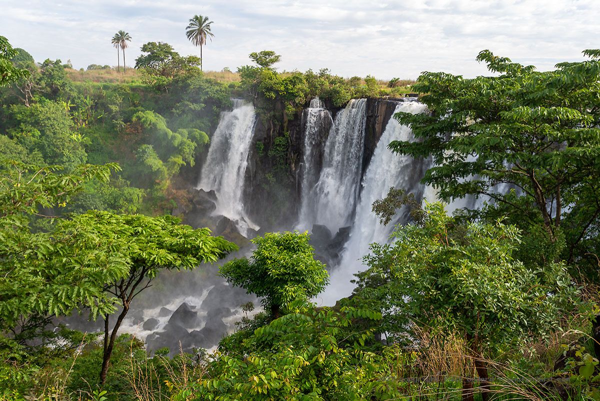
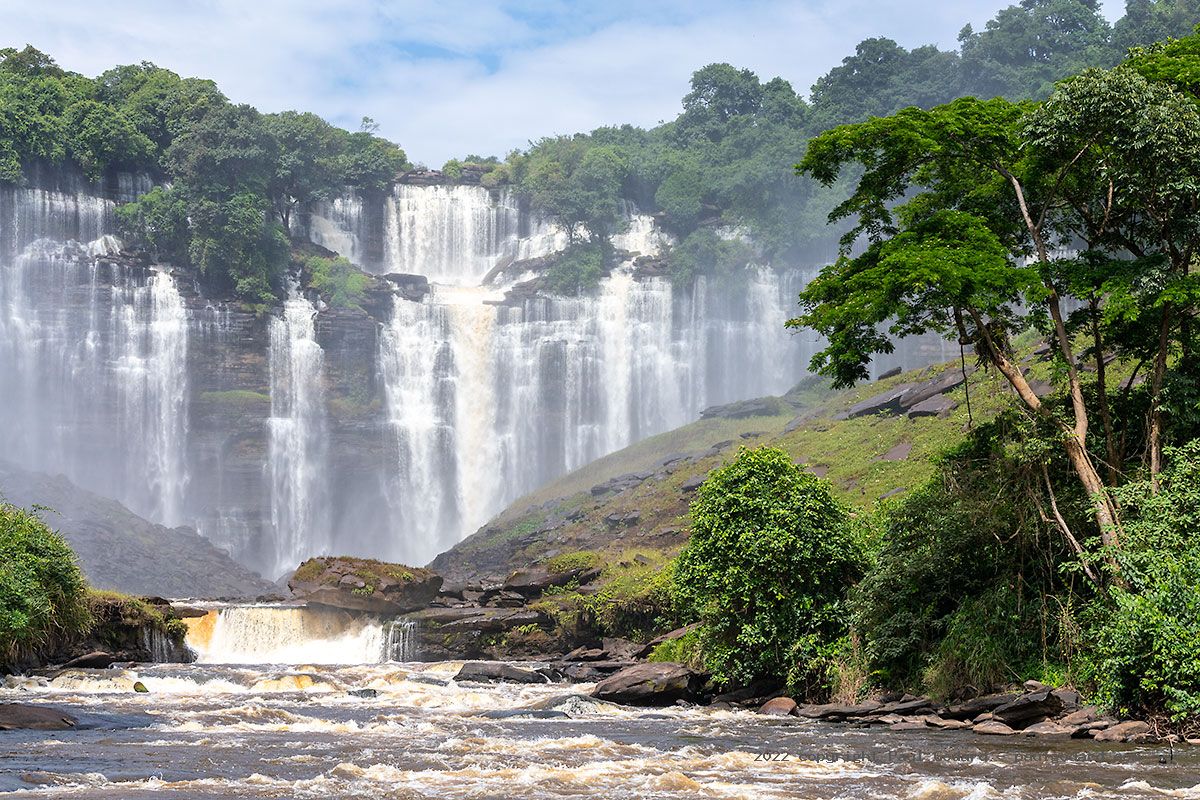
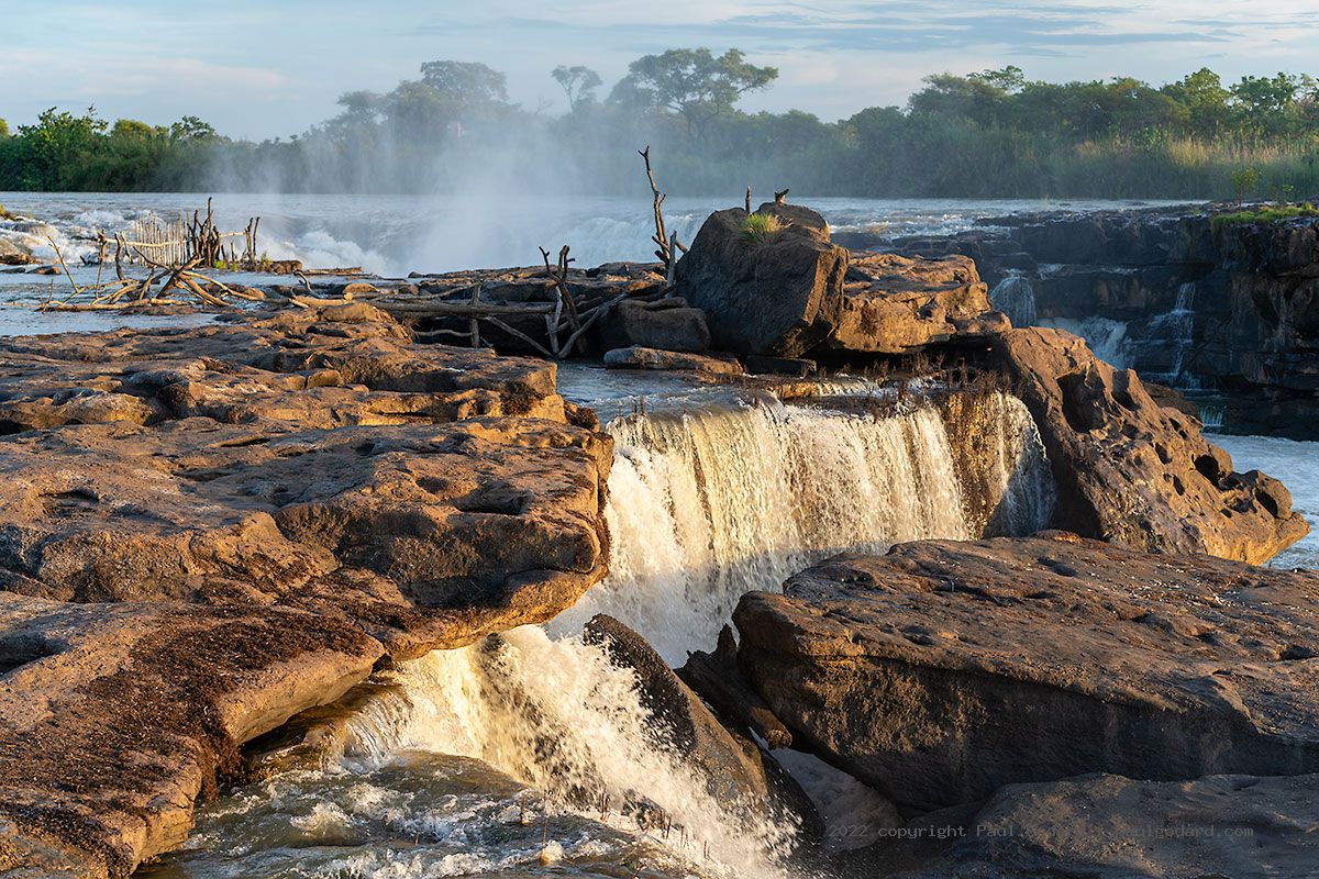
Another highlight was Calandula Falls, one of Africa’s biggest waterfalls by volume. Although the facilities at the viewpoint are looking a little tired, they still offer impressive views. A local guide led me down to the base of the falls along a very steep trail. It took longer than anticipated, but the view of the waterfall amphitheatre from below was well worth it.
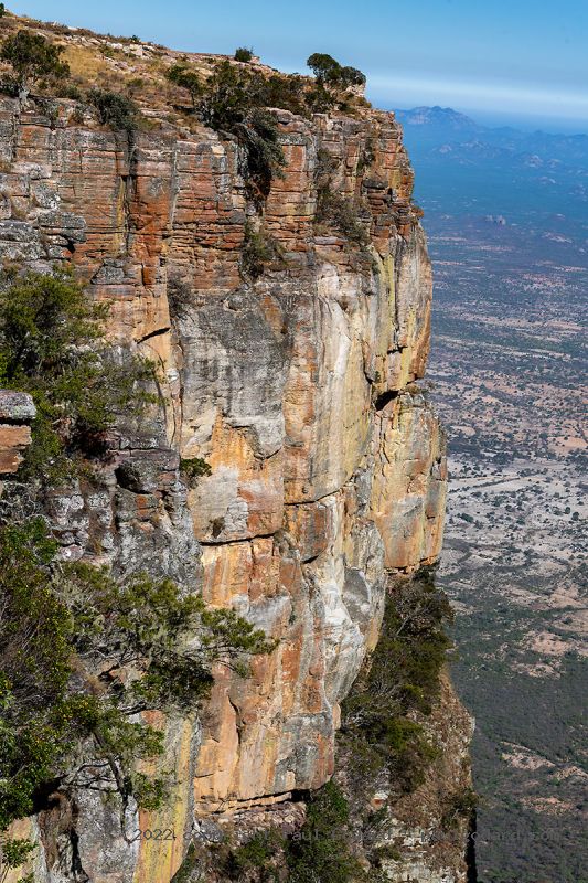
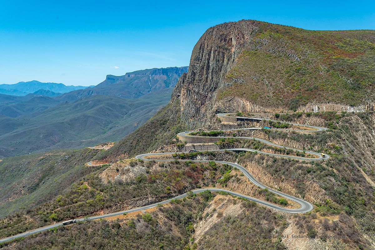
Leba Pass is one of Angola’s most well-known sights and with good reason. We followed the pass’s famous hairpin curves to the top and continued on a road along the edge of the plateau. Sitting down to lunch under the shade of trees, we could watch traffic weave through the switchbacks.
What are the roads like in Angola?
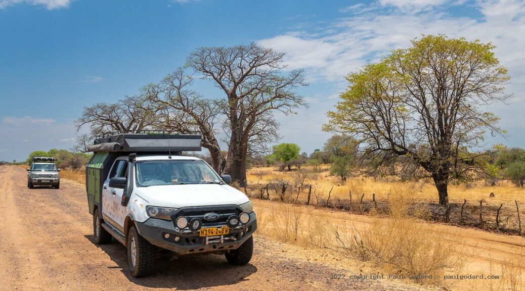
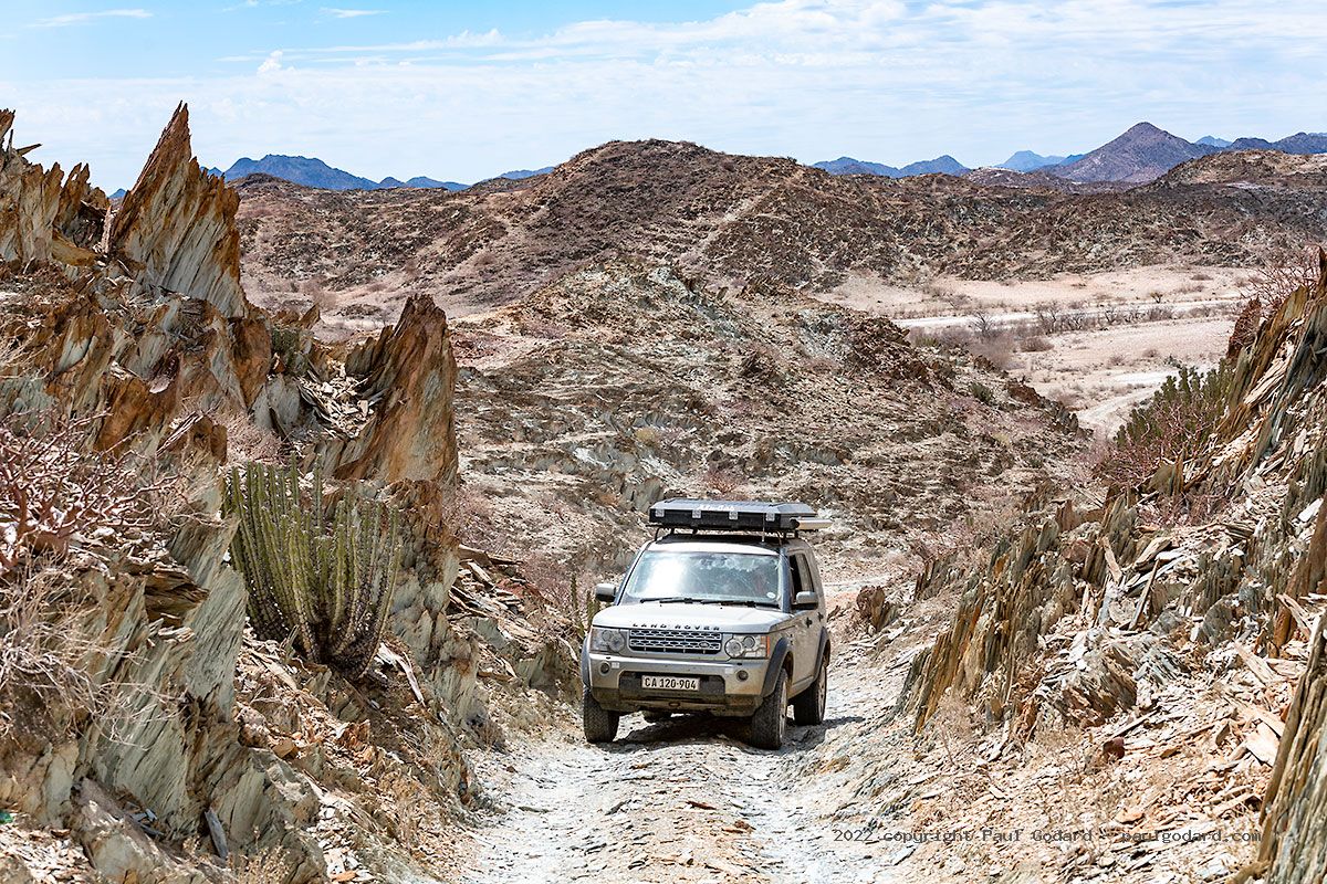
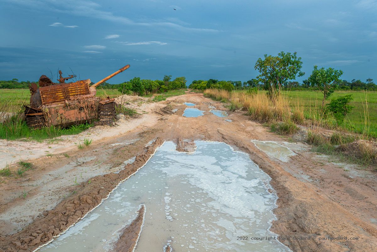
While there are some good tar roads with only a few potholes, we also encountered the other extreme. At times seemingly established roads all but disappeared, becoming barely perceptible motorbike tracks.
The road surfaces vary from tar to sand with loose gravel and rocky patches in between, so it’s vital to constantly keep an eye on tyre pressure. Adjusting your tyre pressure is important for two reasons. Not only will you travel in more comfort, but it will also help you avoid punctures and getting stuck.
See Paul’s road report.
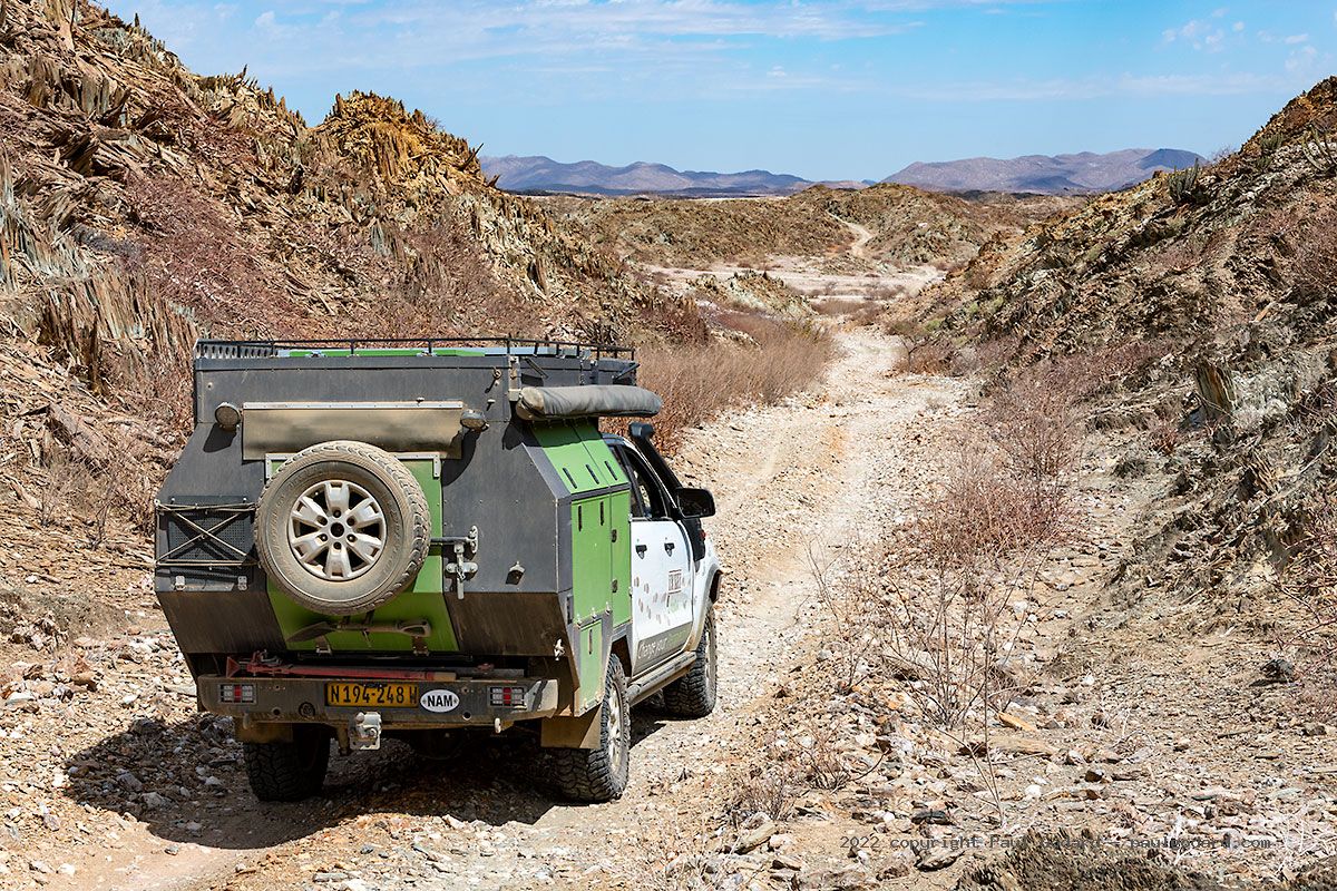
Our route to Epupa Falls (known as Monte Negro in Angola) was particularly slow going. We set out for the waterfalls on the morning of day 4, hoping to be there by lunch. But the track was rocky and we had to stop every so often to remove rocks. We ended up wild camping on the banks of the Kunene with only some 20km left to go. It took us almost another full day to reach Epupa. In some places we had to drive around trees and clear the way with a machete. And in one spot we had to winch a tree that had fallen across the track.
Did you frequently wild camp?
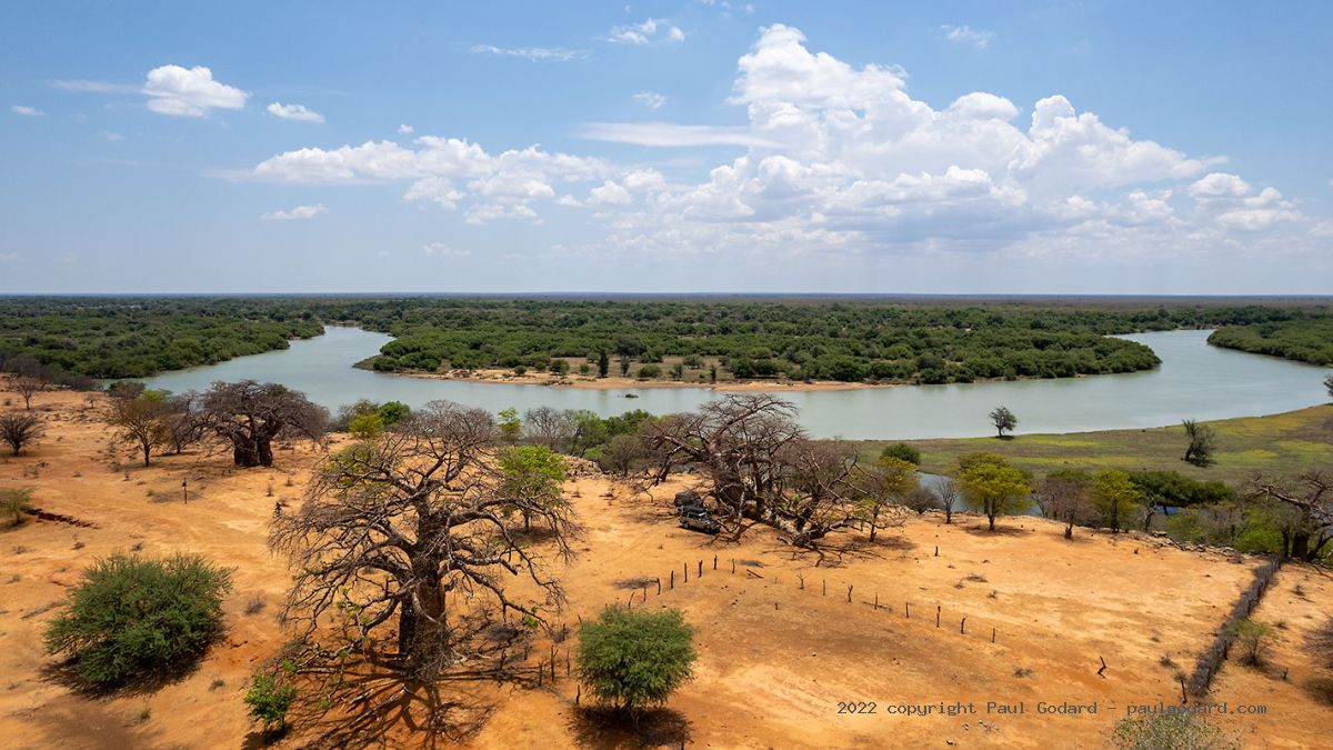
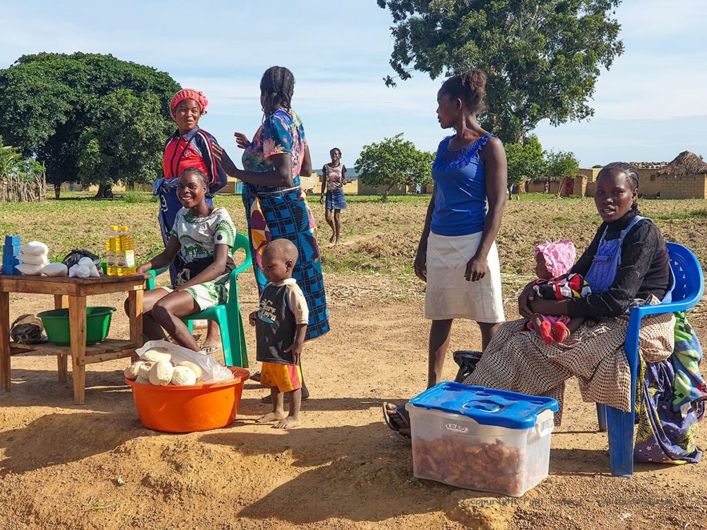
In Angola there are few places with formal camping facilities and mostly we found them overpriced. On the other hand, it is possible to wild camp almost anywhere in the countryside and Angola has a good reputation for being safe. The practice is to check in with the village elders or ask permission from nearby residents. The locals are extremely friendly and hospitable. One of the magical spots we wild camped was next to Cuanza Falls (aka Rápidos do Porto Condo), where villagers showed us the best views of the falls.
Do you have any tips for travellers?
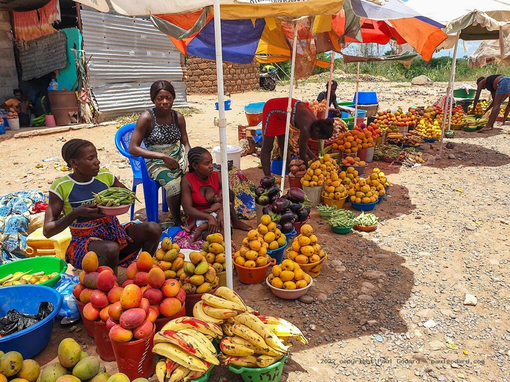
Almost everything in Angola’s grocery stores is more expensive than in Namibia and South Africa. But from Lubango northwards, we passed villagers selling their own produce. We could buy fresh mangos, carrots, tomatoes and gigantic mushrooms – what a treat! We were pleased that we could support the local economy. Be aware that locals prefer to sell their produce by the bucket and aren’t keen to supply smaller quantities. On occasion, we could negotiate a half bucket of avocados and manageable branches of bananas.
Local cantinas along the road are the best place to enjoy a cold beer. In our opinion, the best Angolan beer is N’gola, but it is only available south of Lubango where it is brewed. Note that in Angola they don’t serve quarts. The biggest beer bottle or can is 330ml and costs about R9 in roadside cantinas.
It is a good idea to bring sufficient cash as there are few places where you can pay by debit or credit card. New USD banknotes are in high demand and can be exchanged informally for a much better rate than at the bank.
Read the full Angola trip report on Paul’s website.
Paul Godard is planning another Angola expedition for August/September 2023. There may be space in a vehicle for another photographer or the opportunity for another vehicle to join. If you are interested, email paul@paulgodard.com for more information.

Thank you for the report and the link to the site