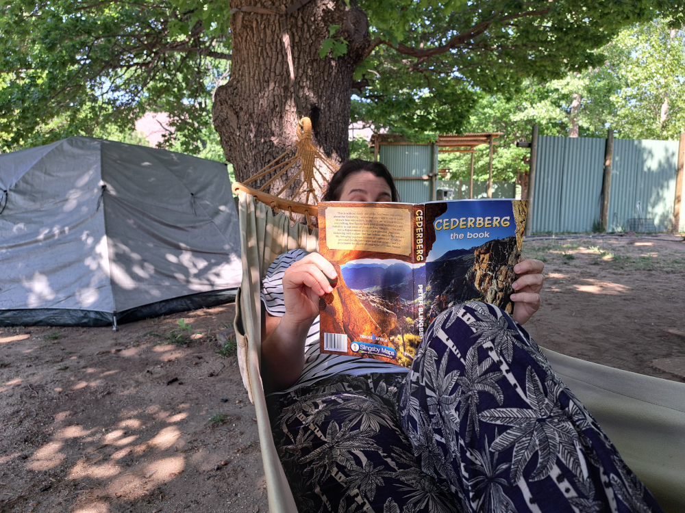
Map guru Peter Slingsby’s latest, Cederberg the book, is a look at his experiences in the area and the places he loves best. For me, it was an invitation to follow in his footsteps. By Magriet Kruger
The Slingsby Hike and Climb the Cederberg map has been my guide on many explorations. It’s known for its accuracy – it’s endorsed by CapeNature, after all. But what I love about it is how Peter Slingsby’s personality shines through: knowledgeable, respectful of nature and playful to boot. Aside from the standard icons for trails and viewpoints, the map is annotated with things that matter to Peter. There are lovely quotes and icons that show where wildlife has been spotted or where spring flowers are particularly beautiful. There’s even a picture of the mapping team: Peter and his dog.
So when his new book about the area, aptly entitled Cederberg the book, arrived, I couldn’t wait to get stuck in. The book is a moving description of his time in these mountains and is packed with fascinating facts and the stories behind place names. What I had to do next seemed obvious: go on a trip with Cederberg the book as my guide.
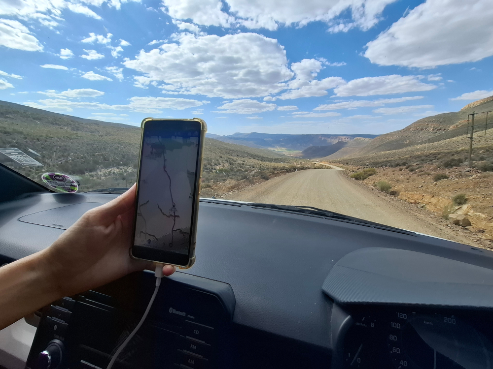
I planned our route using the Tracks4Africa Online Trip Planner. We usually stay at Sanddrif and approach from the N7, rolling down our windows when we hit the top of Nieuwoudt’s Pass. But since we would be staying at Kromrivier this time, we decided to take the ‘back road’ via Ceres and the Koue Bokkeveld. This was the way Peter had come on the memorable trip that he met his wife, Maggie, so it seemed wholly appropriate.
About the Cederberg fire
On 22 December 2025, a fire started on Uitkyk Pass and rapidly spread despite committed firefighting efforts. By the time the fire was out on 5 January 2026, it had burnt around 53,000ha of the central Cederberg. There is some good news though. Many of the iconic areas were saved and there is access to the Maltese Cross, Wolfberg Arch and Stadsaal Caves. Find out more about the areas affected by the Cederberg fire. The people of the Cederberg need visitor support to help the area recover. Accommodation providers will have information on open day trails and safe visitor behaviour to follow.
The way there
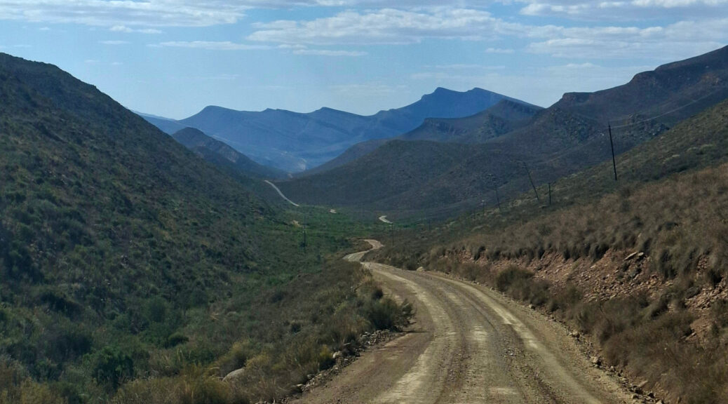
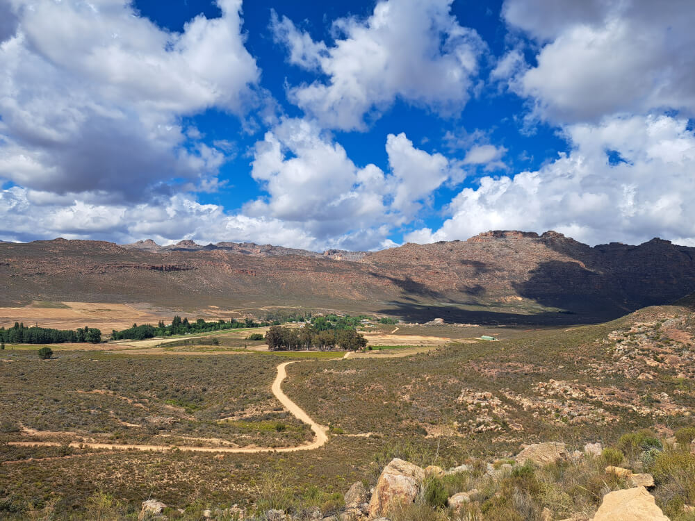
From the moment we turned off the N1 near Rawsonville, I could feel we were heading deeper into the mountains. We drove past vineyards cradled by the Limietberg and Fonteintjiesberg before the road snaked through the Ceres Mountains. Past Prince Alfred’s Hamlet, Gydo Pass offered breathtaking views of the fertile landscape. Op-die-Berg was a last chance to fill up with fuel before heading into the Cederberg. Our tyres crunched onto dirt where the road to Kagga Kamma Nature Reserve turns off.
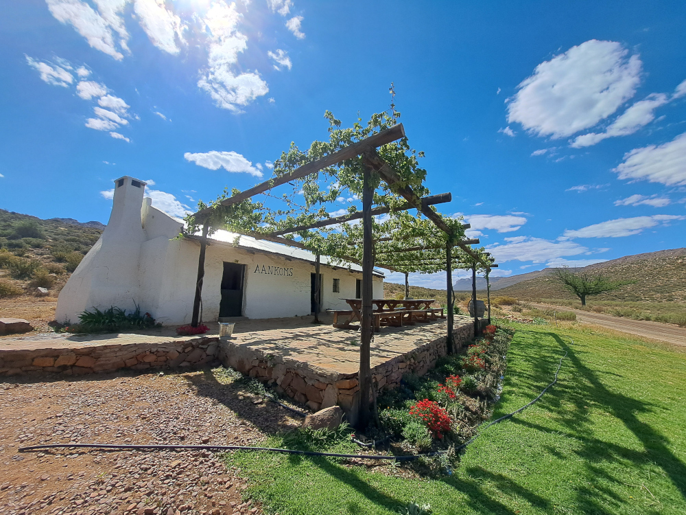
I had noticed a farm stall when plotting the route on the T4A Online Trip Planner. Aankoms did not disappoint: we got huge Hertzoggies, droëwors and cold drinks. Refreshed, we tackled Blinkberg Pass, descending into the Cederberg proper. At the bottom of the pass, the road crosses the Groot River near Mount Ceder Guest Lodge. On Peter’s trip in 1972, there was no lodge here and no low-level bridge either.
“The track simply entered the stony-bedded river at one end and rumbled its way across to the other,” he writes in Cederberg the book. The story of that crossing, which Peter made in a Mini, had me enthralled – especially his reaction when the car’s engine died partway across.
I thought of the Mini as our Suzuki Ignis slowly chugged up Grootrivierhoogte Pass. The ascent is extremely steep and there are no guard rails, so we took it easy. The descent on the other side is little different and we slowly made our way down in second gear, using the engine to control our speed. We didn’t want to risk picking up speed and then skidding on the gravel if we needed to brake.
Camping at Kromrivier
We got our first look at our overnight destination, Kromrivier farm, now known as Kromrivier Cederberg Park, from Kromrivier Pass. Down below a green ribbon of trees highlighted the course of the river, craggy mountains rising above. At the time Peter started exploring the Cederberg regularly, in the late 1960s, Kromrivier was considered the basecamp for adventurers. Owners Rens and Olive Nieuwoudt hosted visitors in old farm cottages and had even established a campsite. Peter recalls how, on one occasion, he and Maggie were stranded in a cottage after the river had come down. Not a problem: Olive sent boxes with her sourdough bread on a wire over the water.
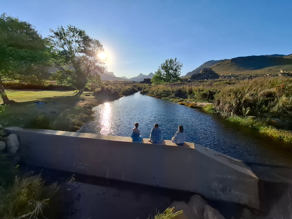
Today, there are six self-catering chalets, a tented camp and 18 campsites, all shaded by mature trees. The stands are spacious and feature a private ablution block, braai pit, power point and even Wi-Fi. Luxury camping indeed! But even better than these creature comforts was having the soundtrack of the river throughout our stay. We wasted no time in pitching our tent under an oak tree, then headed to the swimming spot near reception. The water was fresh and soft on my skin. The weir wall provided a convenient spot to enjoy one of the locally made NieuwBrew beers as we watched the sun go down.
An iconic walk
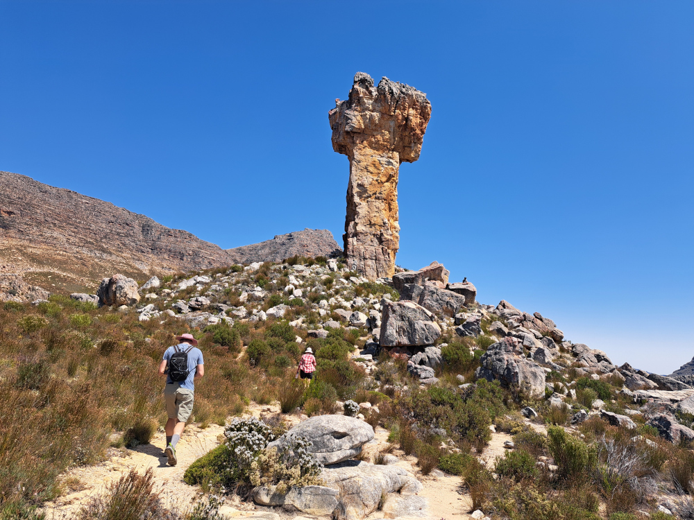
“Everyone wants to go to the iconic Maltese Cross, a truly awesome pillar of rock that seems bigger every time I see it,” writes Peter in Cederberg the book. Who was I to argue?
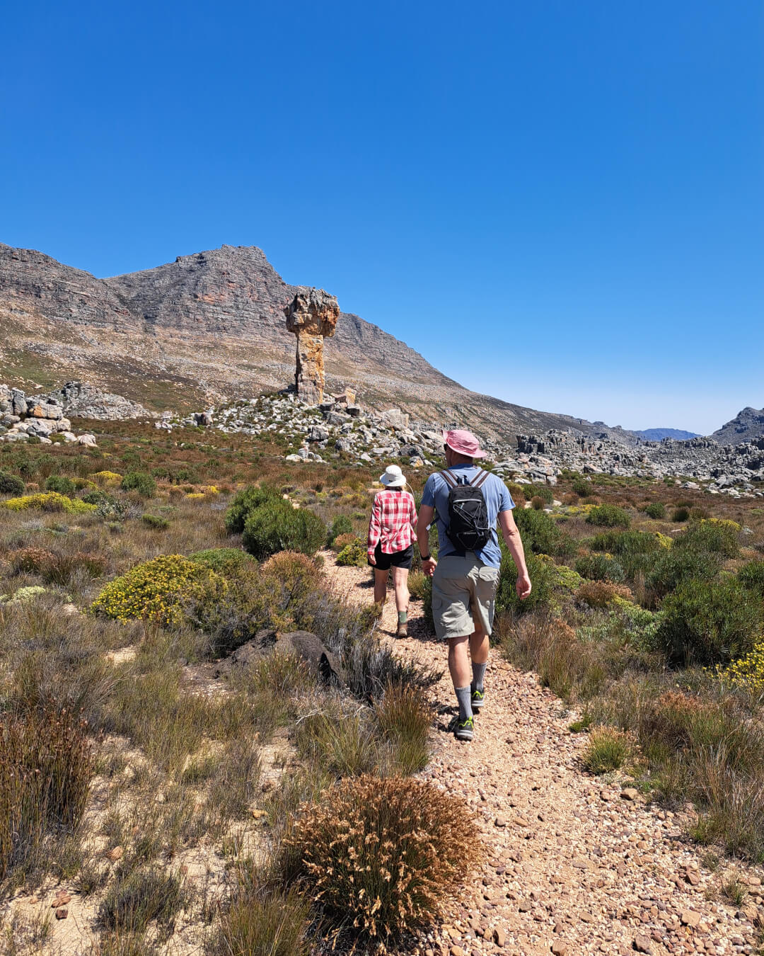
We got our hiking permit (R100 an adult, R65 a child) from the Sanddrif Reception on Dwarsrivier Farm, home to Cederberg Wines. The sign for the Maltese Cross was just around the corner from the farm, on the same road as the Cederberg Astronomical Observatory. With the permit came the code to the locked gate, which allowed us to follow the dirt road to the trailhead. It’s about 6km from the gate to the parking lot and we appreciated being in a car as we drove past a group of heavily laden schoolboys.
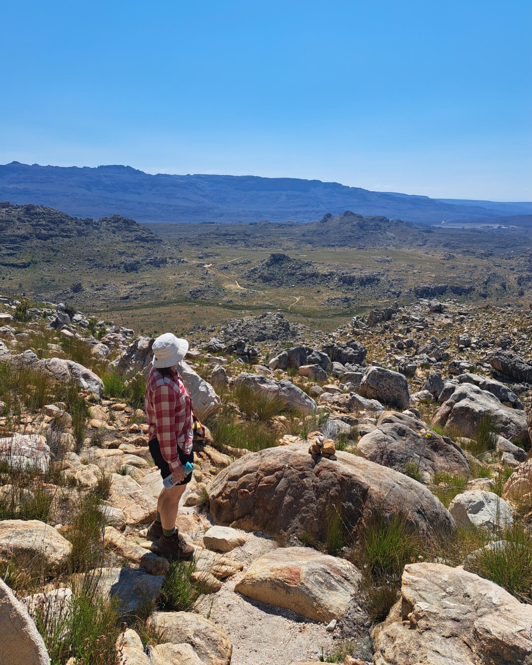
The trail leads down to a pole bridge and then steadily makes its way up Klipbokkloof, winding between the boulders scattered across the slope. I found the path easy to follow; where it led across rocky sections, cairns indicated the way. There were also plenty of flowers, which afforded photo opportunities and the chance to catch my breath – the first stretch was steep. According to the book, we ascended 400m over 2km; looking back, the vista was spectacular. But I had to agree with Peter’s comment: “You’ll soon have eyes for nothing but the giant rock rearing up before you – the mighty Maltese Cross.”
Drinking in the views
As we made our way over a broad plain, the rock pillar grew steadily larger, looking like a craggy fist punching into the air. It took us roughly an hour and a half from the trail’s start to get to the cross. We had the area to ourselves – the schoolboys were still making their way up the slope – so could enjoy an early lunch in perfect peace. Somehow sandwiches taste even better in the shade of a massive rock pillar.
The way down was equally pleasant, as we kept stopping to admire flowers, strange rock formations, colourful agamas. We even came across a little snake, but it slithered away quickly before we could identify it.
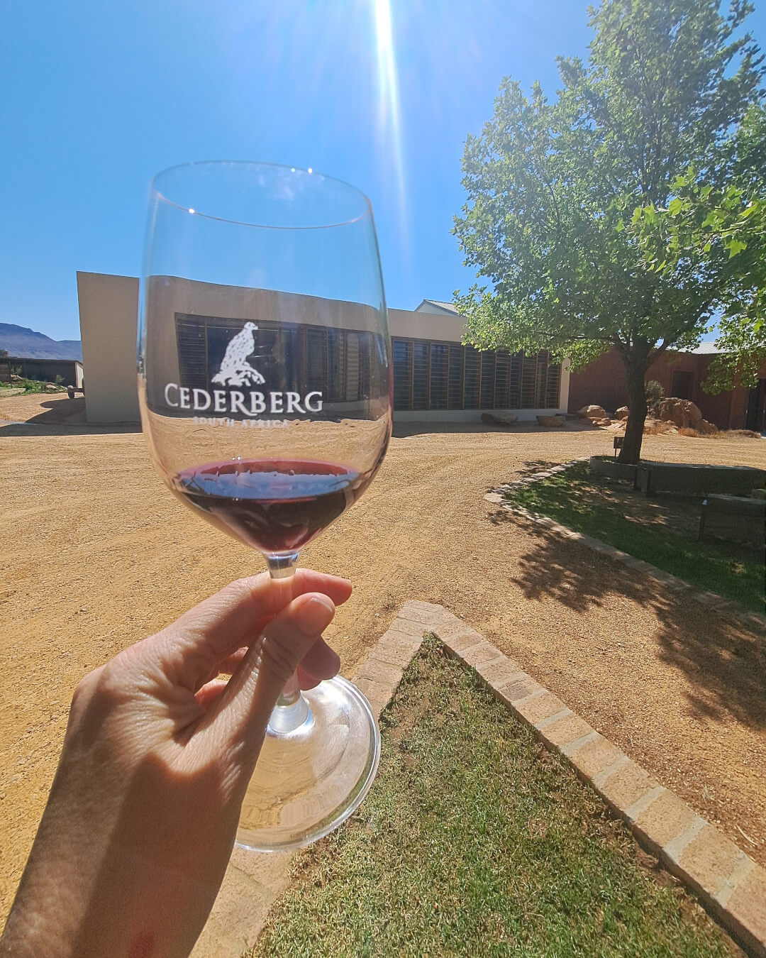
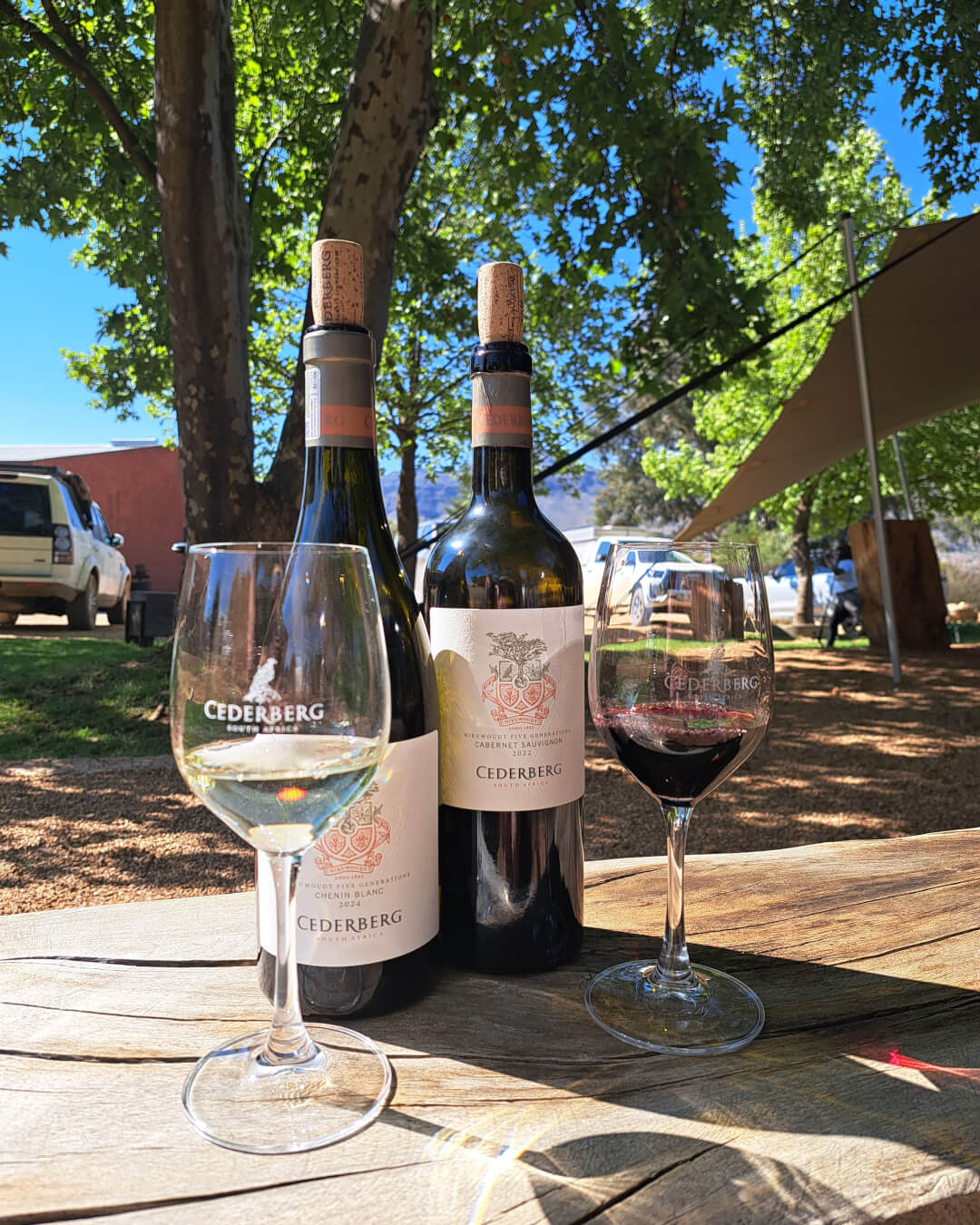
On our descent, we found the time was just right for a tasting at Cederberg Wines. After that, the hammock under the oak trees at Kromrivier beckoned. Peter’s conclusion to his description of the Maltese Cross hike could just as well have been my own: “It’s been a great day out.”
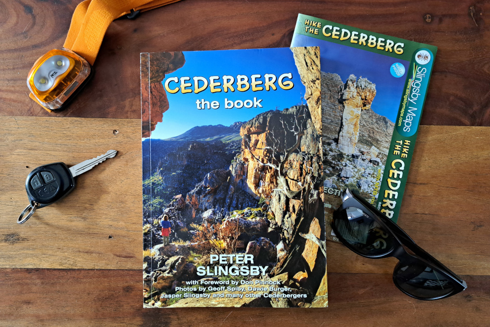
Cederberg the book combines history and anecdotes with insight into place names and traveller information. It’s an invaluable companion for anyone looking to explore and appreciate the area. There are two Slingsby maps to the area. The Cederberg Touring Paper Map covers the roads and tracks in detail, also highlighting places to stay. The Hike and Climb the Cederberg paper map is the go-to guide for adventurers, with accurate trails, permit information and starting points clearly indicated. What’s more, it has been revised to include 200+ bouldering sites.
Traveller note: Kromrivier Cederberg Park is open to visitors.
