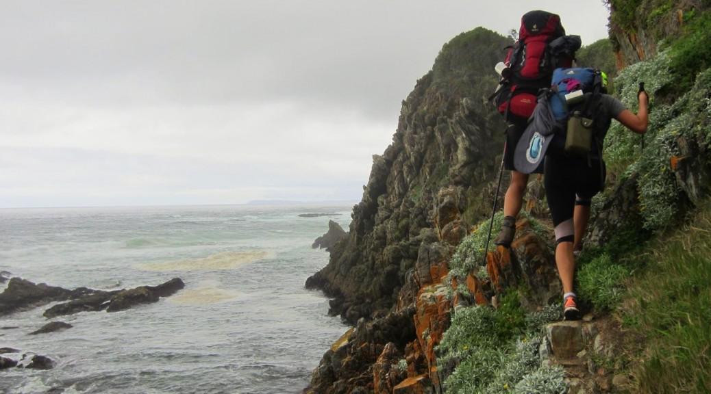
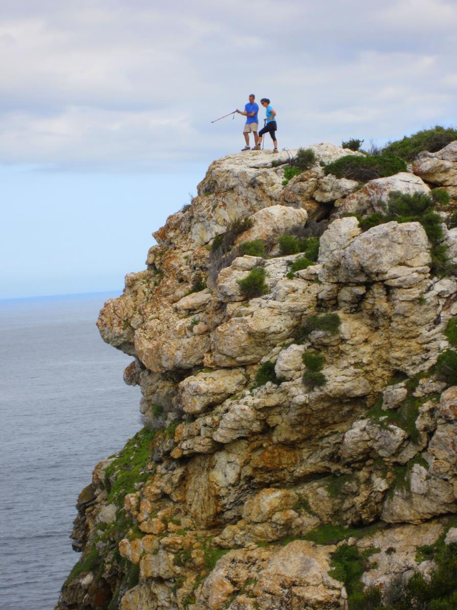
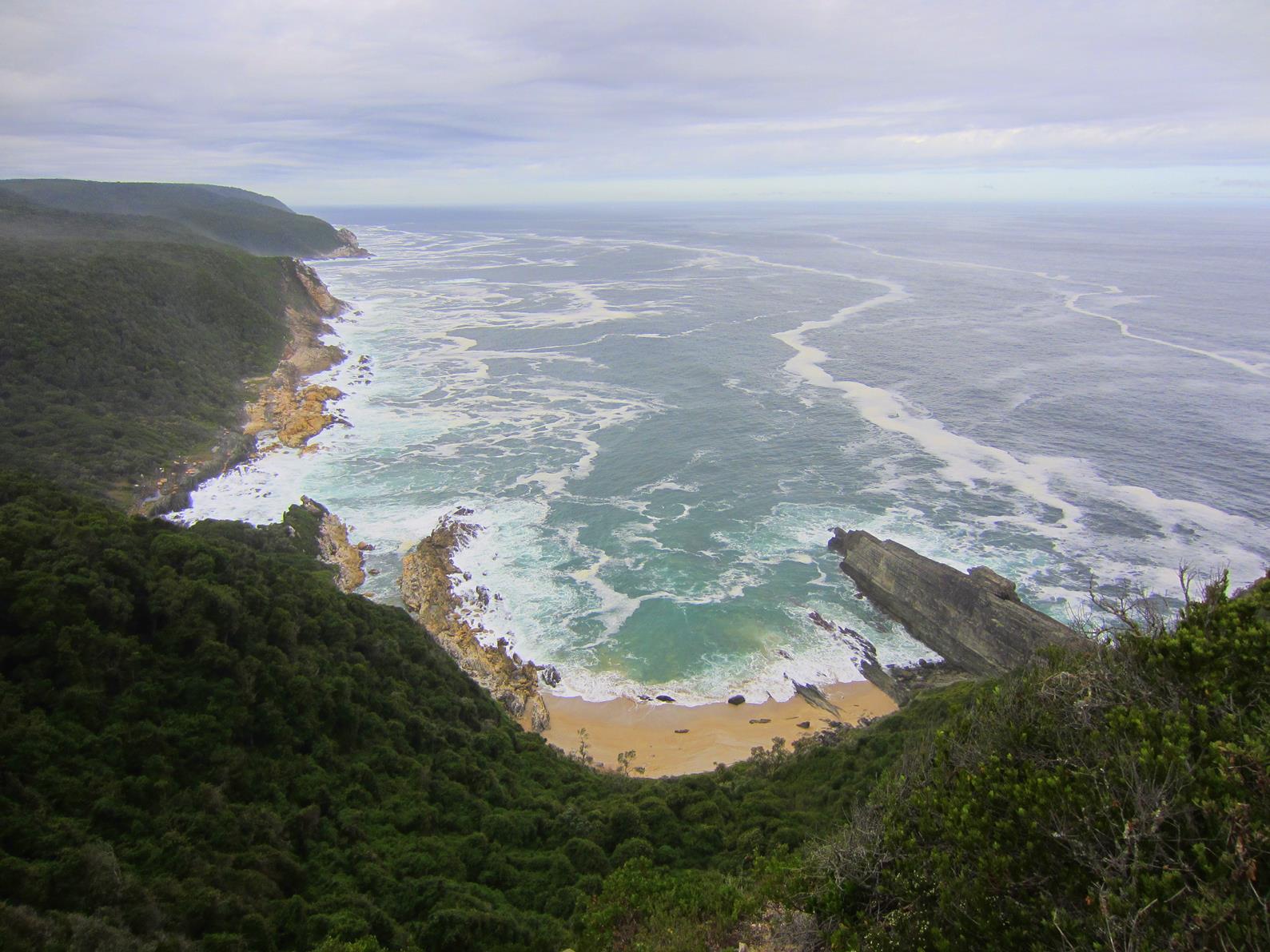
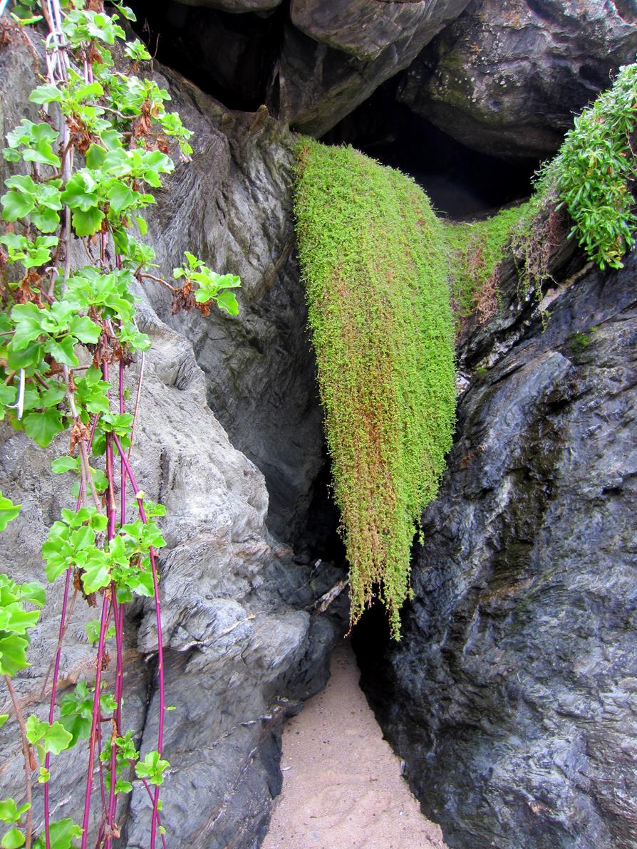
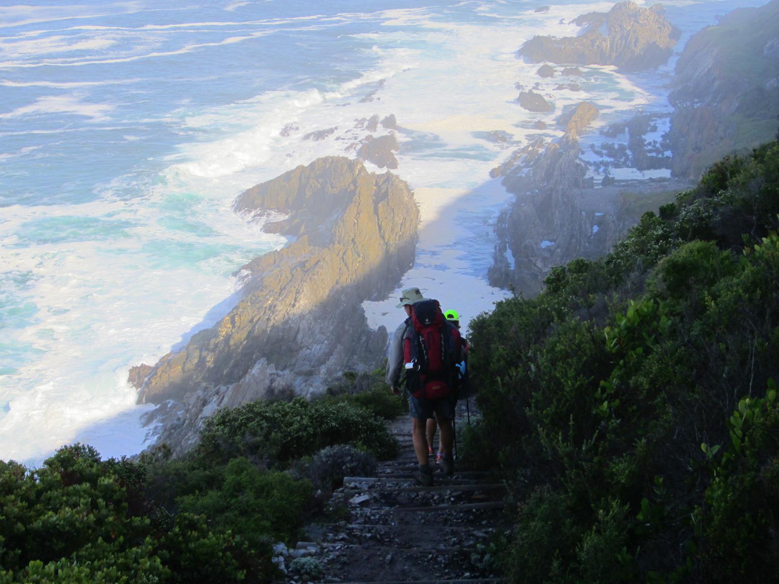
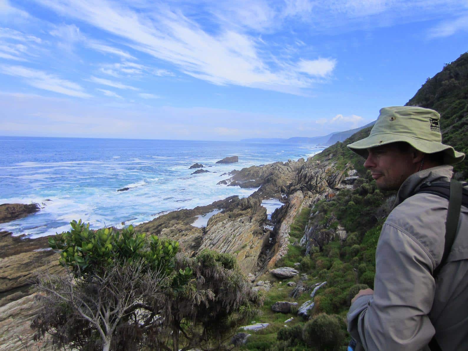
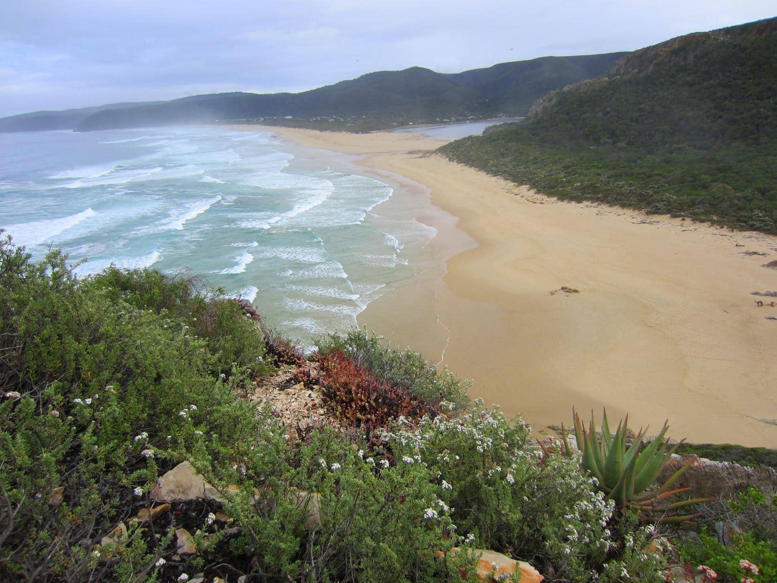
The Otter Trail is breathtakingly beautiful as it follows one of the most rugged and scenic coast lines of South Africa. The trail leads you through both fynbos and forest vegetation. When you walk in the open, the sea can be deafening at times, however, when you are in the forest, the surf is muted to a soft whisper by the trees and the cheerful singing of the birds…
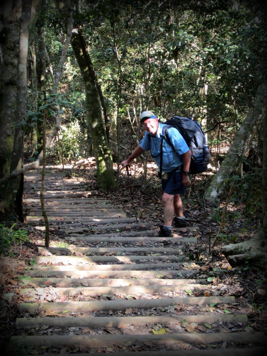
The route is physically challenging, very challenging. You have to climb about a thousand steps, both up and down, and in many places you have to walk or climb over huge rocks. Carrying a backpack of 12 kg plus makes it all the more difficult.
Remember though that the route is so beautiful that you should dawdle rather than rush to get to the huts early. Enjoy the beauty of this amazing coast line; that is why you do the Otter Trail!
Route description
Day 1 = 4,8km (± 2 hours walking time)
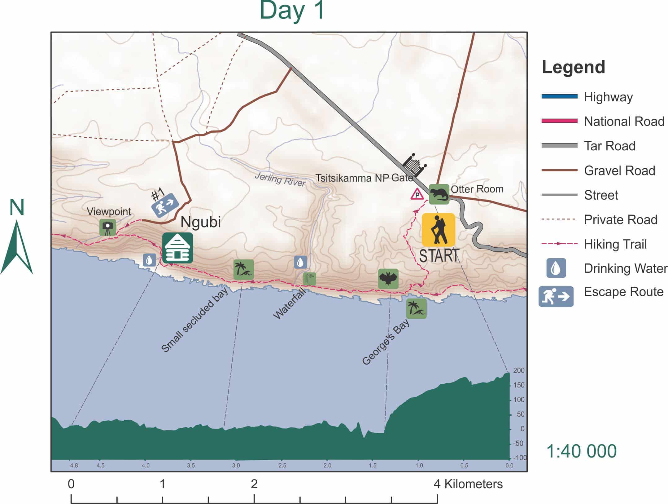
Hikers gather at the Otter Room, where the trail begins for a short briefing by the parks officials.
Day one is the shortest but you should not start later than 14:00 in autumn, winter or spring. In high summer you can leave later because there is more daylight.
The first 1,4km takes you on an undulating route through the forest. It is cool due to shade and a brisk sea breeze, but it will give you a foretaste of the thousands of steps that you will encounter over the next five days.
Once you leave the forest, you walk on a rocky patch next to the sea. Because your backpack is still at its heaviest, it is quite challenging to keep your balance when you boulder hop.
At 2,9km you will reach a beautiful waterfall which is the perfect place for your first stop. Casual day hikers are not allowed past this waterfall.

The next 1,9 km to Ngubi huts combines walking through semi-open fynbos, forest and doing some rock climbing. Fortunately there are bridges and logs to aid the hikers because huge rocks and tree roots make it difficult to balance. There is a sharp descend to the huts, just to give your tired legs a final go.
Day 2 = 7,9km (± 4 hours walking time)
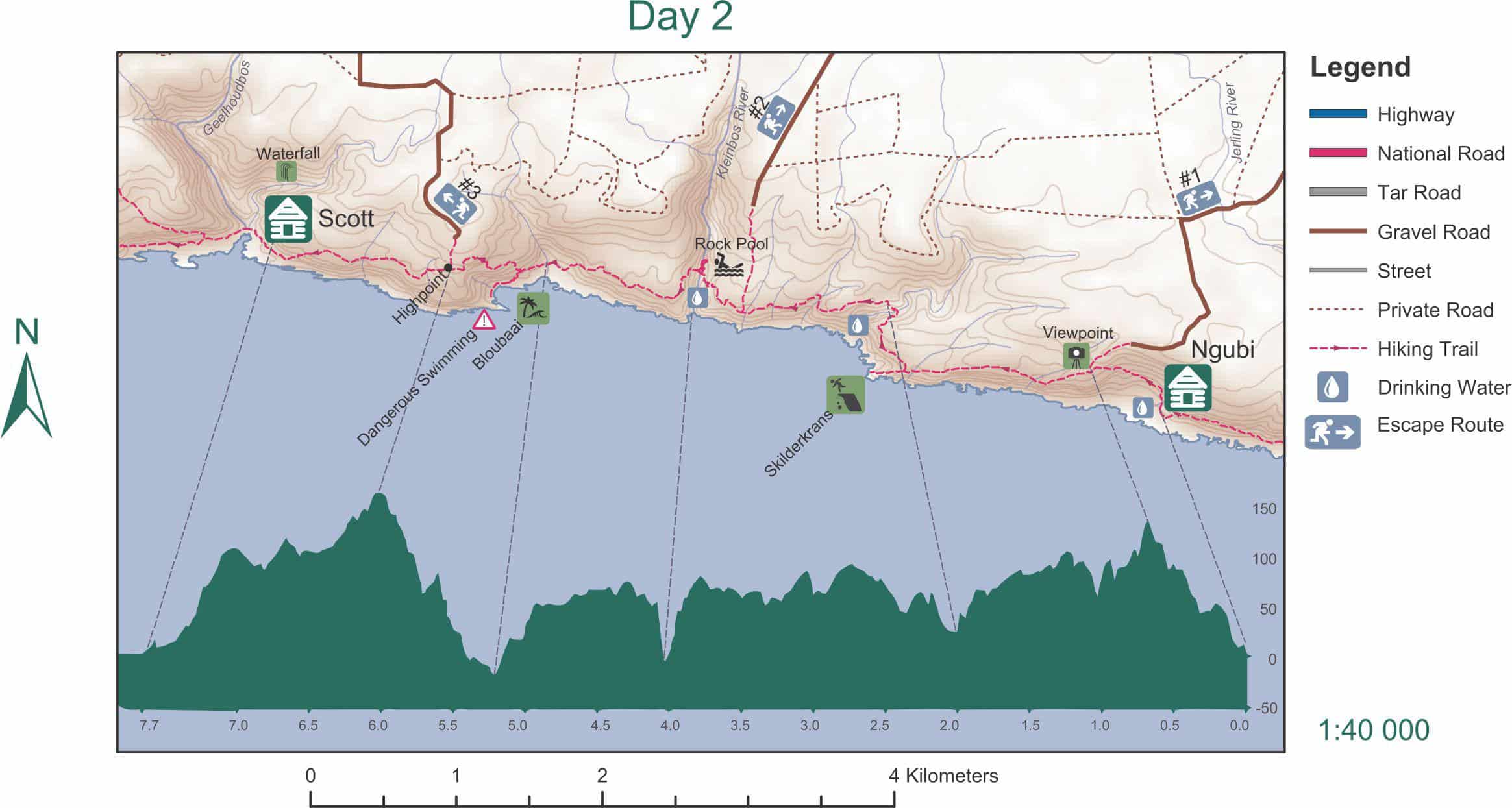
Day two starts with a steep climb followed by a steep descent through forest area. Fortunately it is cool in the shade of both the forest and the mountain.
You will pass a small stream with drinking water and a beautiful viewpoint from where you can look back down on Ngubi huts.
At 2km you will reach Skilderkrans, a rocky outcrop that reaches out over the rough coastline. If you explore it you will find some cormorant nests.
After Skilderkrans the route is quite comfortable through the forest and a short section of fynbos before a steep descent to the Kleinbos River at 4,3km. This is a nice spot to swim, fill up your water bottle and have lunch.
In the forest section you may see the beautiful Knysna Loerie and, if you are lucky, a leopard.
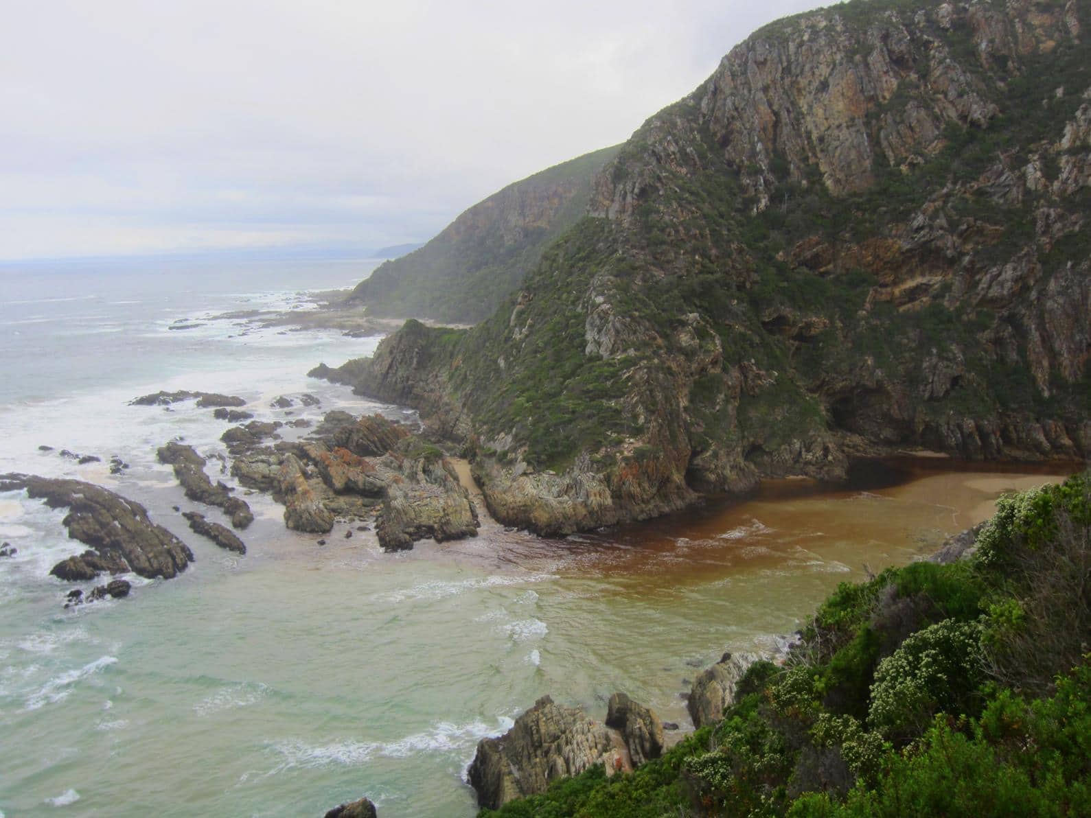
After your lunch stop it is a short, undulating but relatively easy hike until you reach the turn-off to Bloubaai. The route then follows a steep descent to the bay (swimming conditions are dangerous) with a beautiful little beach with crystal clear rock pools that it is worth exploration. If you like you can leave your backpacks at the turn-off point, as you will have to climb back up.
From Bloubaai the last 2,3km to Scott huts is up and down through forest which further drains already tired legs and painful shoulders. The huts have a beautiful setting at the Geelhoutbos River mouth.
Day 3 = 7,7 km (± 4 hours walking time)
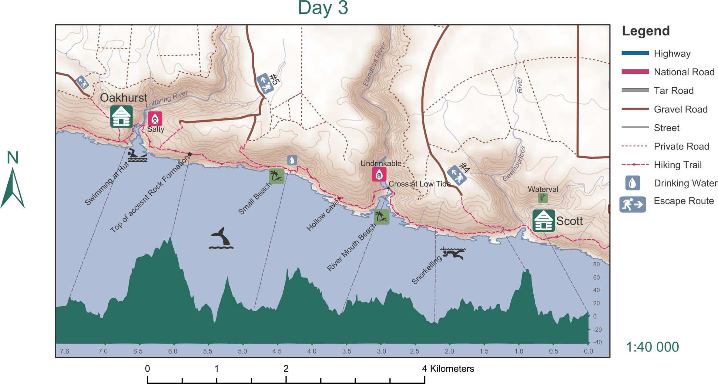
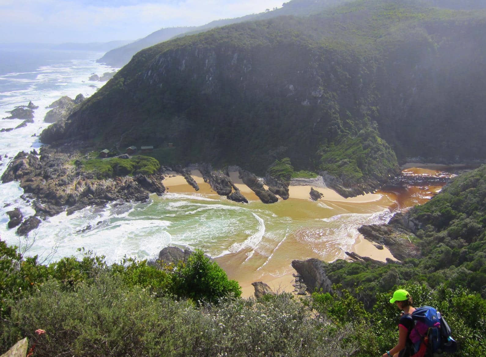
The third day starts with a comfortable walk through the forest. But just when you think this is going to be an easy day, you again hit some very steep uphills and downhills. It is cool due to the shadow of the mountain, even when you leave the forest to walk through fynbos along the edge of the sea.
Day three is without a doubt the easiest of the hike. At 2.2km the Elandsbos River is the ideal place to swim and have lunch.
After the Elandsbos River the route takes you mainly along the coastline. The route is by no means flat and there are some very challenging rocky patches.
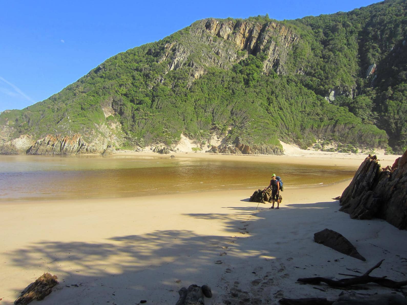
Take a coffee break at the little beach after 4.2km that will make you itch to harvest some mussels for dinner. Restrain yourself as you are in a marine reserve.
You will cross the Lottering River shortly before you reach Oakhurst huts. This is one of the potentially dangerous river crossings therefore you would be wise to check the time for low tide before the hike and plan your day to arrive at the right time.
Day 4 = 13.8km (± 6 hours walking time)
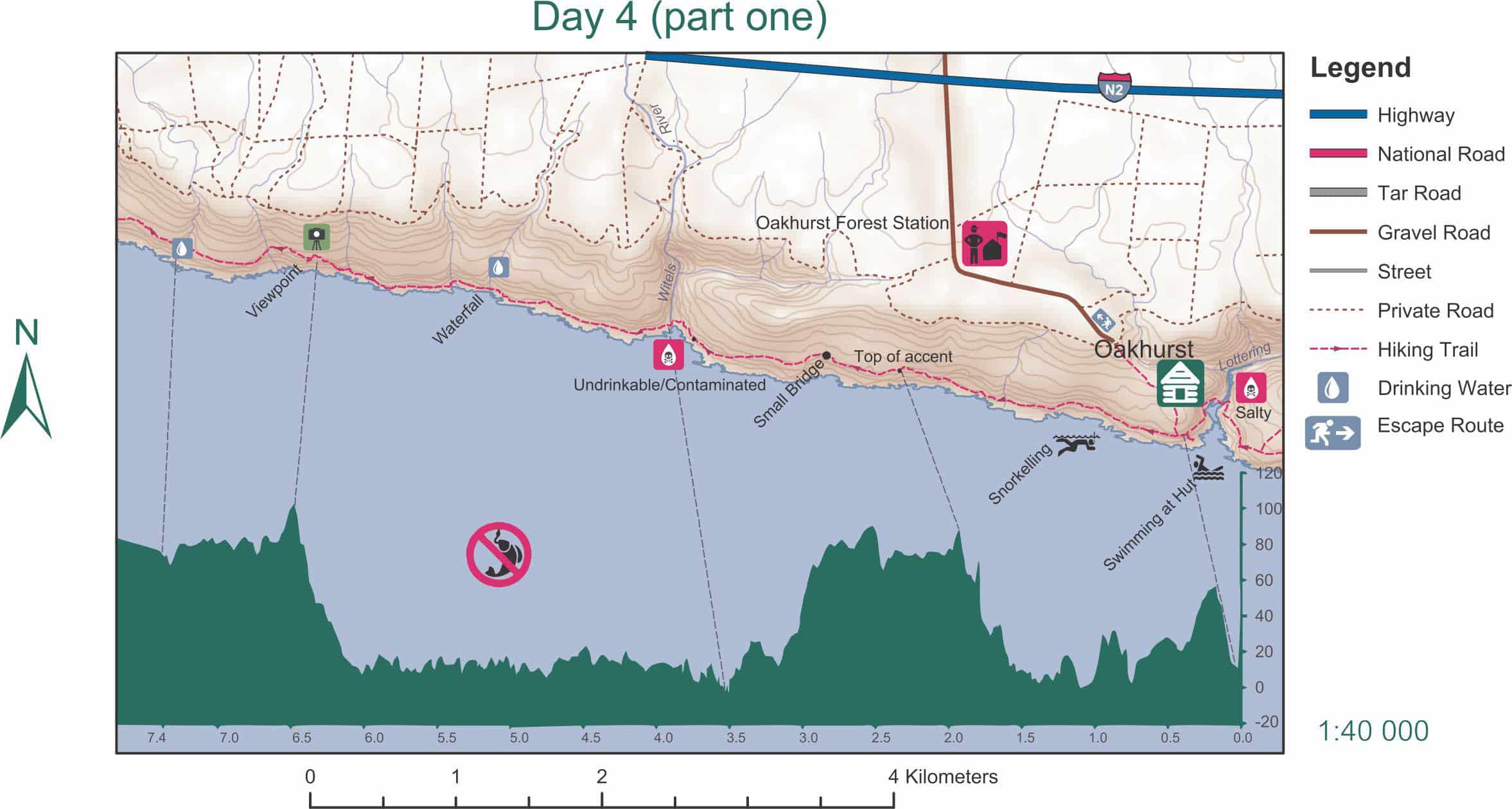
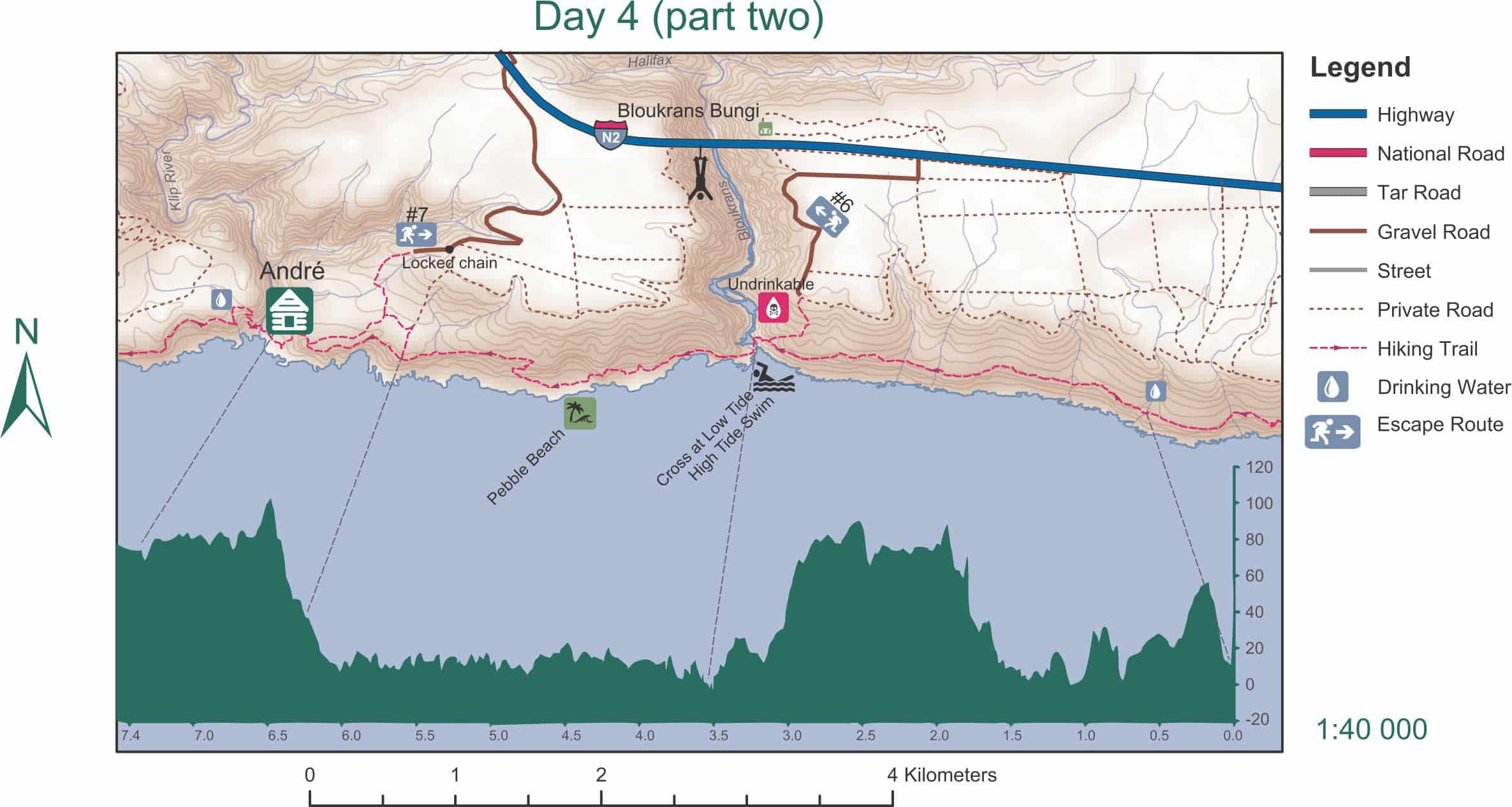
Day 4 is the longest day of the hike and it is crucial that you reach the Bloukrans River at low tide. It is best to start out early, even if you have to wait at the river to cross. Prepare yourself mentally and physically for the river crossing. Even at low tide you can expect to wade through the river with the water hip high.
The day starts with a steep ascent, but fortunately your backpack is much lighter now. The route is interesting, varying between uphill, downhill, forest and beach walking.

The difficult Bloukrans River crossing and subsequent steep climb is followed by a relatively comfortable walk through the forest, a short walk on a rocky beach (Pebble beach) and another undulating stretch through the forest. The last kilometer follows the contour through some beautiful fynbos.
If you are one of the lucky ones who haven’t had any aches and pains until now, you are almost guaranteed of discomfort after the fourth day. From André Huts one can see the faraway lights of Plettenberg Bay.
Day 5 = 6.8km (± 3 hours walking time)
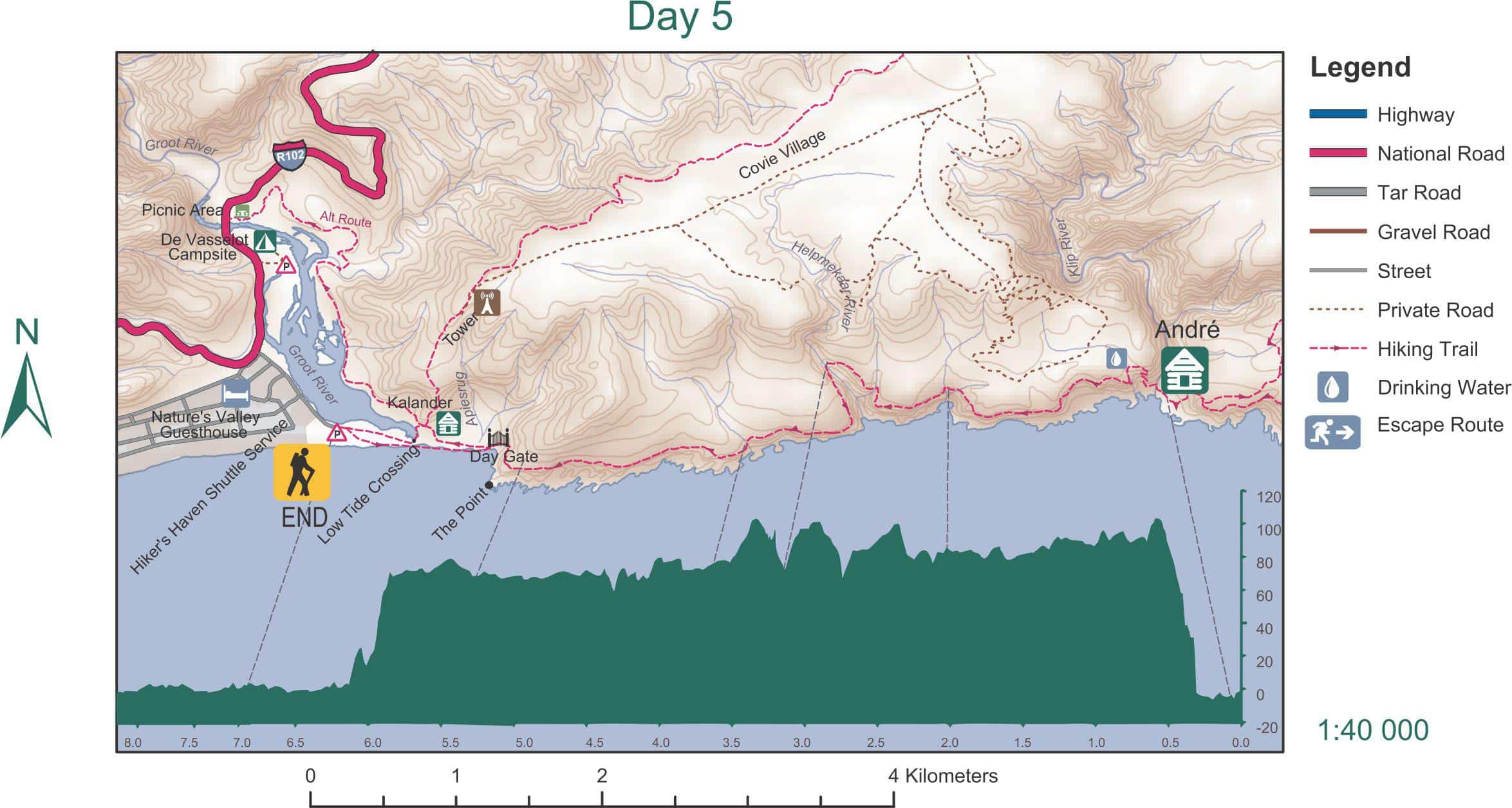
Day five starts out with a steep ascent to the plateau. Most of the route on day five leads through beautiful mountain fynbos with some magnificent viewpoints.
Don’t be fooled that you have reached the end of the hike when you see Nature’s Valley. After a steep descent one has to walk almost two kilometres on the beach and another three kilometers on a jeep track before you reach the parking area at De Vasselot camp.
Start and finish
The trail starts at Storms River Mouth and ends at Nature’s Valley. There are comfortable camping and lodging facilities at both ends of the trail, as well as parking. There is a designated parking area specifically for hikers of the Otter and Tsitsikamma Trails at De Vasselot at Nature’s Valley. Both camps at Storms River Mouth and De Vasselot fall within the Tsitsikamma section of the Garden Route National Park.
You will have to organise within your group to leave at least one vehicle at the end of the trail in order to get all drivers back to the start of the hike to collect their vehicles. Alternatively you can contact Hikers Haven in Nature’s Valley (Telephone +27 (0) 44 531 6805) who offers a transport service for hikers to the start of the trail. They are willing to transport a maximum of four drivers @ R480.
On arrival at Storms River Mouth, hikers have to pay the park fee at reception. There is safe parking available to hikers next to the Otter Room where the briefing is done, as well as a nice bathroom with hot showers for hikers who would like to freshen up at the end of the hike before they hit the road back home.
Overnight facilities
There are two huts at every overnight point that sleep 6 people each. Huts are basic and have bunk beds with mattresses. The huts are serviced and cleaned daily and are well maintained.
There is no electricity. Hikers have to bring their own candles and/or head lights as well as gas stoves and pots for cooking. There is a working surface for cooking in each hut as well as an outside tap with drinking and cooking water.
Each hut has its own braai area with a steel grid and wooden seating arrangement. Ample fire wood is supplied to either braai or to just make a camp fire.
There is also a communal lapa between the two huts with a braai area, wooden benches to sit on and a small basin with a tap for washing dishes.
There is one cold water shower and one flush toilet (with the most beautiful view!) at each overnight point. All hikers on the route share these.
Each hut has an outside rubbish bin. Keep it securely closed at all times as blue monkeys and Cape genets will try to raid the bins. Genets will boldly try to steal food from any cooking area and also enter the huts at night, so keep all food secured.
River crossings
Be prepared for river crossings. Get the time tables before you start out on the trail and plan your hike to try and reach the Elandsbos River on day three and the Bloukrans River on day four at low tide.
The Bloukrans River is the most dangerous crossing. It is approximately 10km from the overnight hut and takes about 4,5 hours to reach. From there it will take you at least another 2,5 hours to reach the next overnight hut.
Line your backpack with a sac liner and pack all your clothing in separate ziplock bags to keep them dry. Take a survival bag along which you can use for floating your backpack across the river if need be. Also take a rope to pull your bag if you need to swim through the river.
If you are unable to cross the river, you can take escape route E6 which will take you to the N2. It is about 2 hours’ hike to the main road.
Drinking water during the hike
There are numerous streams and springs along the Otter Trail that are suitable for drinking. However, it may be wise to use purification tablets if your system is sensitive. You can also fill up your water bottle at the overnight huts.
Your hiking gear
- You will need a good backpack of at least 45 liter capacity.
- Sleeping bag.
- Good hiking boots.
- Walking stick.
- Head lamp.
- Candles and matches.
- Firelighter.
- Toilet paper.
- Hiking gas stove.
- Set of pots.
- Coffee mug, plate, fork, knife and spoon.
- Leatherman or pocket knife.
- Bag liner to protect the content of your backpack from getting wet.
- Survival bag and rope.
- Swimming costume.
- Sun hat.
- Sunglasses.
- Sunblock.
- Mosquito spray.
- One set of clean underwear and socks for each day.
- Five clean shirts (because of the humidity it is a battle to get washing dry during the cooler months). Take shirts that dry quickly.
- Two pairs of shorts to walk in.
- One pair of slacks and a warm top for the evenings.
- A buff and beanie if you do the hike during the cooler months of the year.
- Extra pair of comfortable shoes to wear at the hut. (You don’t want to stay in your boots the whole day, especially if they are wet.)
- Toiletries. (Remember your lip balm!)
- Small towel. (Preferably a drylite towel)
- Camera.
- Dishwashing liquid, sponge and swap.
- Rain coat or poncho.
- A fitted rainproof cover for your backpack.
The weight of your backpack should not be more than a quarter of your body weight. The heavier you carry, the more you WILL suffer. You can spoil yourself a little with nice food (and wine) but you will pay dearly for it. Most of the trail is up or down and you often have to do some easy rock climbing. The heavier your bag is, the more difficult it is to balance yourself over rocky terrain. Be wise and pack as light as possible!
Tips
- Line your backpack with the bag liner before you pack your things. Your backpack might get wet when crossing a river, or if it rains.
- Pack all your clothes in ziplock bags and your sleeping bag in a plastic bag to ensure that it stays dry.
- Wear short stockings or thin running socks underneath your hiking socks to prevent blisters.
- You might not be used to walking with a stick, but it will really aid you on this route.
- As a safety measure the group should have a designated hiker who will remain at the rear and make sure that nobody is left behind.
- Draw up a list of the names, ID numbers, medical aid numbers, group cell phone numbers and contact numbers of relatives and circulate the list among the group.
- If you vacuum pack your meat, you can braai on all four nights. However, this luxury will cost you dearly in terms of weight.
- A compression bag will reduce the space that your sleeping bag takes up in your backpack.
- An inner liner for your sleeping bag will keep it clean and if it is hot you can sleep in just the liner to protect yourself from insects. These are available at an outdoor store or you can make yourself one by folding a double sheet and stitching it together.
In case of emergency
There are escape routes on each section of the hike, starting from the second day. You can also phone the Storms River Police on 10111 or Park Headquarters on 042 28 11 607. Alternatively you can phone 072 917 5079 if you run into trouble before the Bloukrans River and 072 917 4474 if you run into trouble after you have crossed the Bloukrans River.
Cell phone reception is intermittent along the trail and you will only have reception at the first hut. You should nonetheless take a cell phone with you as there is a weak signal in most of the high lying sections of the route.
Safety precautions
- Take a few packets of Rehydrate.
- Take a small first aid kit with plasters, bactroban antiseptic ointment, burnshield, painkillers containing paracetamol and an anti-inflammatory, muscle relaxant painkillers, bandages and Voltaren gel.
- Ideally every hiker should have a whistle to use when in trouble.
- You should always have a thermal blanket with you.
- Take a detailed map of the trail.
Suggested food
Breakfast
Oats-so-easy.
Snacks
Biltong, droëwors, Salami sticks, nuts, apples, prunes, energy/fruit bars, chocolate.
Lunch
Instant soup.
Two minute noodles.
Provita with cheese wedges or chicken mayo / tuna mayo spread (you can buy it already mixed in packets).
Tuna or smoked chicken to make a fresh salad with cucumber and baby tomatoes (cucumber and tomatoes will last a long time and a salad is a fresh alternative to your dry food).
Supper
Meat of your choice to braai.
Potatoes in foil (wrap them at home). Maybe spoil yourself for one or two nights as potatoes are heavy.
Smash.
Beetroot salad.
Cabbage and apple (to make a salad).
Pasta and sauce with tuna or chicken and parmesan cheese.
Extra
Coffee, tea, sugar, cremora or powdered milk, hot chocolate.
Salt and pepper.
Rusks.
Biscuits.
Sweets.

I would just like to say thank you so much for the maps. It’s very difficult to find good maps of the Otter Trail online.
Please excuse the foreigner in the room:
“There is a working surface for cooking in each hut”
Does this mean there is a gas stove top in every hut?
Hi,there are no cooking equipment or gas stoves at the huts. It is simply a place to do your cooking and you would need to carry your own gast stove etc.
No, each hut has six beds, that’s it. There is an area in each hut where you can cook, but you need to bring your own stove, pots etc.
Apologies to be pedantic while looking at your maps … the second part of the day 4 map, the height registration does not match with the trail, it seems to be a copy of that on the first part.
Thank you for pointing that out Charles, we will have a look and fix the map.
Thanks for the update, as one who has done the trail this blog posting has good information.
Having done the ‘Otter’ twice, I can offer the following advice. NEVER be the first to hit the trail in the mornings, you’ll seriously regret it (spider webs and spider bites).
Trying to get hold of the ottertrail official logo
HI
The best would be to contact Sanparks – they should be able to assist you. See https://www.sanparks.org/parks/garden_route/camps/storms_river/tourism/otter.php
Love this! thanks for the post!! 🙂
Wow, thank you for the information. Really short but informative.
En nou vir die Vis!