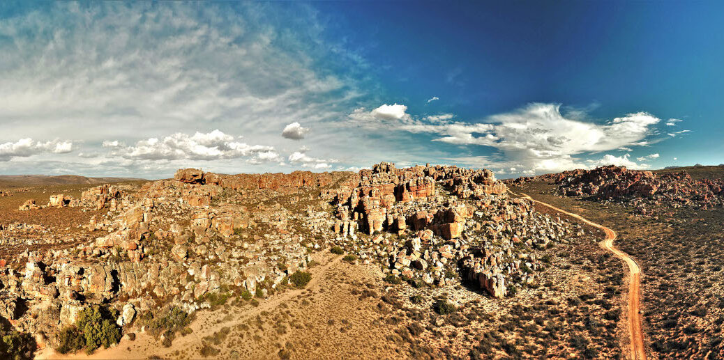
The Cederberg is popular for its mountain passes (memorable drives) and remoteness (recipe for total relaxation). But don’t miss the acclaimed rock art sites of Matjiesrivier Nature Reserve. These age-old paintings offer a compelling window into the past. By Kirsten Fugard
Situated approximately 250km north of Cape Town, the Cederberg skirts over 70,000ha of craggy terrain. This landscape dates back nearly 500 million years! The region’s imposing rock formations in innumerable shapes, sizes and textures are quite spectacular. Formed by rain and snow battering the sandstone boulders for aeons, the rocks bear resemblance to mystical creatures.
What’s more, the Cederberg is home to several Khoisan rock paintings dating back between 300 and 6,000 years. Matjiesrivier Nature Reserve welcomes the public to two significant rock art sites: Truitjieskraal and Stadsaal Caves. These spellbinding locations should not be missed when travelling through the area.
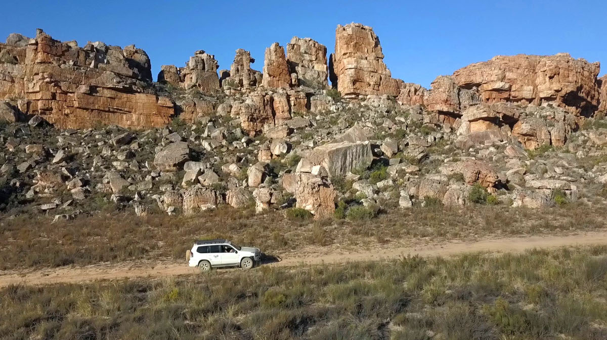
Routes into the Cederberg
There are a number of access points into the Cederberg, each offering unique appeal. Expect breathtaking views, winding mountain passes and a variety of fynbos and renosterveld. Add to this historic ox wagon trails and rambling ruins and you have all the elements for an enriching journey.
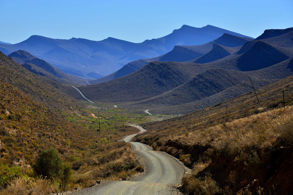
These two routes into the Cederberg are well worth it:
Over Gydo Pass
From Ceres the route leads through Prince Alfred’s Hamlet over the 7km-long Gydo Pass. The parking area at the summit offers great photo opportunities. Picture a patchwork of orchards, dams and fields, set in a valley surrounded by spectacular mountains. The small settlement of Op-die-Berg is the last chance to refuel before entering the Cederberg. Be warned, it’s often closed on Sundays.
A detour to Tankwa
A second route, along the R46 from Ceres, leads to the well-known R355 in the Tankwa Karoo. This road holds the record for being the longest uninterrupted dirt road in South Africa. Though in good condition, sections of the road are interspersed with slivers of sharp shale, so beware of punctures.
Before turning left into the Klein Cederberg, continue for 2km for a stop at the popular Tankwa Padstal. This oasis, seemingly in the middle of nowhere, offers a quirky shop, bar, tourist office and a restaurant. It is deservedly famous for its delicious roosterkoek and you’ll find strong wi-fi.
A morning at Truitjieskraal
For our rock art trip, we stayed at Mount Ceder, a 19km drive from the Truitjieskraal rock art site. The cave here was once an overnight spot for herdsmen when they moved their livestock to better grazing. The name is thought to refer to a local herdsman’s partner, Gertruida, who lived along the route.
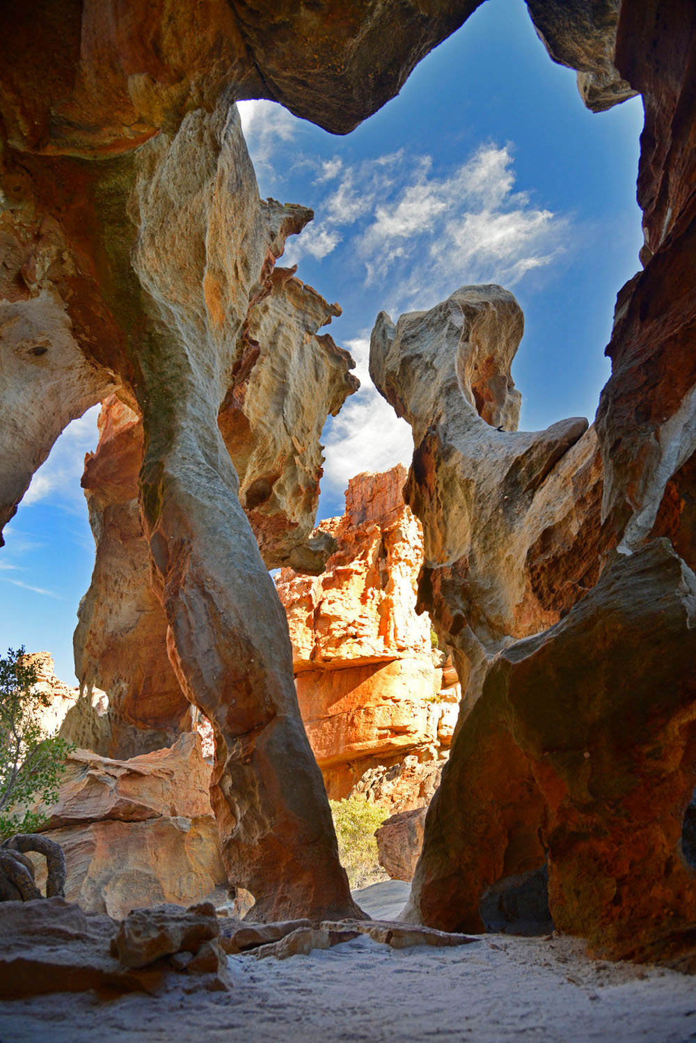
It’s first light when we set off for Truitjieskraal. Due to the soft, deep sand leading up to the rock formations, it’s best to take a vehicle with high clearance. Once we’re through the gate and start the slow drive to the parking area, the monolithic rock formations in the distance grow larger and more breathtaking. It’s easy to see why this location is a photographer’s utopia. The light patterns and shadows on the gaping caves and rock structures create striking motifs.
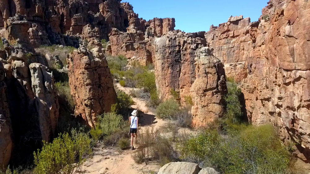
Dating back 5,000 years, the reddish-brown paintings offer a glimpse into the fascinating lives and beliefs of the Khoisan people who dwelled in the area. For as long as I can remember, I’ve been drawn to anything that hints at previous civilisations. So my close-up encounters with these paintings, of which there are over 2,500 in Matjiesrivier Nature Reserve, put me in my element. Most of the paintings portray animal and human imagery, believed to hold significant religious meaning. The half-animal, half-human figures on the main overhang are a common feature in South African rock art.
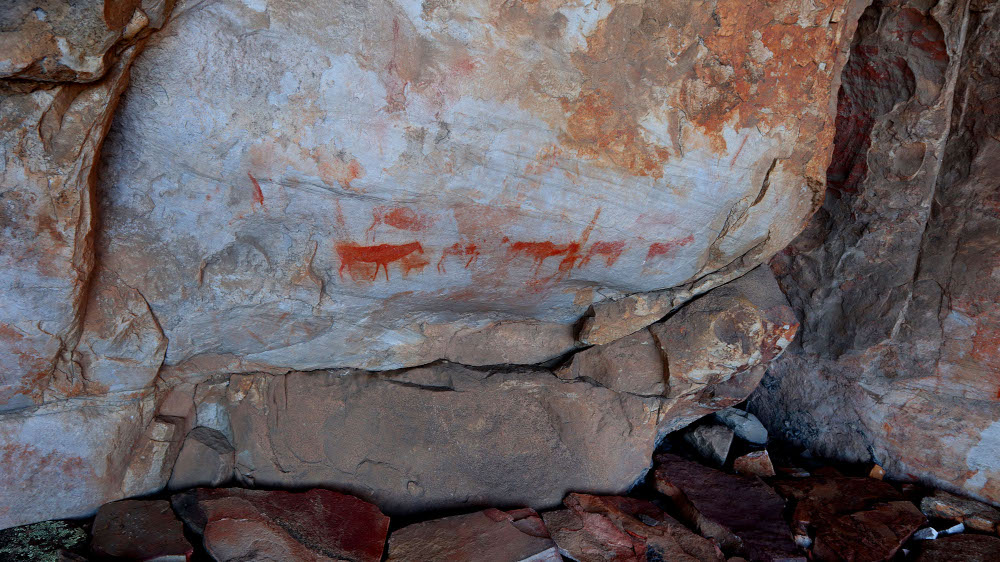
Information boards along the trail provide details about the Khoi and San cultures and the distinctive habitat in the area. The walk through the rock formations is undemanding and takes roughly half an hour. Even so, we spend several hours soaking up the beauty of this sacred place.
Seeing sunset from Stadsaal Caves
After a morning of exploring Truitjieskraal, we head to the Stadsaal Caves, 10km away. The hard-packed sand road leading up to the cave can be driven in any type of vehicle.
Stadsaal (Afrikaans for city hall) is a gaping vault carved out of the rock by centuries of wind erosion. A trail runs around the entire rock formation exposing smaller cavities and outcrops. The walk, starting and ending in the parking lot, takes around half an hour. There is magic around every corner, so be sure to linger!
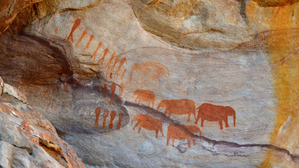
A short distance from the cave complex is the enclosed rock art site showing a painting of a herd of elephants and three rows of people. Experts believe the San people created this painting around 3,000 years ago. As no weapons appear here, it is thought the painting symbolises a ritual, rather than a hunt. The information boards at the site provide further insights regarding the painting, the San people, and the surrounds.
As the sun dips behind the mountains, we reluctantly make our way to the car for the drive back to Mount Ceder, thoughts and SD cards full of unforgettable memories.
Good to know
Where to stay
Whether you favour camping or fully catered luxury amenities, you can find both in the Cederberg Conservancy. Campers are spoilt for choice, with campsites at Cederberg Oasis, Kromrivier Cederberg Park, Algeria, Driehoek, Mount Ceder, Nuwerust Guest Camp and Sanddrif Holiday Resort. From any of these you can do leisurely visits to both Truitjieskraal and the Stadsaal Cave in a day.
Also read: Best places to stay in the Cederberg
Permits
You will need permits (which include a security key for the gate) to enter Truitjieskraal and Stadsaal rock art sites. These are available from Algeria, Dwarsrivier Farm, Cederberg Oasis or Mount Ceder for R50 per adult and R30 per child. Entry for Wild Card holders is free.
Love exploring off the beaten track? Then you’ll love travelling with Tracks4Africa maps, for Garmin GPS devices, on paper and smartphone. Take a closer look at our latest navigation product, Traveller’s Atlas Southern Africa, perfect for route planning as well as navigating.
