
Kruger trails guide Warren Deyzel has found an ingenious way to use Tracks4Africa maps. Loaded onto his Garmin fenix 7X watch, the T4A GPS maps are key to unlocking the wilderness.
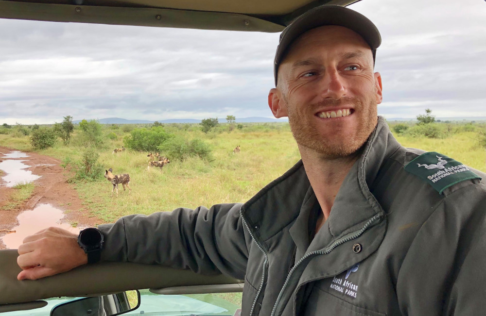
Field guide Warren Deyzel must have the greatest office of all: the Kruger National Park. The park spans nearly two million hectares of savannah and woodland and is a place where wild animals have the run of the land. Where thousands of elephant roam and big cats like lion and leopard hunt. This is where Warren spends his days, guiding visitors as they explore one of the world’s greatest game reserves. A FGASA Level 3 Professional Trails Guide, he is specially qualified to take guests into the wilderness.
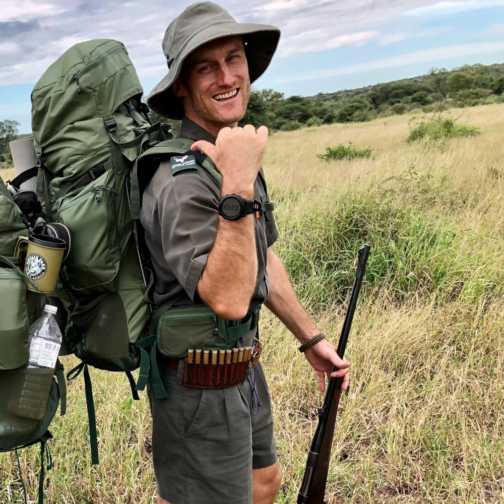
For the adventurous, that means guided hiking trails off the well-trod tourist path, exploring Big Five territory on foot. To do so, Warren has spent five years attaining the most prestigious level from the Field Guide Association of South Africa. The Special Knowledge and Skills in Dangerous Game (SKS:DG) qualification involves several theory exams, practical assessments, over 520 days active guiding and thousands of hours on foot. A professional SKS guide has advanced navigation and orientation skills, is proficient in rifle handling and confident camping under the stars.
Tracks4Africa quizzed Warren about his job and how he uses T4A maps in the field.
What do you love about the work you do?
I love spending my time exploring the most pristine wilderness areas of the Kruger National Park. Tracking the Big Five on foot is one of the most humbling experiences I’ve ever had. You realise how acute their senses are – how much better their eyesight, hearing and sense of smell. They can pick you up from hundreds of metres away!
Do you have a favourite area in Kruger?
For remote landscapes, I feel you can’t beat wilderness trails in the northern parts of Kruger. They afford us the opportunity to see areas which very few people ever traverse into. The north also offers a chance to see some of the oldest, and therefore biggest, trees In the park. Thirdly, it’s home to some of the most breath-taking views, featuring the biggest river courses in Kruger.
Which trails would you recommend?
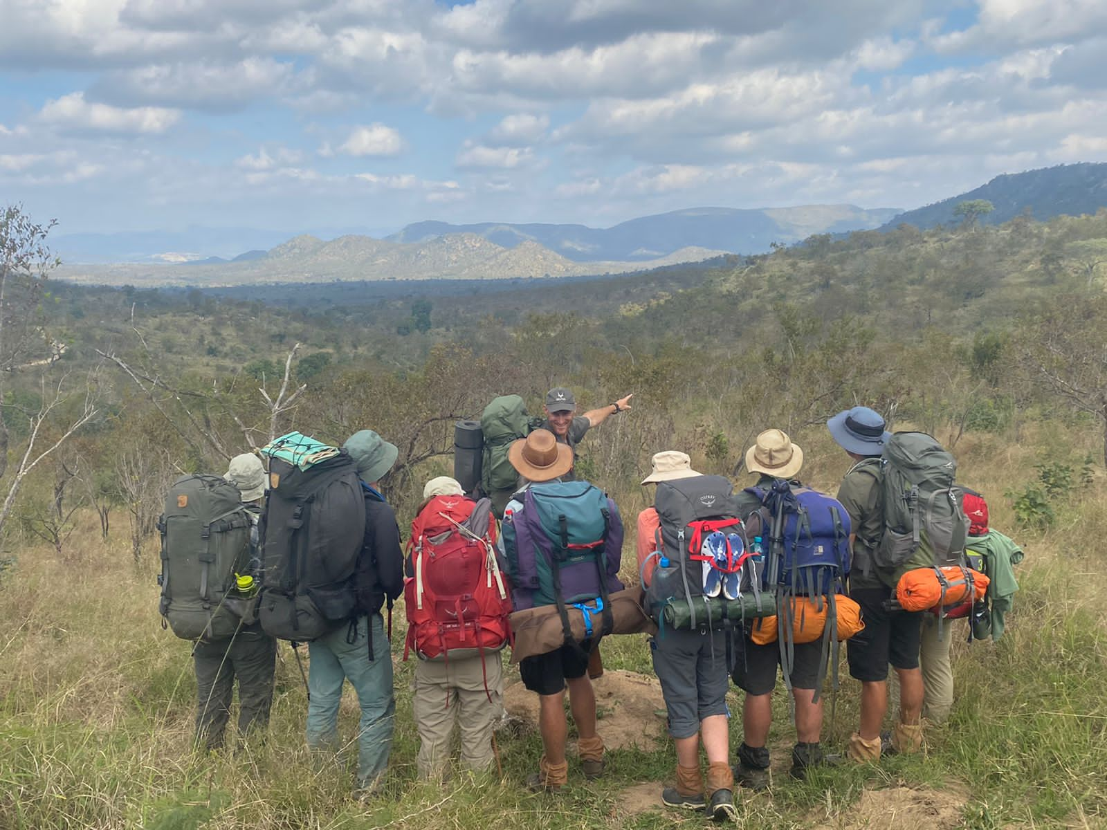
The Lonely Bull, Olifants and Mphongolo Backpack Trails are 3-night, 4-day wilderness experiences. These are ideal for first-timers who want to get a feel for overnight hiking. The Nyarhi Bush Camp would be best suited to families. It’s a 4-day bush camp, where you bring your own camping equipment and have to be fully self-sufficient. It lets you experience the wildest parts of Kruger on foot, while camping comfortably in an unfenced camp. The Kruger Trail is the most demanding one in the park. It is the ultimate wilderness walk: hiking the length of Kruger (650km) over 36 days. This is the only hiking experience of its kind in the world and boasts the most diversity.
How do you use your Garmin watch while working?
I use the Garmin fenix 7X extensively in the field, every single day, to track distance and navigate through the wild. When traversing an area I don’t know, I’ll plug in a start and an end point in advance. I usually work out the distance between them to be 13km as the crow flies, which translates to 20km on the ground. The watch then tells me in which direction to go and the distance to the destination.
I also use the Garmin to navigate to pre-saved waypoints, such as water sources and potential camp sites in the wilderness. I’ll even include places to take breaks under shaded trees and spots which offer incredible views. When I’m covering new ground, I continually add waypoints like these for the future. From the compass interface I can switch to the map view and check out specific details on the Tracks4Africa map.

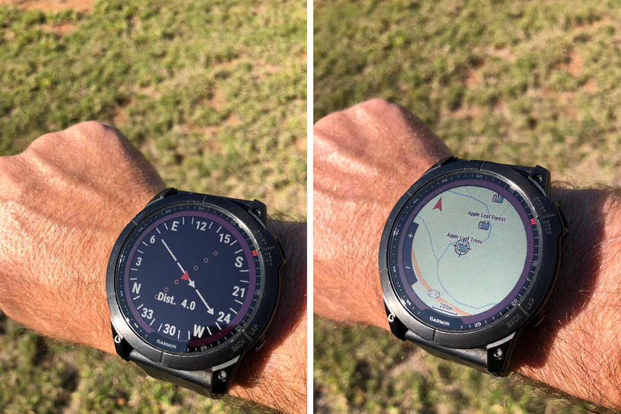
Other functions I regularly use include the barometer and altimeter. If the reading on the barometer drops, rain is on the way and I know I need to plan accordingly. Knowing the altitude is useful when looking at the topography and figuring out ways around features like cliffs.
Where did you get the idea to load Tracks4Africa maps on your watch?
In the past five years of guiding across Kruger, I relied heavily on my Garmin eTrex 30 for navigating. The GPS was loaded with Tracks4Africa because I needed to identify all the possible river courses in Kruger. This not only helped me name all the rivers, which enhanced the guided experience, but also helped me find good water sources while in the wild. (On a backpack trail you have to be self-sufficient – that includes finding water.) As soon as I got my Garmin fenix 7X, I knew this was the only software I needed to make this watch the most powerful navigating tool in the wild!
Read more: Garmin eTrex 22x – Tracks4Africa Trip Tested
What did you have to do to get Tracks4Africa maps working on the watch?
I simply purchased the maps from the Tracks4Africa online shop, then used MapSource to load the link directly onto my watch. The map set was loaded in seconds and worked immediately, without any complications. The process was straightforward, just the same as loading Tracks4Africa onto any other Garmin device. Since I’ve loaded the maps, which was in April, I’ve already traversed over 350km through the most remote parts of Kruger.
What is the most useful feature of the Garmin watch for you?
Definitely its ability to process the Tracks4Africa maps. This is specifically why I chose to go for the Garmin fenix 7X, because of its compatibility with Tracks4Africa. These two systems operate seamlessly together and are a perfect fit!
The watch itself has dozens of features – it can be quite overwhelming. But luckily you can customise the interface to suit your needs. For my work, for example, it’s really useful to know the sunrise and sunset time. On walks we have to depart as soon as the sun is up and we have to pitch camp before it gets dark. And, of course, there are sundowners to plan. The watch uses geolocation to display the sunrise and sunset time to the minute.
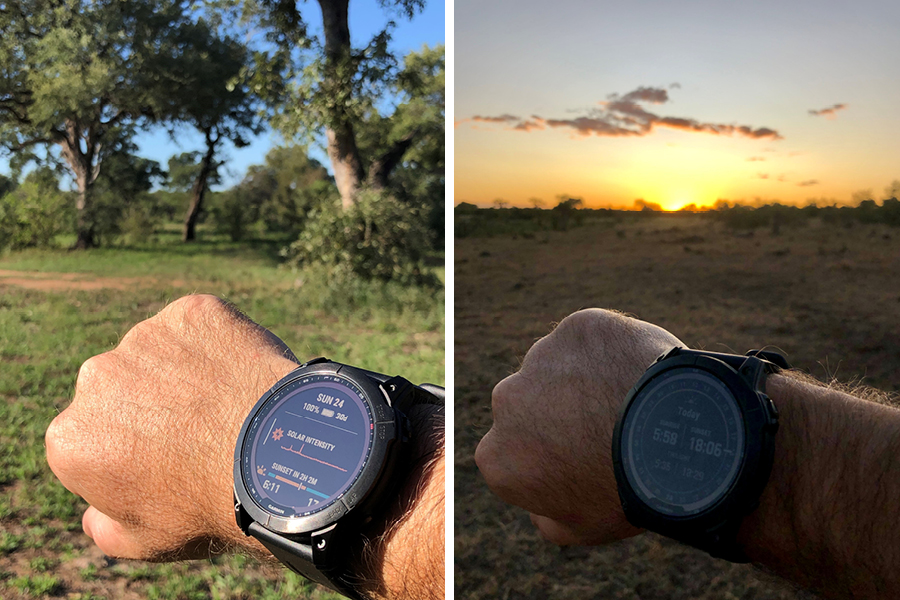
Furthermore, the watch shows the remaining battery life. I get around 65 hours GPS tracking per charge, which perfectly covers a weeklong trail. On top of that, the solar glass is an energy-saving feature. When I’m on the trail, with the watch in the sun, it saves the battery that extra little bit. When not GPS tracking, the battery lasts much longer – up to 200 days.
Some of the other features I like are the body battery and sleep monitor. Knowing the duration and quality of my sleep helps me to manage risk in the field. If I’m not in peak condition, I can ask the back-up guide to lead the trail. It’s so important to stay alert in the bush.
What should hikers pay attention to when using the watch?
The Garmin Explore app on your phone is a must have! It works efficiently between your watch and your phone, syncing all the data in seconds. It’s also extremely helpful in tracking your progress. The Garmin Explore app would be so much more powerful if it could also use Tracks4Africa maps.
You can see what Warren gets up to on Instagram (including great sightings from Kruger): @kruger_direct_safaris
Installing T4A maps on your Garmin device
Want to load T4A maps on your Garmin GPS (such as the fenix 7X watch)? Have a look at our user guides:

I look forward to that
Do you have a step by step guide as to how to get T4a on the Fenix please?
While we don’t have an existing guide in our FAQ section yet, we will send you pointers.