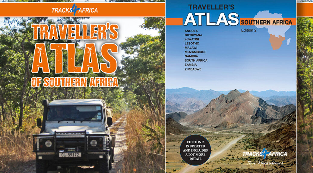
The long-anticipated second edition of the Tracks4Africa Traveller’s Atlas Southern Africa is here – and it’s been worth the wait. The new atlas has been comprehensively updated, but that’s not all.
It’s been five years since we first published our Traveller’s Atlas for Southern Africa. Now the second edition is here, with updated roads data and points of interest. Like its forerunner, it features 10 countries south of the equator: Angola, Botswana, eSwatini, Lesotho, Malawi, Mozambique, Namibia, South Africa, Zambia and Zimbabwe. But the second edition Traveller’s Atlas Southern Africa also brings self-drive travellers much more.
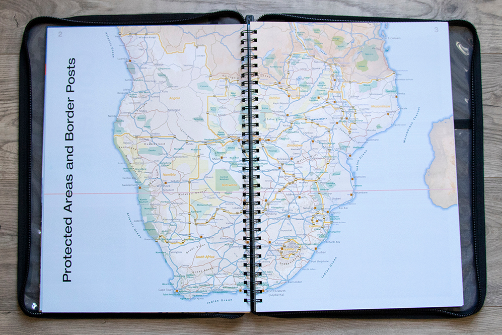
What’s new in the second edition?
We updated roads and points of interest to show you the picture on the ground and assist with planning. We’ve also expanded the map coverage substantially and the atlas now comes in at 223 map pages. It uses a variety of scales to present the information most efficiently:
- 1:4m maps for Southern and Eastern Africa, perfect for macro planning.
- 1:1m maps for the 10 countries covered by the atlas.
- 1:500k maps for South Africa, Malawi, most of Zambia and the area around Moremi/Chobe in Botswana.
The new atlas boasts a thick hard cover to protect the pages inside and we’ve created a new canvas cover to accommodate the expanded size. The new cover has plastic sleeves that fit the atlas so you can use it while it is fitted into the cover. Plus we added a handy document pouch on the inside of the cover.
Our second edition Traveller’s Atlas is already getting great reviews from users:
I used the 1st edition very often on my travels through Southern Africa. I am impressed with the improvements the new 2nd edition offers. – Dirk Brinkman
Excellent atlas, quality printing and materials…highly recommended. – Harry Gazendam
Why is the Traveller’s Atlas so popular? Take a look at the 10 best-loved features:
#1: Getting the big picture
You can’t get the sense of scale on the GPS that you get from these A3-size maps. At a glance you can take in vast stretches, from the Knersvlakte to Putsonderwater, for example, and see the roads leading between even tiny hamlets. Because of this, the atlas is ideal for trip planning. Use it to plan your route in advance or work out your next stage around the campfire if you’re a more spontaneous traveller.
#2: Travel info for each country
If you’re wondering if it’s OK to drive on the beach in Mozambique or why there are freshly-cut branches in the road, the atlas has the answers. Each country section covers the general driving conditions as well as traffic rules. You’ll also find travel tips, a list of top attractions and beautiful pics that will have you packing your vehicle.
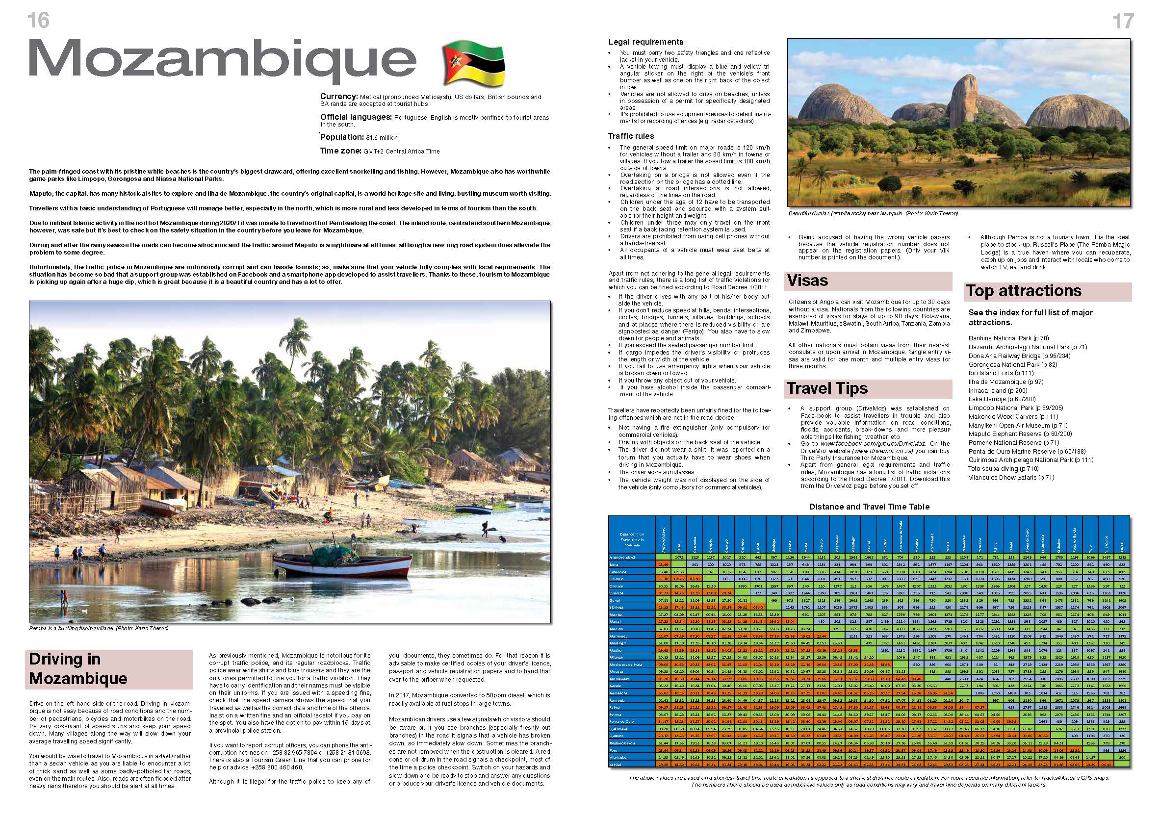
#3: 127 border crossings with opening times
Where and when to cross the border is part of the puzzle of planning an expedition. With the atlas by your side, you can check that your route leads to a legal crossing point. Plus you can use the border post’s opening hours to factor in the best time to get there.
#4: Getting a handle on red tape
Before you get to the border, you need to know if you have the right documents. The atlas explains the legal vehicle requirements (think fire extinguisher, reflective vests) as well as visa information.
#5: Actual travel times
Thanks to the GPS data of overland travellers, our atlas offers reliable travel times. The country section in the front you’ll find a table with distances and travel times between key destinations. Distances and travel times for less prominent places and routes appear on the map pages themselves.
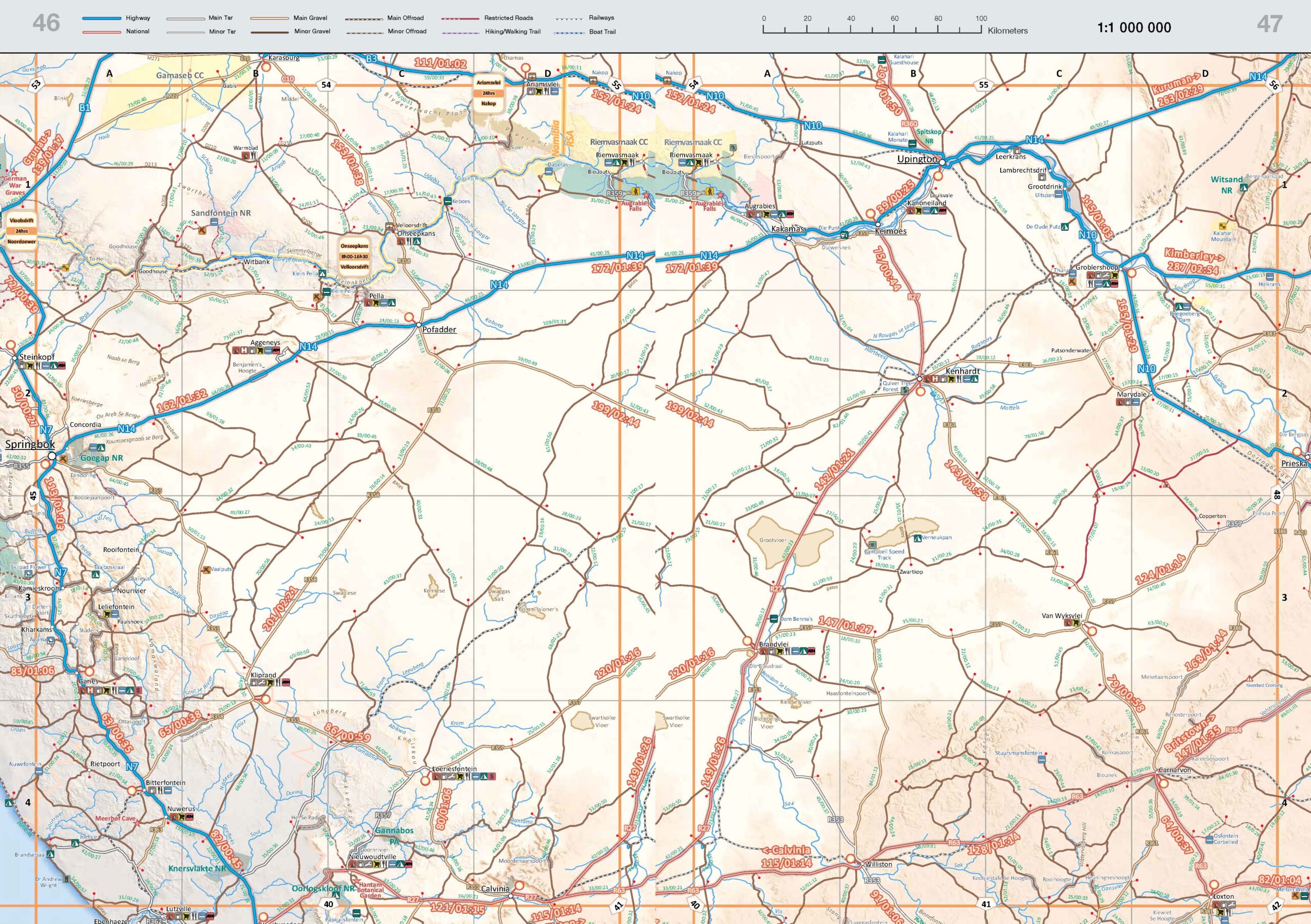
#6: Locating traveller services
Need to know if you can stock up on supplies or where the closest mechanic is? The atlas has your overlanding needs covered with a useful key to traveller facilities.
#7: Tourist attractions
Map your route to take in the top sights with the help of the atlas, which highlights major attractions with a red star.
#8: Accommodation
The atlas conveniently shows campsites and lodges right on the atlas pages. This makes it equally useful for trip planning in advance and adapting your plans on the fly.
#9: Protected areas
With national parks and protected areas featuring facilities shaded in green, the atlas makes it easy to plan your trip around Southern Africa’s wild places.
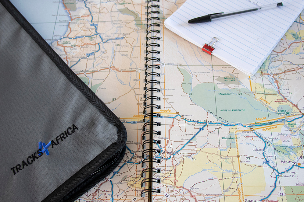
#10: Ring binding
Flip it open, lay it down flat or even fold it back onto itself. Thanks to the hard-wearing spiral binding, the atlas is flexible and user-friendly.
Buy the second edition Traveller’s Atlas Southern Africa from the Tracks4Africa online shop and receive the canvas cover included.

I’ve just received the 2nd edition of the traveller’s atlas, What a bonus, using it to plant my overlanding trips, also used it watching Voetspore on the TV to get some insight into their travels. What a bonus
I have used the original T4A map from inception. I found its use limited by the virtual absence of minor road and route numbers and have had to constantly refer to other maps for that information. Has this been rectified in your second edition, because it has not been mentioned in the “what is new” item list?
Have sent you an email to get some more details on the absence of minor roads, so our team can look into this. Tracks4Africa maps are continually evolving and the overlanding community plays a vital role in this. Regarding minor roads, on some paper products we may leave certain minor roads off due to space constraints.