
On a monthlong road trip, the Tracks4Africa Namibia Paper Map proved its value again and again. Given the vast distances, it pays to know the road conditions, fuel stops and points of interest before you set out. By Harriet Nimmo
Oh, how I love a proper, big paper map. And there are no better maps for road tripping in southern Africa than those produced by Tracks4Africa. While some people get pleasure from cookery books or interior design magazines, I could look at a map all day! All those roads less travelled, all those places to explore and those adventures to plan.
Yes, we also have Tracks4Africa routes (GPS maps) loaded onto our Garmin, but a paper map gives you a much better overview. From a paper map you get a sense of direction and how places are connected. It also enables you to plan route options, spot points of interest close-by and choose between dirt and tar. So the Tracks4Africa Namibia Paper Map was essential for our trip earlier this year.
We have self-driven and camped throughout Namibia a number of times over the years, but this most recent trip was the first time we had been invited for work. My husband runs Wild Shots Outreach, a South African NGO that engages young people in conservation and nature through photography. We had been invited to work with rural communities bordering protected areas in three very different parts of the country.
We started our travels in Windhoek and embarked on a 5,000km, 4-week journey, driving in a Toyota Fortuner.
Sightings from the C27
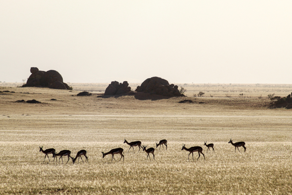
First stop was the Namibrand Nature Reserve, around 50km from the famous red dune centre of Sesriem. Heading south from Windhoek our last fuel stop was Rehoboth and we then tacked further south west on a network of dirt roads via Rietoog and Bullsport. Having the Tracks4Africa paper map definitely gave us more confidence, plotting the turns and counting the kilometres as we headed down empty dirt roads. The public C27 road runs alongside the private Namibrand Reserve, with spectacular landscapes and roadside sightings of desert-adapted wildlife. We saw ostrich, springbok, bat-eared foxes and numerous pairs of croaking Ruppel’s korhaan.
After a week of working with young jobseekers from the Nama community of Maltahöhe, we returned to Windhoek. We chose to drive back a different way and found it easy to plot an alternative route using the paper Tracks4Africa map. Our route led via the tiny settlement of Solitaire. We first visited here more than 30 years ago, when it was just a dot on a map and the fuel was pumped by hand. Today it is a well-known refuelling point when travelling from the dunes to Windhoek. Yet it is still just as photogenic with its old-fashioned provisions store, rusty cars and delicious home-made apple pie.
Refuelling vehicle and selves
Our next leg was heading north to Etosha, travelling along good tar roads all the way. We stopped for a break at the small farming town of Outjo, about 100km south of Anderson’s Gate. Outjo is the last place to stock up before the park, and we enjoyed a delicious meal at the Farmhouse Café with its pretty beer garden. Our destination was Etosha Heights, a private concession bordering the park to the west. We were guests of the safari company, Natural Selection, who had invited us to run Wild Shots Outreach photography workshops with unemployed youth from Outjo. Despite living only 100km away, this was the first time any of these young people had had the opportunity to visit Etosha and connect with their natural heritage.
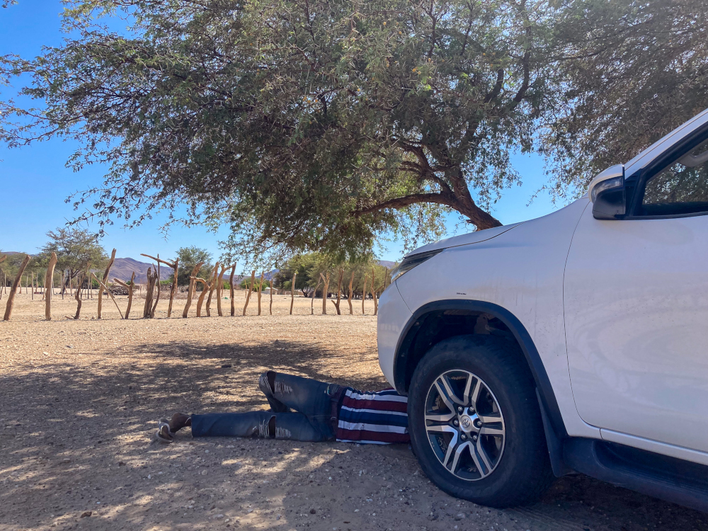
After Etosha, we headed north west to Damaraland. When travelling in these remote destinations, it is wise to refuel whenever you can. Fortunately, the Namibia Paper Map indicates fuel stops. We stopped at the small settlement of Kamanjab, which has 24-hour fuel – and enjoyed queueing up in the little grocery store with two striking Himba women, covered in red ochre. Crossing the spectacular Grootberg Pass we stopped to help a car that had overheated, sharing our water. It is so important to always carry extra water with you when self-driving in Namibia.
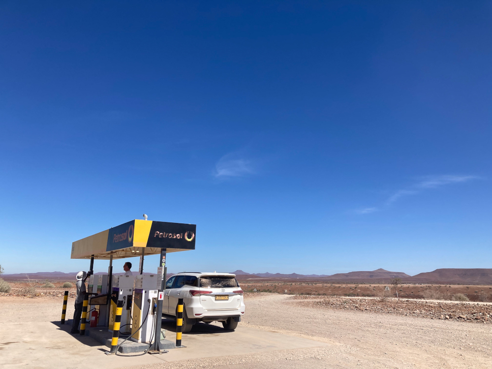
At the oasis of Palmwag, we topped up our fuel supplies at the isolated petrol pump and decided we needed to refuel too. We had lunch at Palmwag Lodge, enjoying the raucous rosy-faced lovebirds in the tree next to the bar.
The dusty settlement of Sesfontein is the last place for fuel before Kaokoland. When we drove through Sesfontein a few years ago, they had not had a fuel delivery – so always make sure you fill up at every opportunity.
Remote Hoanib Valley
In a country jam-packed with vast, spectacular beautiful landscapes, Kaokoland might be just the most incredible of them all. We were heading for the Hoanib Valley – part of the Sesfontein Conservancy – a remote, unfenced communal land. Here wildlife, people and livestock co-exist surrounded by dramatic cliffs, mountains and dunescapes. The dry riverbed of the Hoanib Valley is home to the remarkable desert-adapted elephant, giraffe, springbok and oryx.
It is quite a hair-raising drive into the Hoanib Valley, through thick sand and clouds of choking dust obscuring your way. There are many confusing tracks and it is hard to know if you’re exactly on the right route. Self-driving in the Hoanib Valley is not for the faint-hearted, and you must be totally self-sufficient and ideally travelling with more than one vehicle.
As you finally approach the valley, you pass through a community checkpoint gate, and you’ll need a permit to camp. While you are allowed to wild camp, please camp responsibly and be sensitive to this incredibly fragile environment. Do not create your own tracks (you will see the ugly scars left by selfish, irresponsible 4×4’ers). Also do not risk disturbing the scarce wildlife by camping near the waterhole and never camp in the riverbed itself due to the risk of flash floods. It is best to tuck yourself away discreetly in one of the side canyons.
Although we wild camped here a number of years ago, this time we were privileged to be guests of Natural Selection at Hoanib Valley Camp. They invited eight young Himba, Herero and Damara-Nama jobseekers from Sesfontein to participate in the Wild Shots Outreach programme.
Kaokoland mysteries
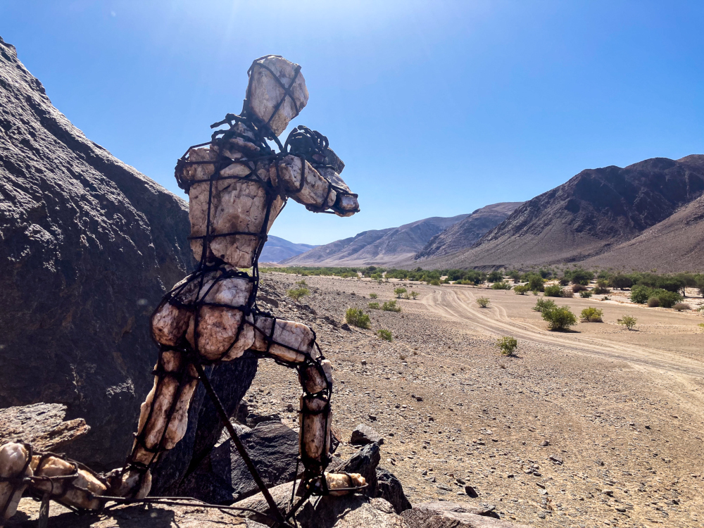
On exiting the Hoanib Valley we aimed for the tiny hamlet of Puros. The route was very indistinct, despite using both the paper map and the GPS. It was a long journey, through areas of thick sand and rocky riverbeds, at times wondering if we were even on a track as such. We limped into Puros with a rapidly deflating hissing tyre – a victim of the bone-shakingly rough route. Remarkably, we were able to get the tyre plugged after asking around for help. However, there is not much else in Puros and no reliable fuel.
Puros is the start of the stone-men of Kaokoland, a series of remarkable rock and wire sculptures scattered across the remote landscapes in the far north of Namibia. The artist has chosen to remain anonymous and it is a tantalising treasure-hunt. You never know where the next stone figure will appear in the barren landscape. Overlanders are asked to keep their locations a secret and to not publish the GPS locations. In this age of high-tech comms, it’s a chance to keep the mystery alive.
The kindness of strangers
The final leg of our road trip led to the Skeleton Coast. Terrace Bay is the furthest north you can self-drive – beyond here is a private concession. Driving along the coastal road, we desperately needed fuel. We had checked there were fuel supplies at Terrace Bay and that we could pay with a credit card. After finally finding the fuel pumps (in a small wooden shed) and filling our tank, we realised we hadn’t asked if the credit card machine was actually working. The system was down – and we now had a tankful of petrol but no cash! A huge thank you to the Namibian fishermen who rocked up in a 4×4 convoy, with kayaks strapped to their trailers, and loaned us the cash to pay for the fuel.
This random act of kindness by complete strangers was a heart-touching finale to our month on the road. A long two-day drive back to Windhoek via Swakopmund brought our road-trip adventure to a close.
Thank you, Tracks4Africa maps, for inspiring us and giving us the confidence to venture down the road less travelled in Namibia.
The Tracks4Africa Namibia Traveller’s Paper Map is now in its 5th edition. At 1,000 x 1,265mm when unfolded, this is the largest paper map of Namibia with a scale of 1:1,000,000. Despite the size, it is easy to use, having been engineered to unfold in sections. The Namibia Paper Map covers distances and travel times and includes detailed maps for Swakopmund and Windhoek.
