Water in the desert is a very rare occurrence and I just had to go see it for myself. So I joined a landscape photography tour to capture southern Namibia’s iconic sights following good rains. I ended up swimming in Sossusvlei! By Johann Groenewald
A tourist to southern Namibia once asked a resident farmer when it rained in the area. The old man thought for a while and replied that it normally rains in February – every couple of years…
‘Namib in Flood’ was the name of our landscape photography tour. Our itinerary covered some of the iconic landscapes of southern Namibia, which I have visited many times before. Every year thousands of tourists make their way there. Not my ideal trip but when you take southern Namibia and add lots of rain and thunderstorms and the resulting green grass, you are in for something really spectacular, not to mention rare. On top of that we are coming out of a pandemic, which meant tourist numbers are still quite low. It was starting to sound like my ideal trip.
I am sounding blasé about southern Namibia and I really should not. These landscapes will blow away any first-time visitor, any time of the year. But it is not typical to see green grass and water in these areas. So please do not look at these images and get the idea that this is typical of the landscape. The harshness of southern Namibia is also very beautiful. Furthermore, these places are not just beautiful to look at, they offer a special experience. Humans do not play a meaningful role in these landscapes and part of the appeal in visiting them is to immerse yourself in their solitude.
Timing is everything
The Namib in Flood tour started out with the famous Fish River Canyon, followed by a quick visit to the Quiver Tree Forest near Keetmanshoop. From there the group travelled to Lüderitz to photograph Kolmanskop. For the business end of the tour, we visited NamibRand Nature Reserve and ended off with a very special version of Sossusvlei.
The timing of a trip like this is everything. Our guides, Hougaard Malan and Jandre Germishuizen, are two supremely experienced landscape photographers. What’s more, they have been visiting this area for over a decade. They selected dates based on a lot of research around macro weather patterns and local rainfall to determine when the landscape will start showing green. They even considered the phases of the moon so we could have the potential for a full moon in our photographs. These are the hidden skills of the trade that I came to learn.
When the time came for PCR tests, I was the only one in our group to test positive. Ultimately, I had to retest a couple of times before I could join the group. As a result, I missed out on the first three locations. I only joined the group in Aus to start our journey to NamibRand and Sossusvlei. The images for the first three locations were graciously shared by my fellow photographers.
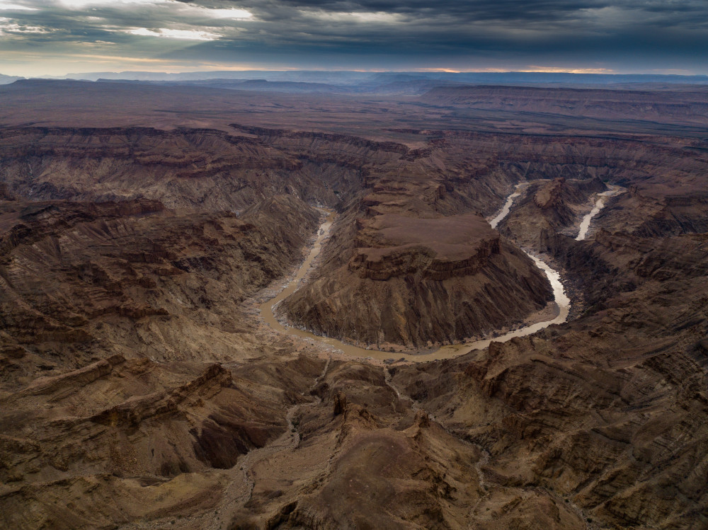
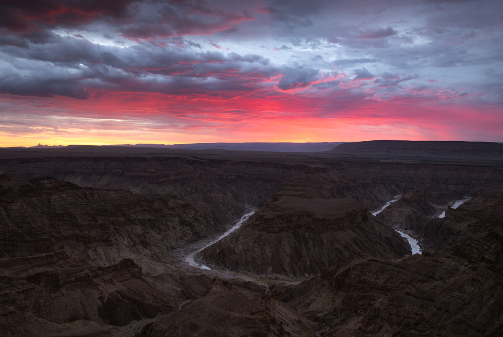
Fish River Canyon
The largest canyon in Africa and the second largest in the world, the Fish River Canyon is one of Namibia’s most iconic landscapes. It is always worth a visit regardless of the time of year or day. But for spectacular images of the canyon below, it is essentially a sunset photography location. The canyon stretches over 160km long, but we focused our lenses at the Hobas lookout point. The view is to the west, into the sun. The sky can easily be a boring monotone but when you have beautiful clouds, this becomes part of the landscape. The colours change constantly as the sun sets.
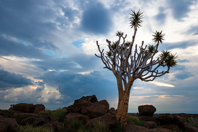
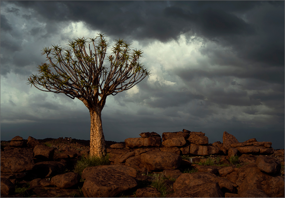
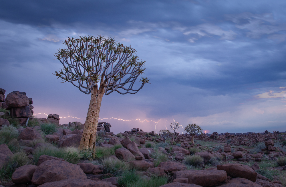
Quiver Tree Forest
This national monument is located on a farm about 13km outside Keetmanshoop. At Giants Playground, gigantic dolerite boulders look like they have been placed there by giants. At any given sunset or sunrise, the combination of the boulders and quiver trees make for great landscape images. But during our visit we encountered glorious thunderstorms, which made it all the more dramatic.
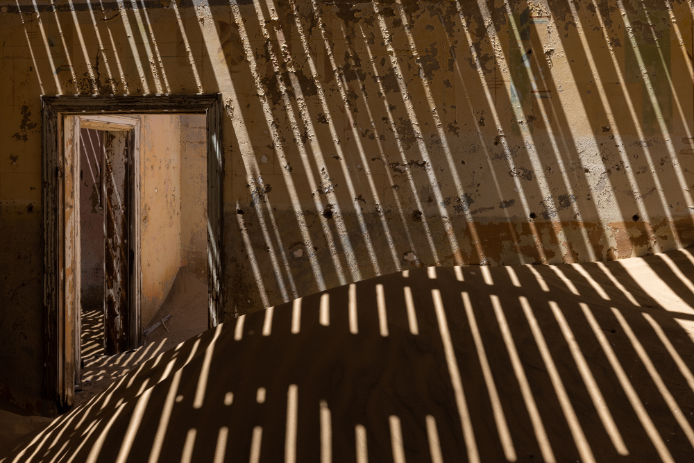
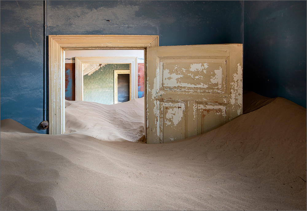
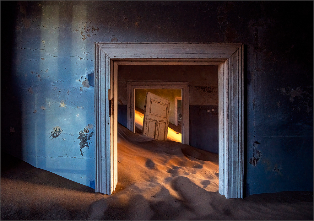
Kolmanskop
This deserted mining town near Lüderitz has become a famous tourist attraction. Apart from the interesting history, the Edwardian architecture against the dunes lends itself to striking photography. Kolmanskop is slowly being reclaimed by the desert. Your creativity is your only limitation when deciding how to capture this landscape.
NamibRand Nature Reserve
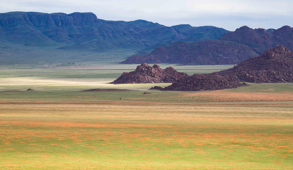
NamibRand, which translates to ‘Namib edge’, is a private nature reserve bordering the Namib Desert. It is one of the largest private nature reserves in the world and a wonderful example of conservation. Old livestock farms were merged and converted into a vast protected landscape, allowing wildlife to migrate from the neighbouring Namib-Naukluft National Park. The reserve is only accessible via the handful of tourism concessions which provide a self-sustaining income to the park.
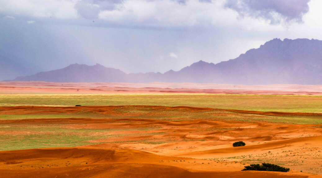
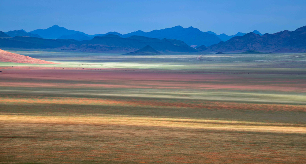
The landscape consists of sand and gravel plains with stretches of savanna bordered by mountains and dotted with inselbergs and vegetated dune belts.
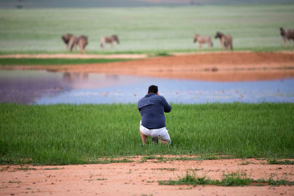
During our visit, this usually arid landscape was transformed by the recent rains into a lush green pasture. We were greeted by large herds of oryx grazing across the savanna. Through our lenses, we saw pans filled with water and beautiful clouds over the mountains. We even got soaked in the rain on an afternoon shoot. This is a truly unique experience which proves that the Namib Desert can also be green on rare occasions.
Sossusvlei
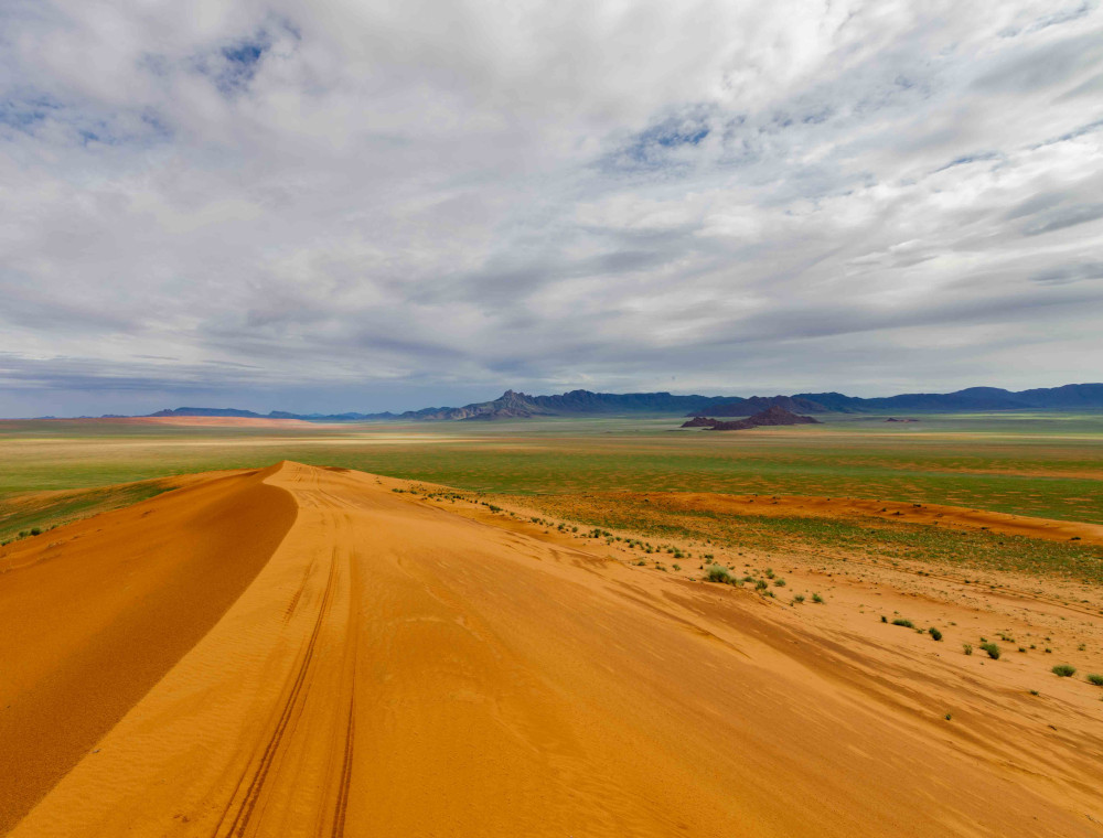
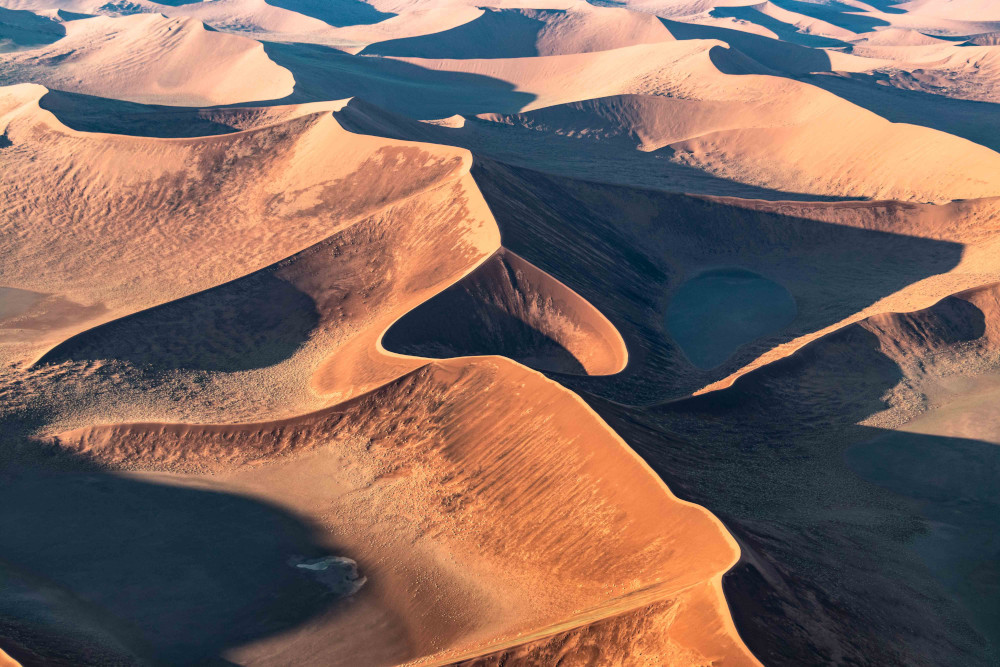
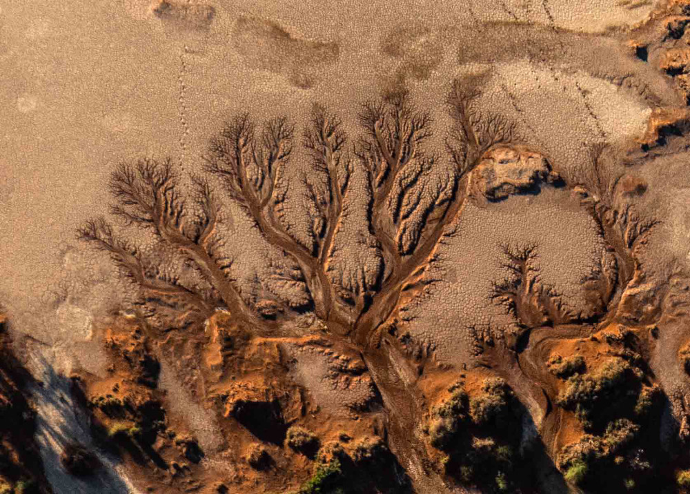
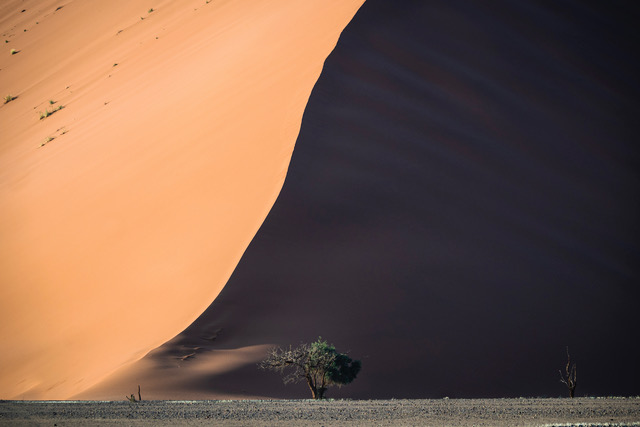
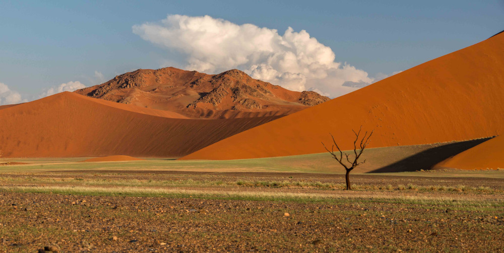
Sossusvlei ranks as one of Namibia’s top tourist attractions and forms part of the Namib-Naukluft National Park. This is where the Tsauchab River meets its end in a clay pan surrounded by the world’s highest sand dunes. Over time the wind changes their shape and during sunrise/sunset the colours reflected off the dunes will constantly change.
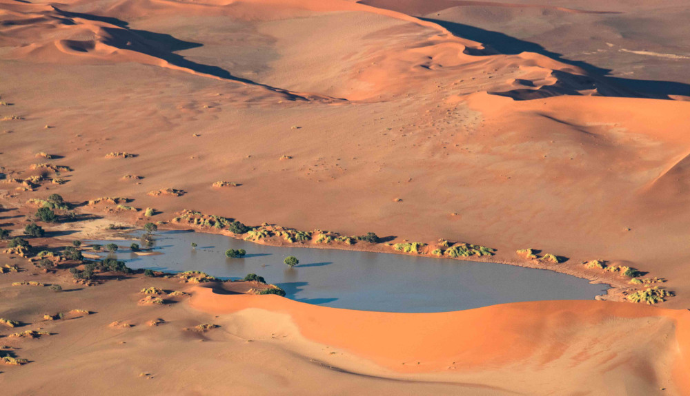
While the name refers to the vlei at the end of the Tsauchab River, the entire area is commonly called Sossusvlei. From the entrance gate it is a 60km drive through the Tsauchab Valley to get to the end. Here there are several pans, some ‘alive’ while others are ‘dead’. Sossusvlei with its lovely camel thorn shade trees is very much alive. But the trees in the famous Deadvlei died hundreds of years ago after the vlei became cut off from the Tsauchab River. These blackened dead trees, the white clay pan and surrounding red dunes create wonderful compositions for landscape photographers.
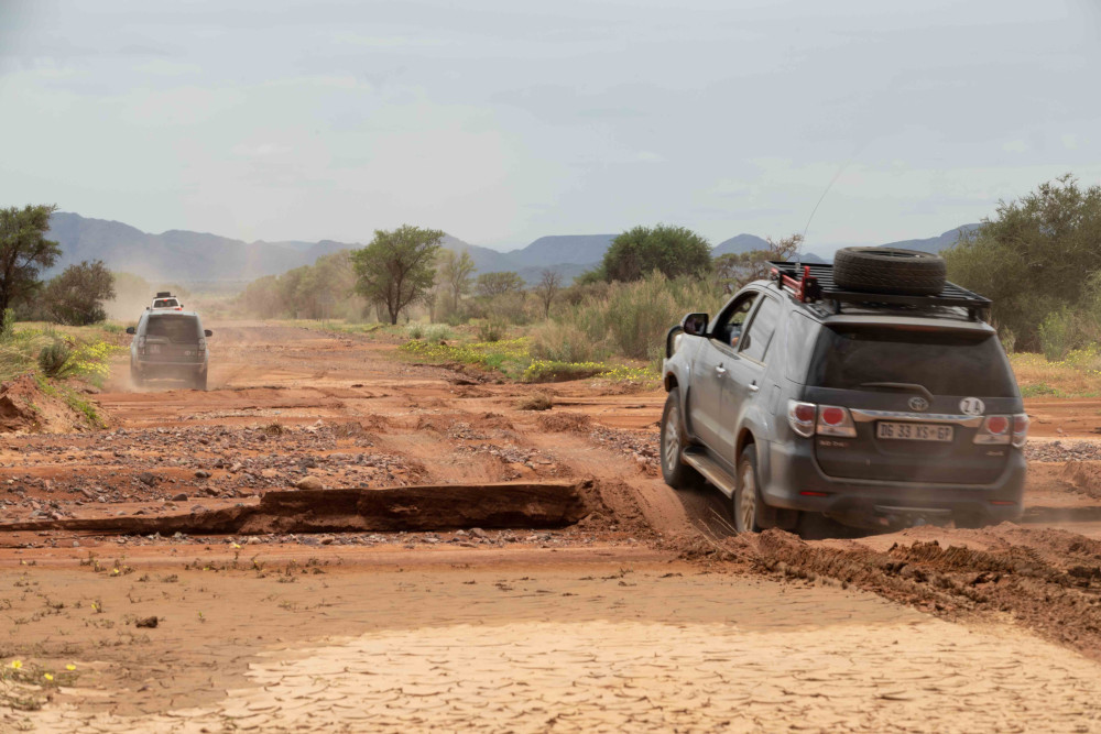
During our stay at NamibRand the Tsauchab River was in flood and the road into Sossusvlei was closed for a day or two. Our timing was perfect: we arrived just as the area became accessible, with plenty of water in the valley still. The wet dunes offer a different range of light and patterns from the usual dry sand.
We could photograph various unique features that are only visible during such an exceptionally wet season. Wet mud cracks, standing water in the valley and thunder clouds with rain in the distance. Even green grass with oryx and springbok grazing at the water’s edge.
As an added bonus we could swim in Sossusvlei as well as Sesriem Canyon – a truly unique experience.
The verdict
Three days in Sossusvlei was hard ‘work’. The days are very long and during midday you are faced with extreme desert heat and fierce thunderstorms. The entire 60km valley offers various photographic opportunities. This means you end up driving around a lot in the limited hours of good light. But the experience is very rewarding. I can understand why landscape photographers come in their droves to capture this beautiful place.
To me southern Namibia had long since become an extension of the land I needed to cross to get to Zambia. My trips are usually in the winter months when this region is extremely arid. I had also heard many stories of farmers in southern Namibia who were devastated by the drought of the last decade. To experience this landscape with green grass standing almost a foot high was surreal. Green Namibia is an entirely different world from the one I’d got used to over my lifetime. I will certainly go again.
Explore the country’s iconic sights with our Namibia Self-Drive Guide. At 400 pages, it features everything you need to make the most of your overlanding trip. Find information on major attractions, road conditions, campsites, trip planning and more.

Oh my hat what lovely photos. Johann I note that you are the credited photographer on a number of the photos in the Zambia Self-Drive Guide as well & having visited Soussisvlei in April of 2019 when it was so so very dry it must have been quite surreal.