On a road trip from Golden Gate’s shapely sandstone buttresses to the towering peaks of the Drakensberg, mountain views abound. Whether appreciated from the car, or on foot, this is scenery to feed your soul. By Marié Bester
It’s true that we rarely visit places in our own backyard… until you move to a new province. Then these “I’ll visit them on another day”-places move up on the Backyard Bucket List. After moving to Swellendam from Matatiele, the distance to our former backyard places increased with a few thousand kilometres. Yet, we still wanted to see Golden Gate and, of course, the Drakensberg loomed in the background, begging to be climbed. So during the summer holidays, we set out to tick them off our list.
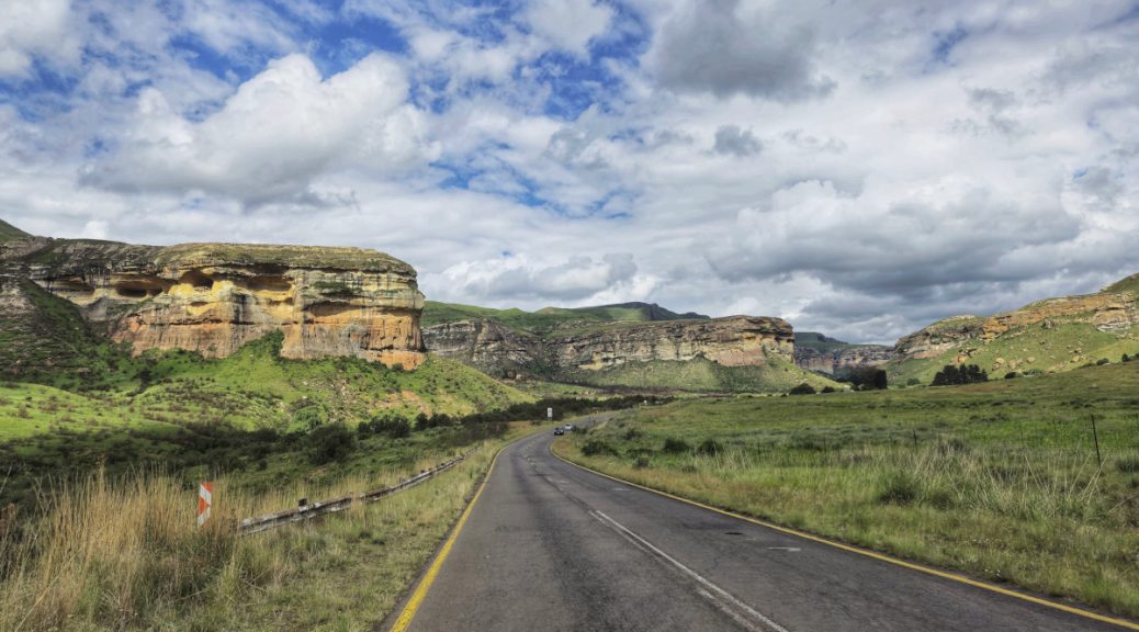
“I don’t understand why more people don’t travel here in summer,” I sighed with awe as we came closer to Clarens. Everything is bright green against the stark amber rock formations with tall grasslands that cover the sides of the road.
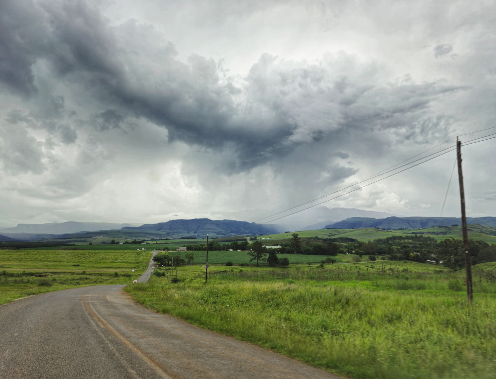
It didn’t take us very long to realise the answer to that question: it’s green for a reason – rain. Bucketloads of it. Some call it the La Niña effect, others may point to global warming. The locals just call it “a wet summer”, but during this rainy season even they used the word “relentless” more often.
We arrived at Golden Gate Highlands National Park unceremoniously on the R712 from Clarens. The park’s entrance gates still stand proud, but are deserted. The R712 is now a public open road between Clarens and iNtabazwe (formerly Harrismith). Albeit narrow at places, the overall condition is good without too many potholes, even during the rainy season. The tarred, windy road is a pleasure to drive with excellent views around every corner.
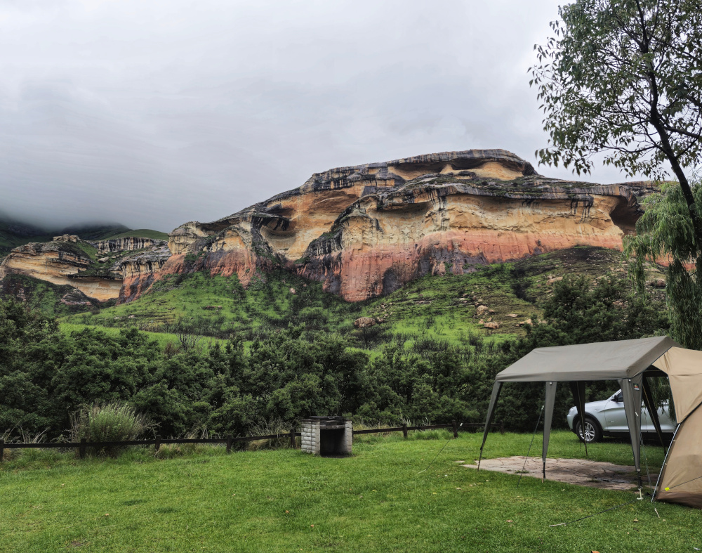
Glen Reenen Campsite
Check-in was smooth at Glen Reenen Rest Camp, with reception on the righthand side of the road. There’s also a small fuel station and convenience shop where you can stock up on tinned food, soap, maps, charcoal and curios. The grass-covered campsites are on the opposite side of the road, in between big shady trees. Each has a braai area, but you need to bring your own grid and tripod. There is a small communal kitchen adjacent to the ablution block, with an electric stove and sinks. The facilities were cleaned daily and in a good condition.
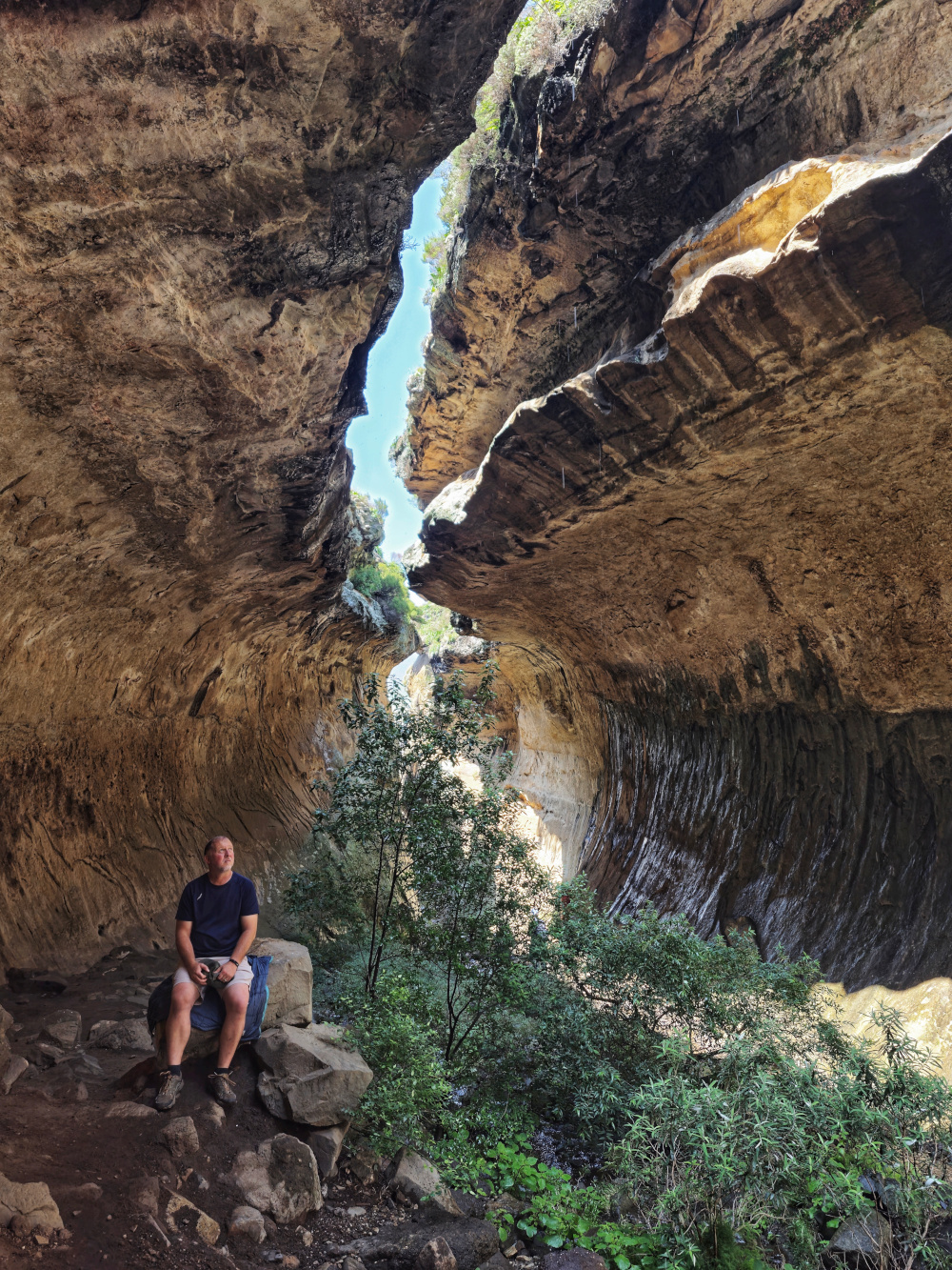
This relatively small campsite is a fantastic base for hiking enthusiasts, as the hiking routes start at the edge of the campsite. The well-known Brandwag Buttress greets you every morning and Echo Ravine is only a 30-minute hike away. The views from the top of the buttress are worth the climb!
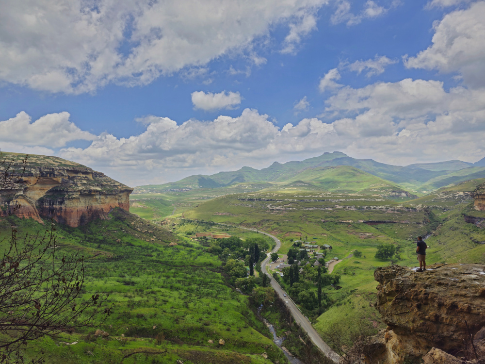
There are also two loops to drive: Oribi Loop with a vulture hide, and Blesbok Loop. These are tarred roads that take you straight into the mountains with surpassing views of the Drakensberg in the background.
Travel tips
- Take an afternoon drive from Clarens towards Glen Reenen – the mountains really do turn golden.
- For a mere R80, as a camper at Glen Reenen, you can have a large bag of laundry washed at the Golden Gate Hotel.
- You will need a blue caravan adaptor for the power points in the campsite.
- Book through the SANParks website. The riverside sites are quieter, but beware of baboons. The sites directly behind the ablution block (facing the river) tend to become a mud bath in heavy rains.
To the Dragon’s Back
Following the R712 east makes you once again wonder why this road isn’t busier. You’re on top of the world with the Drakensberg ridges on your right and deep green ravines on your left, before you descend to the green plains below.
After winding your way through the mountains, past almost forgotten farmsteads, you turn off towards Bergville. This road stretches out before you like only the flats of the Free State can, but it also holds a secret: Sterkfontein Dam. The viewpoint of the third largest dam in South Africa is worth a visit. There’s not much, other than to take in the magnificence of such a large body of water.
Continuing this lonely tar road will take you to the top of Oliviershoek Pass as you cross into KwaZulu-Natal. Overlooking the Kilburn Dam surrounded by farmlands down below and the Mont-Aux-Sources mountain peaks in the distance, this is a short mountain pass worth driving more than once.
Inevitably, one must pass through civilisation between isolated mountain stopovers. Luckily, Bergville and Winterton are on the smaller side and are less of a shock to the system. These small towns have the basics – a Spar, a Build It, a liquor store and potholes in abundance.
Monks Cowl Campsite
We opted to camp at the Monks Cowl campsite, about 35km west of Winterton, at the foot of the majestic Drakensberg. From Winterton, the road gets narrower, bumpier and steeper, the scenery more expensive. This stretch of road is a popular area for golf resorts, spas, bakeries, top-rated hotels and the Drakenberg Boys Choir.
Then you turn into the Monks Cowl campsite at the end of the road. We felt this campsite left much to be desired. Most sites are at an incline or quickly collect rainwater in large puddles under your tent. There are very basic ablution facilities and no kitchen. In the rainy season, deep muddy tracks mark the grass between the top- and lower-level sites. The few stand-alone braais were mostly rusted through. Here you will also need a blue caravan adaptor for the power points.
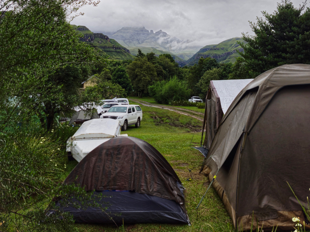
The campsite conditions really are a pity, since, as with Glen Reenen, the day hikes all start at the edge of the campsite. If you’re not camping here, the Mountain Splendour Eco Resort, 10km back towards Winterton, is the next best campsite with far better facilities.
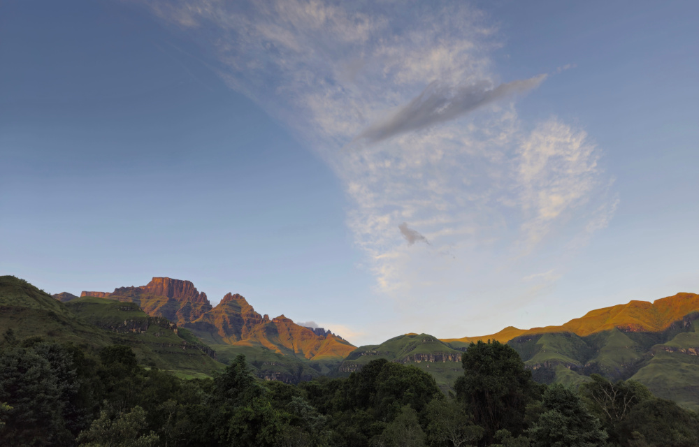
After two days of constant rain and being shrouded in clouds, we woke to a wonderfully clear morning. The Dragon turned pink before our eyes and you could see mountains upon mountains. Of course, this only happens on your last morning.
Travel tips
- Try the best freshly baked bread and all kinds of confectionary at The Valley Bakery.
- There’s a fuel station at the Cedarwood Village Shopping Center, 10km from Monks Cowl. Don’t miss lunch at Mac’s Café.
- The Build It in Winterton is a haven for anything camp related. Many tents at the campsite sported a waterproof blue tarpaulin bought here.
- Buy the well-written Visitor’s Information Booklet at Monks Cowl reception for information on day hikes. A steal at R10.
- Don’t underestimate the weather and sign the visitor’s book before hiking. Always carry a rain jacket. Waterproof bags for our phones and cameras also proved to be invaluable.
This is prime hiking country, so get the excellent Slingsby maps from our online shop to help you explore. The Drakensberg: North map covers the Monk’s Cowl and Cathedral Peak area. As the first-ever recreational map to the northern KZN Drakensberg, the third edition has been completely updated and includes difficulty ratings.
