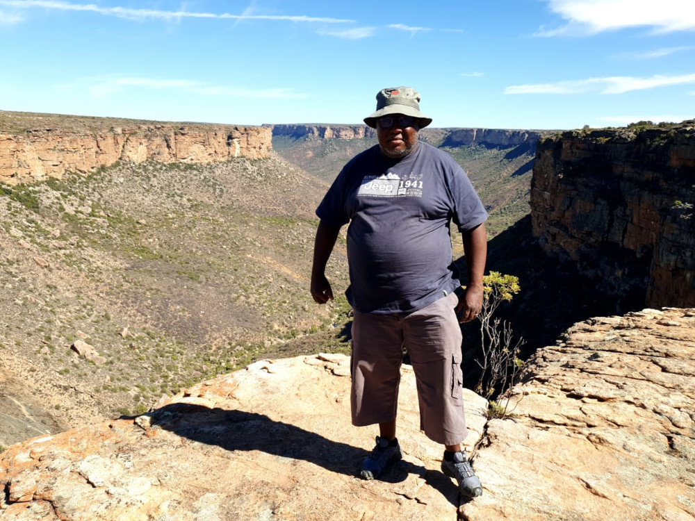
Where does a group of keen overlanders go for their first major expedition? The Karoo, with its vast open spaces, star-studded skies and good gravel roads, must surely feature. By Aslam Mxolisi Tawana (aka Black Boy Adventures)
I have always loved camping and when I got my Toyota Land Cruiser, I couldn’t wait to go on longer overlanding trips. So when the Meerkat Squad decided to plan an 11-day overlanding expedition, I was more than ready.
What’s the Meerkat Squad, you may ask? We’re all overlanders who are active on social media and who love showcasing Africa’s remote destinations. My passion is to make the overlanding lifestyle more accessible to black travellers.
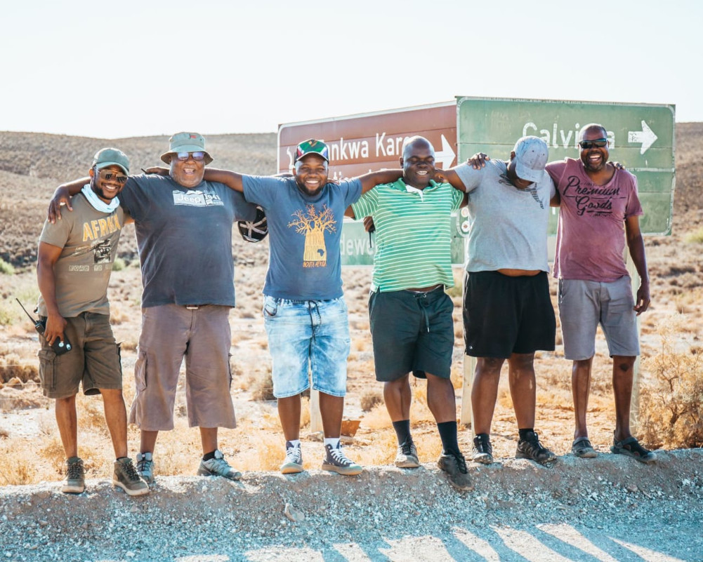
The inaugural Meerkat Squad expedition consisted of myself, @blackboy_adventures, driving my rig, Musafir (‘traveller’ in Arabic), and:
- our convener: Stephen Mogapi (@stevoski_4x4_africa) in a Ford Ranger Wildtrak named Tshukudu, or ‘rhino’ in Setswana
- Judah Mphela (@darkiegonewild) in a Toyota Hilux
- Nduna Mposi (@hadji_adventures) in a Toyota Hilux
- Lesego Tlailane (@cigos.the.adventurer) in a Toyota FJ Cruiser
- Mduduzi Motsa (@showstopper) in a Toyota Land Cruiser 79
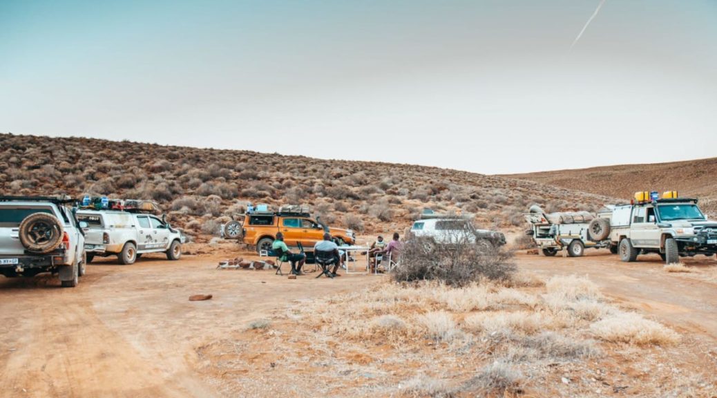
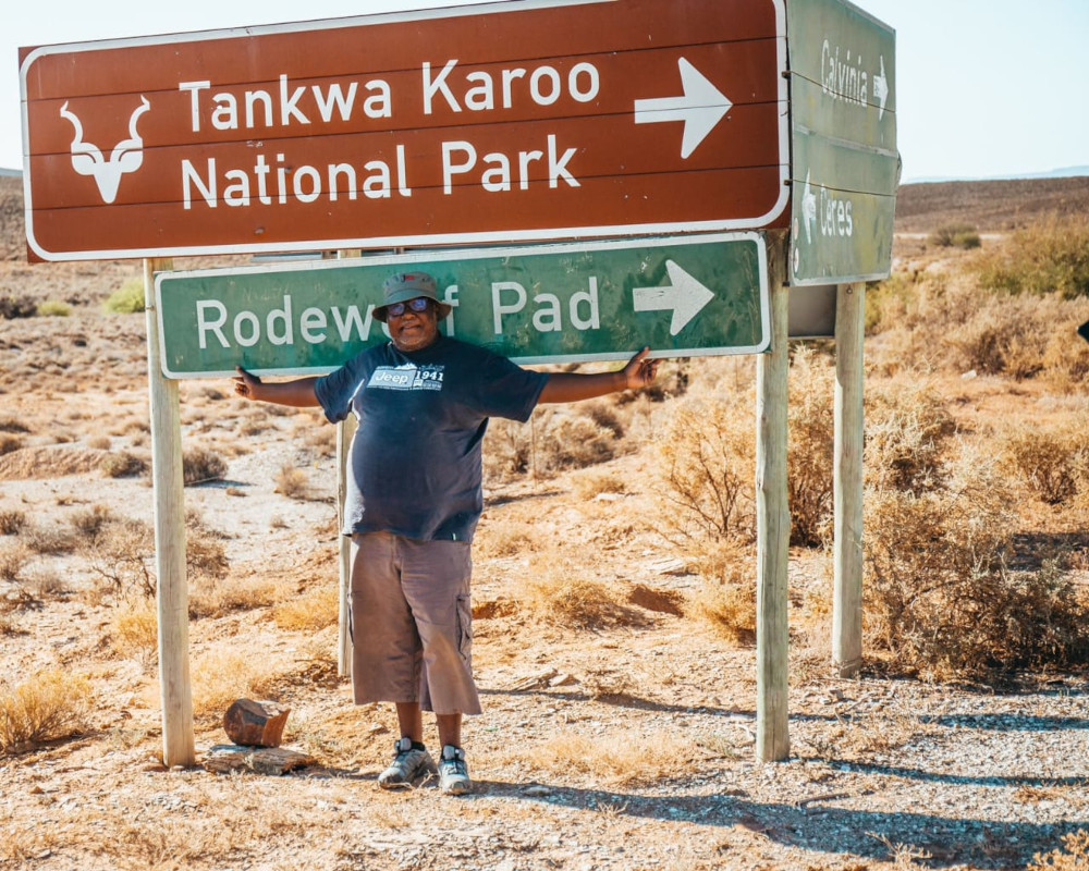
As the only one in the group from the Northern Cape, I was excited to show the other members my province. We first made the trek to Mokala, Witsand, Augrabies, and Riemvasmaak before turning south to explore the Karoo.
The R361 gravel road to Kenhardt claimed our first breakdown. We had to stop the convoy for about 30 minutes to assist Stephen Mogapi as the left fender of his Ford Ranger was scratching the tyre. With a mallet and a few blows we managed to sort out the problem. It was around 17:00 when we reached Kenhardt and stopped to fill up with fuel and water. There’d be no such opportunity at our next destination: wild camping on Verneukpan.
Finding Verneukpan
Verneuk is Afrikaans for “to trick, mislead or swindle”. And this place really tricked us in that we had to have a 10-minute caucus in order to interpret the exact location of the pan. The different GPS gadgets in the group all showed different locations! [There are various POIs related to Verneukpan, among them a viewpoint and two campsites. For camping on the pan, check in at Kareeboomdam – use Verneukpan Camping as the waypoint. – T4A]
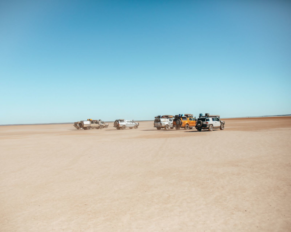
Measuring 57km long and 11km wide, Verneukpan is a salt or mineral pan just northeast of Brandvlei and 90km south of Kenhardt. The pan is a real paradise for 4×4 enthusiasts – as is the stretch of road from Kenhardt leading there. About 10km out of the little town, we turned off the R27 to take a gravel route to the pan. The road was in a bad state so we couldn’t travel fast. As a result, we got to the pan’s reception around 20:30 and found no-one there. Because we had booked, we continued on to the pan, some 10km further on.
The quietest place on earth
On the entire pan it was just our convoy of six vehicles and one other vehicle, which we could see at a distance. It was a beautiful moonless evening with the stars as bright as ever. What I experienced is impossible to put into words, but it left an indelible mark on me. After all the okes had gone to bed and switched off their tent lights, I was still outside taking pictures of the sky.
We woke early the following morning and prepared a quick breakfast so we could explore the pan. It was only during the day that the magnificence of its vast nothingness hit home. There is no tree nor building in sight. It is just a flat, vast and bone-dry surface. It then dawned on me why Verneukpan is referred to as the quietest place on earth. There are no people, nor noise, and definitely no cellphone reception. The Afrikaans saying ‘’tussen erens en nerens” aptly describes this place.
The long road onwards
The distance to our next overnight stop, Papkuilsfontein Guest Farm, was the longest one of the trip: approximately 290km. It was on the 88km stretch to Brandvlei that our trip claimed its second victim: the air conditioning in my rig started to malfunction. This was serious indeed! After all, temperatures were hovering in the high thirties. It meant I had to use what we in the Northern Cape call the Kalahari air con: driving with an open window. That was my overlanding ‘’ontgroening”.
At Die Windpomp in Brandvlei I downed two tall glasses of cola tonic & lemonade with lots of ice. Even though my air con wasn’t functioning, I was ready for the 150km stretch to Calvinia. I was hopeful of finding a mechanic there who could quickly determine the problem. Being a novice in mechanical issues, I sommer thought to myself that it must be the gas that had run out. How wrong was I.
Some 50km from Calvinia our convoy stopped for a drinks and snacks break. I stretched my legs for 5 minutes, took out an ice cold one from my fridge and told the others I would drive ahead. I needed to get to town before the workshops closed at 17:00.
Serengeti of the flower kingdom
I rolled into Calvinia just 15 minutes shy of closing time and was referred to Karoo Dienssentrum by someone I knew. After the mechanic had taken a look, he advised me that the only place that would be able to assist me was in Vredendal. So I resigned myself to the fact that it would be Kalahari air con until we finished our expedition.
After stocking up on some essentials, we proceeded to Papkuilsfontein. This campsite is situated 40km from Nieuwoudtville in the heart of South Africa’s rooibos tea country. This region is also referred to as “the bulb capital of the world” because it has the highest variety of flowering bulb species on Mother Earth. This brought back good memories as one of my professors at university was a specialist in bulb flowers. Nieuwoudtville is indeed the Serengeti of the flower kingdom.
We set up camp at the farm’s small campsite, which has no electricity but a super ablution facility. I was on cooking duty for the evening: a lekker braai with pap and out-of-this-world gravy, compliments of Stephen Mogapi. The next morning, we took a drive up to the canyon to take in the scenic views. Due to time constraints, we couldn’t hike the 6km trail to the waterfall. Since Nieuwoudtville falls in the winter rainfall area, we were also too early for the waterfall to be in flow.
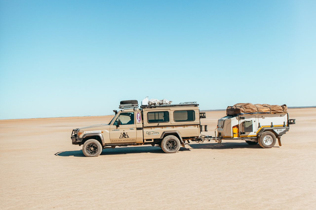
Before setting off for Tankwa Karoo National Park, we filled up all our water containers. The XT160 Jurgens trailer which I was hauling is capable of carrying 140 litres of water onboard. We filled it to the brim from the borehole on Papkuilsfontein Guest Farm and then departed.
Perfect peace in the Tankwa
From Papkuilsfontein, it took us about an hour and a half to reach the famous R355. It’s renowned as the longest uninterrupted gravel road in South Africa. We joined it briefly for about 5-10km before turning off to Tankwa Karoo National Park.
This route was not an easy one and it claimed the third victim of the journey. Nduna Mposi, travelling in his Toyota Hilux, lost his left rear tyre just after entering the park. Half of the convoy remained behind with him while the other half continued to reception to check in.
After 30 minutes, Nduna and the others joined us and we made our way to Skaapwagterspos Campsite. Tankwa Karoo National Park is situated in an area that is so arid, it annually receives less than 100mm of rain on average. The park is bounded on the east by the Roggeveld Mountains and on the west by the Cederberg. To the north lie the mountains of the Koue Bokkeveld, to the south the scattered foothills of the Koedoesberge and Klein Roggeveld Mountains, and the Tankwa River.
Our campsite was alongside the usually dry Tankwa River. The two nights spent there offered off-grid camping on another level. The skies were clear and on both nights the stars shone brightly. The quietness of the area was deafening and the tranquillity magnificent.
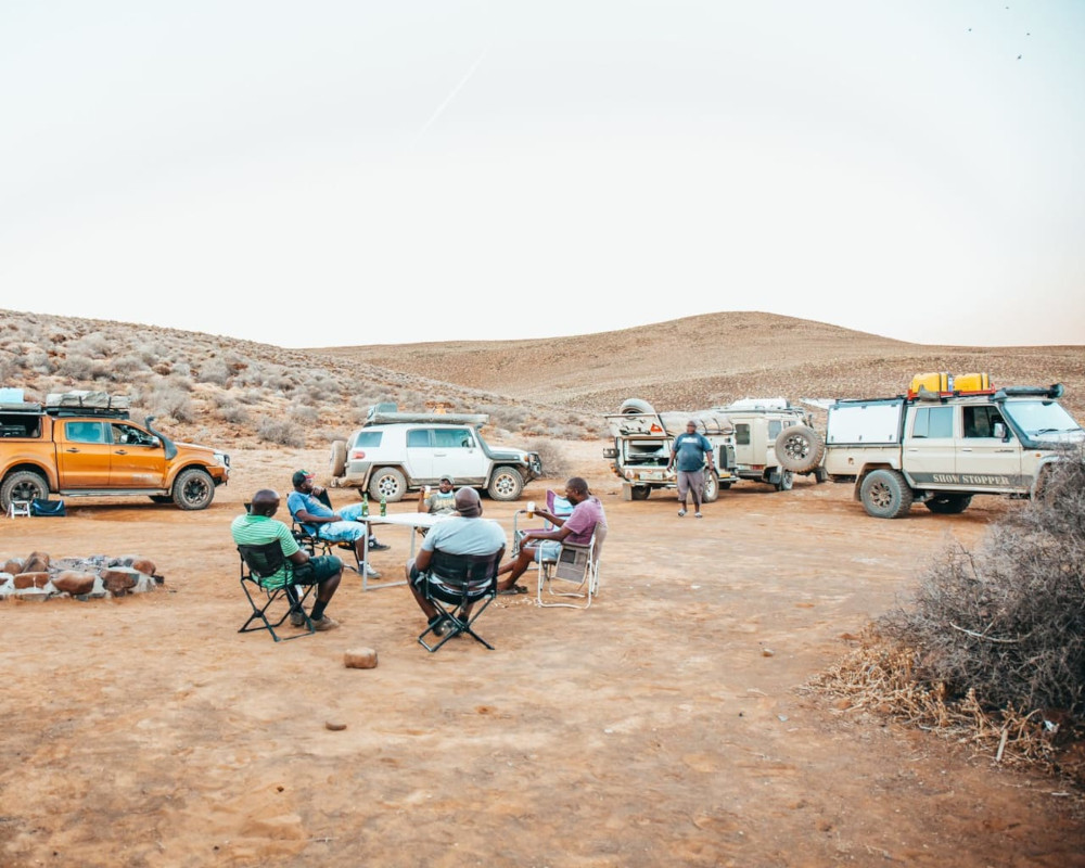
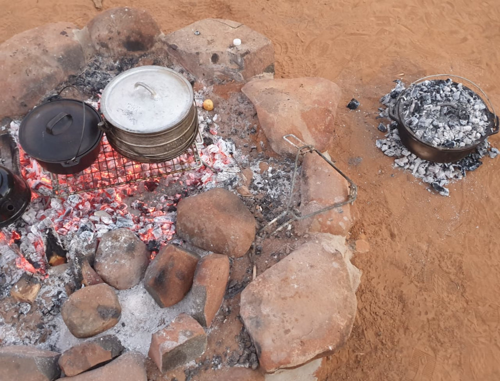
We spent a leisurely day at the campsite. Mduduzi Motsa prepared a lamb stew, served with cinnamon-infused pumpkin and freshly baked bread. Judah Mphela made the bread in my flat black cast iron pot, also called a Dutch oven. That evening we had a long campfire session. This is one of the things I love most about overlanding: sitting out under the stars, chatting to good friends.
A worthwhile detour
On our way to Sutherland we decided to go via the ever-popular Tankwa Padstal run by dreadlocked Oom Hein and his wife. This detour into the Western Cape was about 100km longer than the route leading straight from the park to Sutherland. But for an overlander who was in the Tankwa area the visit was worth the while. Tankwa Padstal is a convenience store cum diner cum curio shop cum bar that sells everything under the sun. You can find hot patches for bicycle tyres, repairs for gas bottles, homemade ginger beer, curios and everything in-between. The hosts of this joint are good and friendly people, who made us feel welcome when we stopped for a quick lunch.
Sutherland’s stars
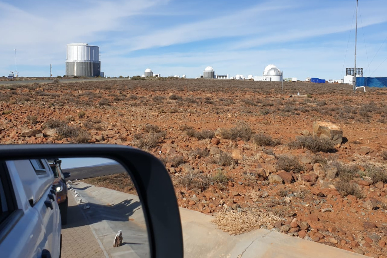
We arrived to a cold Sutherland in the late afternoon and checked in at the Sterland campsite, 5km outside town. This sleepy Karoo dorpie is known for its stars and snow. It is also renowned for hosting the internationally acclaimed South African Astronomical Observatory with the Southern African Large Telescope (SALT).
When the sun set and darkness set in, we could see why this is one of the best sites in the world for stargazing and astronomical observation. The Milky Way could not have been more beautiful to the naked eye than from our campsite. I marvelled at it for about 30 minutes, long after everyone of my mates had gone to bed and the campfire had been extinguished.
The next morning we had to be at the Observatory at 08:00 for our scheduled tour. For the first time on this trip, I wore long pants because the morning air had a bite in it. Our friendly tour guide, Claudine, took us into the large telescope and explained its intricacies. It was interesting to learn that other nations also have observation stations at Sutherland. I could see countries like the Netherlands, Japan and the USA.
The trip comes to an end
For our last night together as the Meerkat Squad, we headed to Victoria West via Fraserburg and Loxton. In Loxton we got back on tar for the stretch to Victoria West. Our destination: Camp Nguni, a luxury lodge 30km outside town. For once, we didn’t set up our tents. Our last night together as a group was spent at the lodge, looking back on a successful trip. The next day I would drive back to Kimberley via the N12 while my maatjies would head for Richmond and the N1 to return to Gauteng.
When we undertook this expedition, we were all relative overlanding novices. It was the first time we had undertaken such a long overlanding trip without an experienced expedition leader. In fact, it was only Judah Mpela of Darkie Gone Wild who had a bit more experience than the rest of us. What helped us a great deal was that we were navigating our trip using Tracks4Africa GPS maps. I can vouch that those easy-to-use maps made it child’s play to find our intended destinations – even in the middle of nowhere.
The complete Tracks4Africa GPS Mapset covers roads across the entire continent of Africa. So whether you want to explore back roads in your backyard or travel further afield, our GPS maps have you covered. For your convenience, the GPS maps also come preloaded on SD Card for plug and navigate.
See more of Black Boy Adventures on:

Clearly all had a good time! Nicely written,thanks.
I will now put this one on my itinerary
great read , thank you
Looks like so much fun. I am going to drive some of those roads now.
Enjoy your explorations and let us know how you go.
What a great bunch of guys, thanks for sharing with us. Ed- Kuhamba Kubona ( Travelling opens one’s eyes)