Yes, you can take part in mapping Africa. Follow these simple instructions and learn how to share GPS data from your next overland trip.
How did Tracks4Africa develop its reputation as the go-to route finder for travellers in Africa? We are a navigation company built for overlanders, by overlanders. We collect, catalogue and process your travel information in order to produce some of the most trusted GPS maps of Africa out there. Thanks to you, our navigation products are reputed as reliable, up-to-date and detailed. And we’d like to keep it that way! Share your data with us and help others travel Africa informed.
How do I get involved?
There are three different ways to contribute data to Tracks4Africa:
- Submit GPS data from your overland trip (read more below)
- Share useful traveller info on our website by adding to, updating and correcting our online database
- List your business as a Point of Interest (POI) on our various platforms
As you journey through Africa, you can record valuable GPS data along the way (in the form of tracks and waypoints) and send it to us. We use this information to update all T4A maps as well as our website listings.
How do I submit GPS trip data to T4A?
We’re looking for two types of GPS data contributions: tracks and waypoints.
A track is a breadcrumb trail of your current GPS activity. In other words, it’s the road you have just driven or the path you have just walked.
A waypoint is a stopping place on a journey. Waypoints can be notable sights and attractions, toll gates and checkpoints, border posts, accommodation, fuel stops, and any POI (Point of Interest) that you come across. The sky’s the limit!
Both tracks and waypoints are immensely valuable because they tell people what roads to follow and what to look out for along the way.
It may seem complicated, but rest assured that submitting your GPS data is actually quite simple.
How do I get the data off my GPS and onto my computer?
You’ve reached your destination, your tracklog is full and your waypoints are detailed and precise. Now what?
You need to download your data onto your computer using Garmin’s software, either Basecamp or MapSource.
These applications allow you to view Garmin compatible maps on your Windows PC/laptop, do route planning, and transfer tracks, waypoints and routes between your computer and GPS device. Both are free to download.
Follow these step-by-step instructions on how to extract your tracks and waypoints.
Garmin MapSource
Connect your GPS to your PC
Open Garmin MapSource
Click on “Transfer” at the top of your toolbar
Select “Receive from Device”
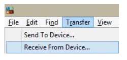
The following window will pop up
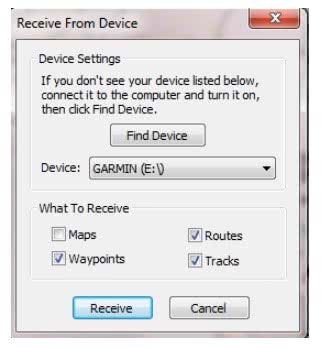
Tick the boxes of what you would like to receive
Click on “Receive”
The data will be listed on the left-hand side of the screen
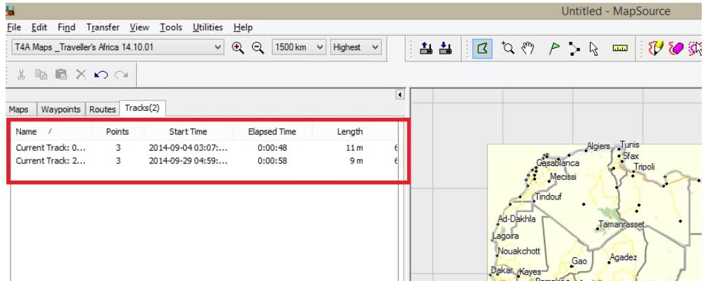
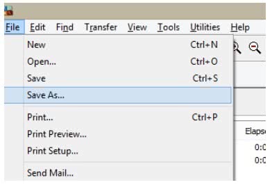
Save it to your desktop by going to File > Save As
Save the file in the file format that Mapsource prescribes: .gpx format
Garmin BaseCamp
Connect your GPS to your PC
Open Garmin Basecamp
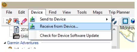
Click on “Device” at the top of your toolbar
Select “Receive from Device”
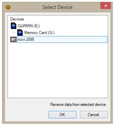
Select the device name to receive data from and click “OK”
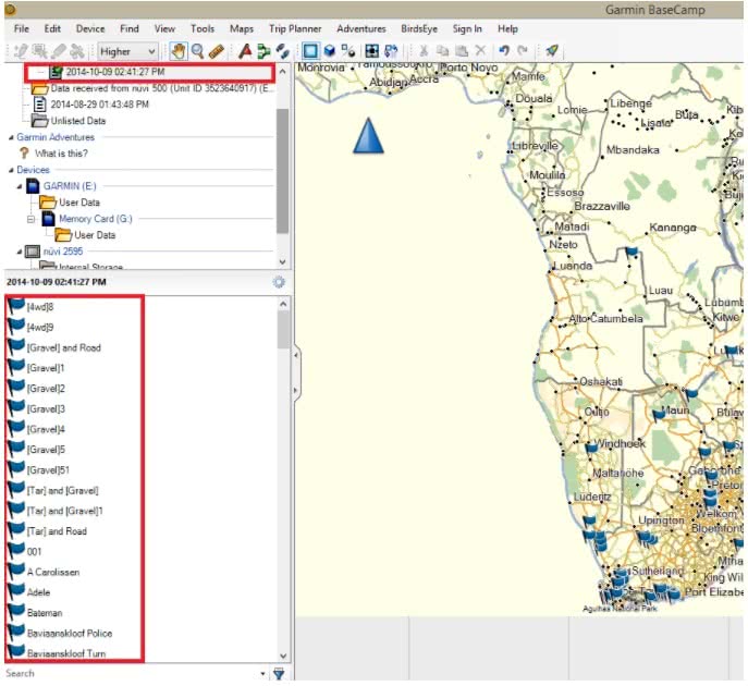
The data received from your GPS unit will then be listed on the left-hand side of your screen
Save it to your desktop by going to File > Save As
Save the file in the file format as BaseCamp prescribes: .gdb format
How do I send my data to Tracks4Africa?
Once your data has been downloaded, you are ready to send it to us! To submit data via our website, you need to register first. If you email us directly, you don’t need to be registered
For email, simply send your file as an attachment to newdata@tracks4africa.co.za. If the file is too large, you may need to compress it using something like WinZip.
We will notify you when your data has been processed. We may also come back to you with some questions if we need clarification on anything.
Anything else I need to know?
While you don’t have to become an official member of the T4A Data Community in order to contribute, we do encourage it.
Our community forum is run as a Google group and anyone using T4A GPS maps is welcome to join. Membership is free and voluntary.
As the best place for fellow travellers and experts to share information and ask questions related to using our GPS maps, it is the heartbeat of the T4A community.
Useful Links
Overview of T4A quality standards for data submissions
FAQs about GPS Maps for Garmin

Do not share information that is sensitive and on private land. I’ve come across tracks to rock paintings on private property and found it vandalised. Don’t share EVERYTHING. Rhino with their horns intact must not be shared as another example as to how these platforms help destroy all that is precious to us.