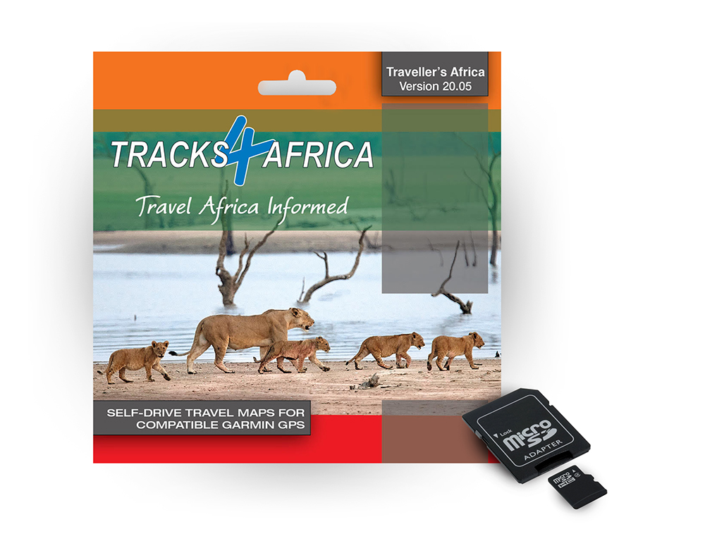
The new version of our GPS Maps has landed. Traveller’s Africa version 20.05 has new roads to help you stay on track wherever you go.
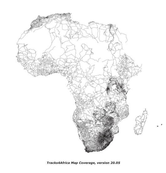
For self-drive overlanders, the Tracks4Africa GPS Maps on micro SD card is a game-changer. Simply plug the preloaded card into your map-capable Garmin unit and you’re ready to navigate Africa. What’s more, version 20.05 has been updated with the latest data from the field, with more places to eat, drink, refill your tank or spend the night. Road coverage for the continent has increased by 2%, thanks to the 342 data submissions received from other overlanders.

Since we’re working on a guide book on Zambia, there’s more detail on this must-visit country. The latest map release reflects a 6% increase on Zambian points of interest and 1% on roads. Some highlights include:
- Lusaka street name updates
- Lusaka malls updated – get your essentials more easily
- Bypass roads added – improved routing around the capital
- Fuels stops added
- Toll roads updated

Other major updates are on the Kenyan road network (17% increase) and 400 South African mountain passes that have been newly attributed.
What can you expect?
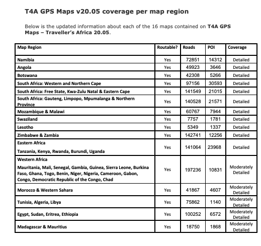
- 1,335,960km of roads – fully navigable and with detailed tourist coverage
- 168,707 points of interest
- 15,751 accommodation listings
- 4,205 campsites – the most complete camping database in Africa
- 2,385 parks – the most comprehensive list of protected areas
- 6,649 places to eat or drink
- 13,090 places to refuel
Who can use Tracks4Africa GPS Maps?
- The micro SD card with standard adapter is compatible with most map-capable Garmin units – both off-road models, such as the Montana and Overlander, and street navigators, such as the Drive series. View the full range of compatible devices.
- The card contains installation files for PC and Mac – can be used to transfer maps to older Garmin units such as the 276c, 76csx, previous generation eTrex.
The SD card is not compatible with:
- iGo in-car navigation systems
- Android smartphones/tablets
- Apple iPhones/iPads
Visit the Play Store or App Store to check out our Overland Navigator App or Tracks4Africa Guide App instead.
Get a free upgrade
Every purchase of the T4A Traveller’s Africa GPS Map comes with a free upgrade of the next version guaranteed, so you can be sure you’re navigating with the latest route info available. This doesn’t mean your GPS maps will stop working when a new version comes out. Once uploaded onto your Garmin it will keep going as long as your GPS does. You can even transfer the map from your old GPS to a new one. It just means you have the benefit of a free upgrade within a year cycle, so when new roads are built or river crossings close, you have that information to hand.
As a GPS maps user, you also get a 50% discount on all future SD cards purchased. To qualify, register your SD card on the T4A site. When the next version is released, you will automatically receive an email about your free upgrade. Read our upgrade policy for more information.
What’s new on version 20.05?
Hiking, MTB and 4WD Trails
- New path near Arusha leading to Hot Springs added
National parks, game reserves and protected areas
- Namaqua National Park Marine Protected Area information updated
- Tracks and lodging updated in Limpopo Transfrontier Park
- Seekoeivlei Nature Reserve updates
- Bivane Dam Nature Reserve updates
- Moonvalley River Camp added in Namib-Naukluft National Park
- Wolkberg Wilderness Area update
- Zinave National Park accommodation updates
General
- Ymansdam Outdoor Camping & Chalets added in Tankwa area
- Kallabakop Lodge & Campsite added in Tankwa area
- Berchtesgaden Game Ranch & Lifestyle Farm updated
- Waterval Plaas Campsites added South of Groenriviersmond
- Eagle’s Nest Riverside Camp added along the Breede River
- Tracks around Lake Kyogo, Uganda added
- Bubha Game Lodge added
- Landsberg Farm Campsite added West of Helmeringhausen
- Hennops Pride Lifestye Resort added
Buy now: Traveller’s Africa GPS Maps Version 20.05


