
Overlanding in the Mountain Kingdom, you can’t escape the rivers of Lesotho. From an awe-inspiring waterfall to an impressive dam, rivers run through the landscape like a silver thread. Henk Bogaards reports back on his Lesotho trip, which focused on the Senqunyane River Valley and Maletsunyane Falls in the first stage.
In May 2025, mine was one of four vehicles to explore Lesotho as part of a recce with Halfway Toyota Fourways. As we ventured deep into the remote countryside, we followed the course of rivers, splashed through water crossings and camped by the water’s edge.
Day 1: Ficksburg to Semonkong
It was early, very early, when I set off from Johannesburg. Leaving at 03:00 meant a long stretch in the dark, but my spotlights (DAG Midnight 7”) made a difference. A stunning sunrise greeted me en route, and I hoped it was a sign of great things to come.
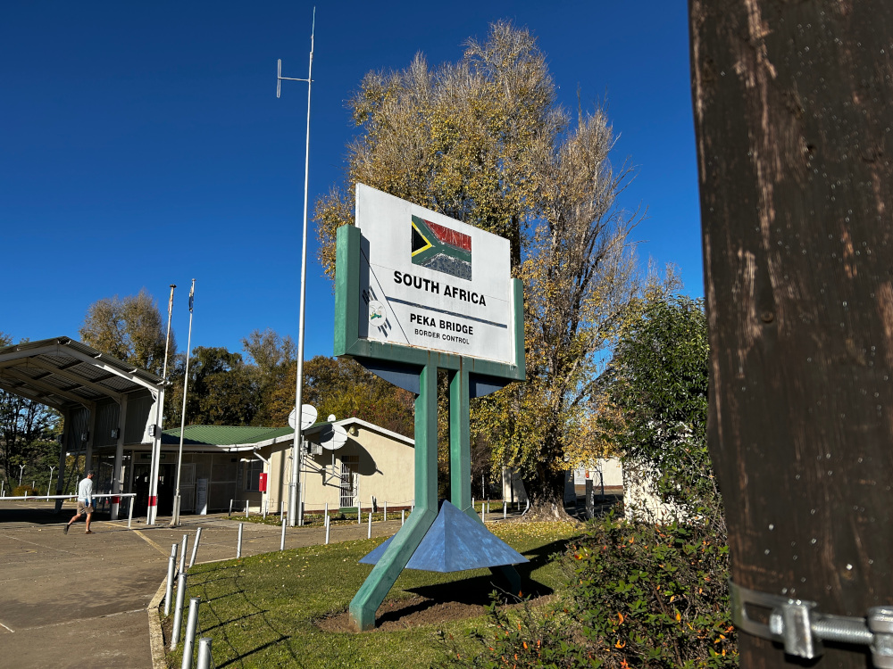
In Ficksburg, I met the rest of the group and after a quick radio check and refuelling, we headed for the Peka Bridge Border Post. Border procedures on both sides were efficient, and after paying the R100 entry fee, we were officially in Lesotho.
Our route took us toward Roma, with an interesting stop along the way: Mount Qiloane, a distinctive conical hill. According to local legend, this hill inspired the design of the Mokorotlo, the traditional Basotho hat. The hat has become a national symbol of Lesotho and is even featured on the country’s license plates. Mount Qiloane overlooks the historical plateau of Thaba Bosiu.
This flat-topped sandstone mountain, whose name translates to “Mountain at Night”, is perhaps the most important historical site in Lesotho. It served as the stronghold of King Moshoeshoe I, the founder of the Basotho nation, in the 19th century. The mountain provided a natural defence and was never conquered during Moshoeshoe’s time. Today, visitors can explore the Thaba Bosiu Cultural Village, where you can learn more about the nation’s origins and view royal graves.

Winding mountain passes
In Roma, we stopped at the prominent Catholic Church of Roma, known for being the spiritual heart of Lesotho’s Catholic community. There’s a steel platform here that was used by Pope John Paul II during his visit to address the Basotho people: a historic moment in the country’s religious history.
After Roma, the road became more exciting, with winding mountain passes, steep ascents and dramatic descents. The driving was exhilarating, and the rugged terrain made many of South Africa’s mountain passes feel tame in comparison.

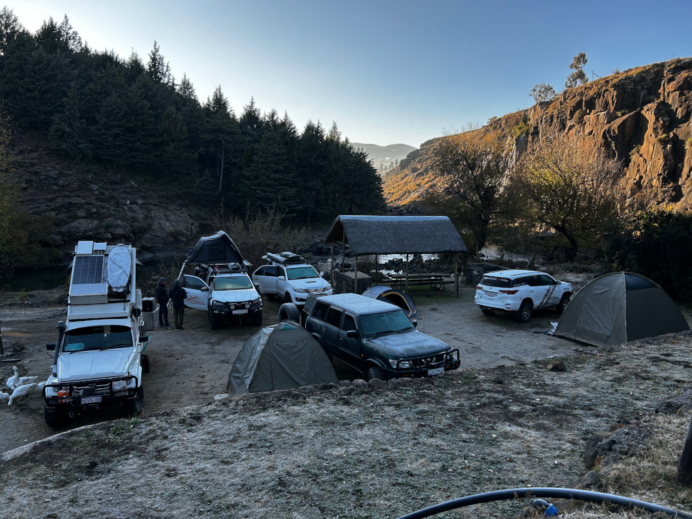
We finally arrived at Semonkong Lodge, where we had a light lunch at the Duck and Donkey Restaurant before setting up camp. Although chalets are available, we were there for the full camping experience.
Later in the afternoon, we set out to explore the area, aiming to reach the confluence of the Senqu River and the Senqunyane River. This journey included more mountain passes and steep descents. Brake fade is a real concern here, as the brakes can get extremely hot. Engine braking is essential, though on gradients this steep, a combination of both braking methods is necessary.
A tale of two rivers
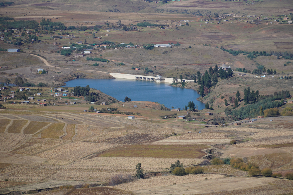
Reaching the confluence was a highlight. We took a moment to reflect on how these rivers connect and their importance. Interestingly, water from the Senqunyane River reaches South Africa in two ways:
- Via Mohale Dam: The Senqunyane feeds into this dam, from which water is channelled through a tunnel to Katse Dam. From Katse, it travels via the Ash River Outfall into the Vaal River, which later rejoins the Orange River near Douglas.
- Directly at the Confluence: The Senqunyane merges with the Senqu River, which flows westward and becomes the Orange River.
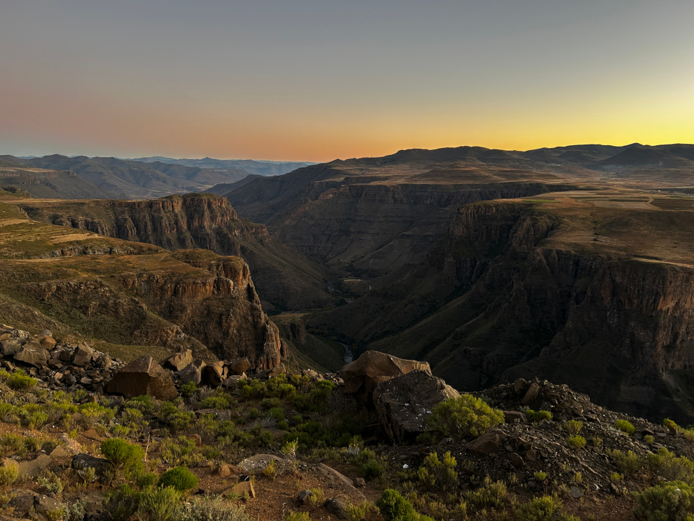
On our return, we stopped at a viewpoint on the same side as Maletsunyane Falls. The view was absolutely breathtaking even though the falls are not visible from this position. Some of our group remarked that it rivalled the vistas of the Fish River Canyon. While they are vastly different, both are magnificent in their own right. It was the perfect place to watch the sunset.
Back at Semonkong Lodge, we wrapped up the day with dinner at the restaurant – our final catered meal. From here onward, we would be cooking for ourselves.
Day 2: Semonkong to Maletsunyane Falls and Senqunyane River Valley
The night in Semonkong was bitterly cold: we woke to find a layer of ice both inside and outside our tents. After a quick coffee and some rusks, we packed up our camp (wet tents and all) and got ready for another day of exploration. Our plan was to reach a viewpoint overlooking the Senqunyane River Valley and assess the condition of the road leading down to it.
Shortly after leaving Semonkong, we turned off onto a gravel road. It was time to air down our tyres, and we all settled on a pressure of 1.8 bar. This leg of the trip would really put our equipment to the test. It also offered the chance to venture deeper into the heart of Lesotho and interact with the Basotho people.
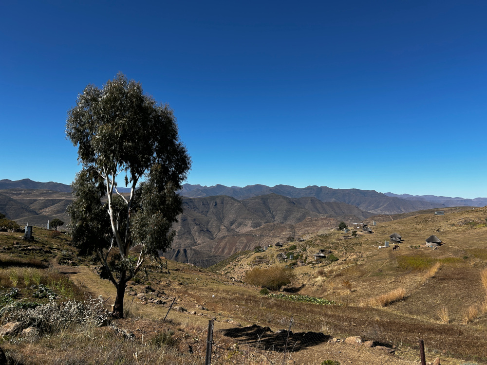
The road started off relatively smooth, but it gradually became rougher. While not an extreme 4×4 trail, having low-range capability made the technical sections far more manageable. The mountain scenery along this route is indescribable: rolling peaks, terraced fields and remote villages dot the landscape. It’s one of those places where you just have to roll down the window, breathe in the crisp mountain air and soak in the views.
Rugged and remote
We eventually left the “main road” – locally referred to as bus routes, although they’re not what most would consider drivable by a bus. This is where we officially engaged low-range gearing. A small river crossing was followed by a steep uphill climb. As we passed a school, a group of excited children came running to greet us. Don’t hand out sweets to children by the roadside. Dental care is not readily available in these remote areas. Rather consider gifting useful items like clothes, stationery or even tennis balls.
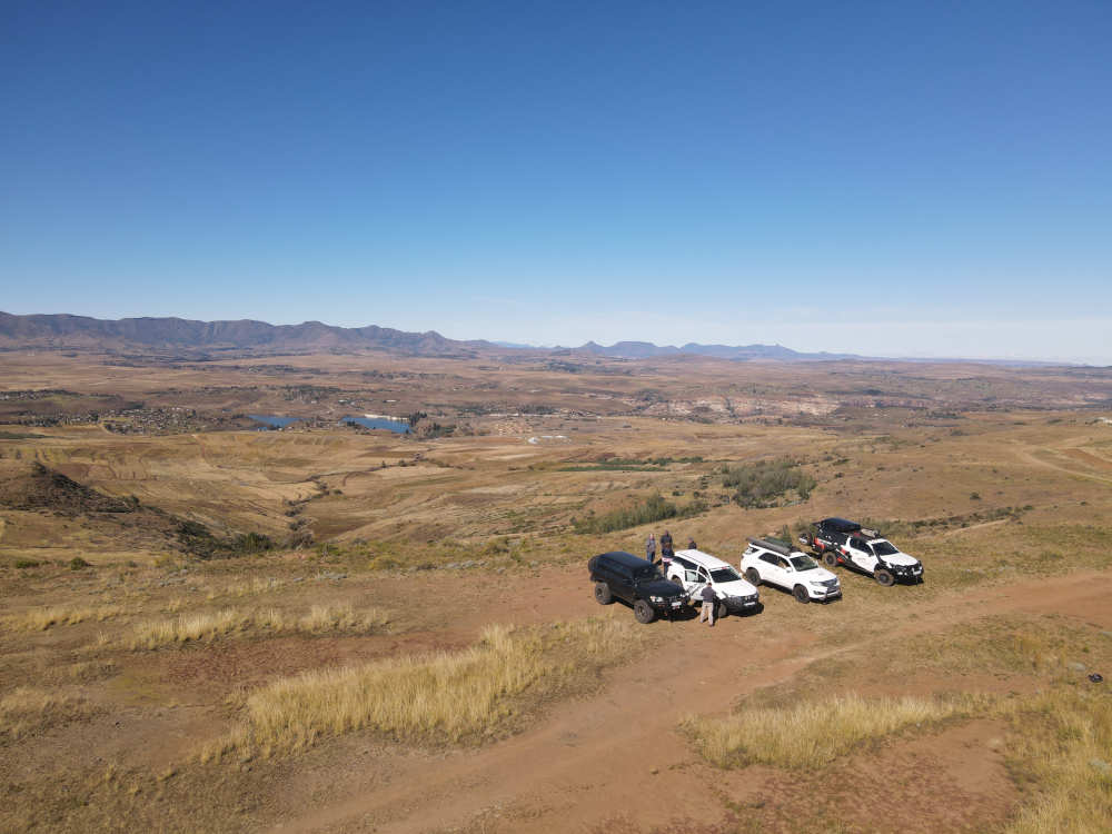
As we continued, the road became more technical, but the reward was worth it. We stopped at a viewpoint overlooking the Senqunyane River Valley, one of Lesotho’s most remote and rugged landscapes. The river winds through steep, jagged mountains and forms part of the catchment for the Lesotho Highlands Water Project.
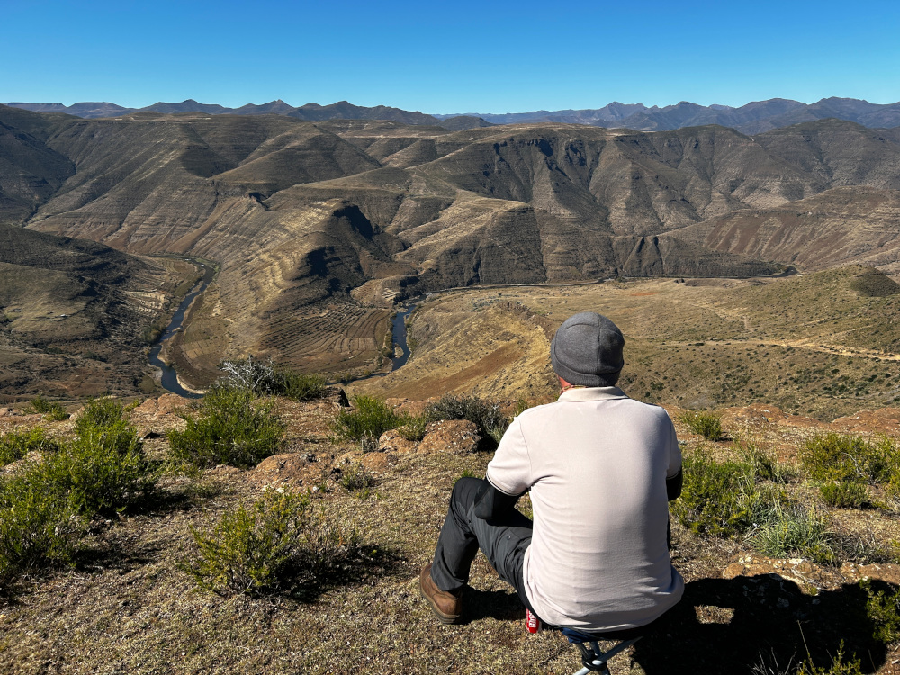
From the viewpoint, the scale of the valley is truly overwhelming. You look out over deep gorges, towering ridges and trails etched into the mountains by generations of Basotho. Watching the local children navigate these steep hillsides as if they were flat ground was humbling. Some were even playing with handmade bows and arrows. Life here is simple, yet rich in connection to the land. While they lack many of the material things children in cities take for granted, one could argue that they have something even more valuable: freedom, space and a strong sense of community.
The viewpoint also made for the perfect lunch stop. We pulled out our snacks and simply sat there, gazing out at the vastness and beauty of the valley below.
Magical Maletsunyane Falls
After lunch, we headed back to Semonkong. Our goal for the evening was to camp at a truly unique site near Maletsunyane Falls. First, we settled our bill at Semonkong Lodge and got the necessary approval for our chosen campsite.
From town, it was a short drive to Maletsunyane Falls, where we arrived just before sunset – perfect timing. It’s important to highlight that we obtained approval from the local chief beforehand to camp at this special spot. The land belongs to the community, and camping without permission would be disrespectful. Always seek approval and support local structures.
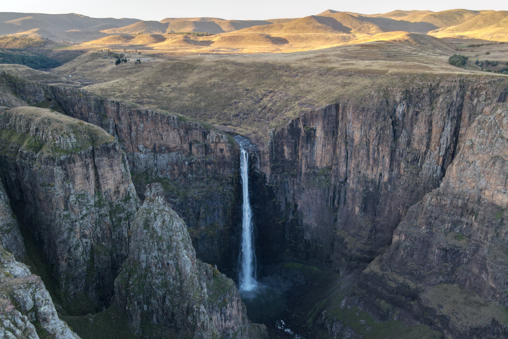

Camping beside Maletsunyane Falls is an unforgettable experience. Plunging 192 metres, it is one of the highest single-drop waterfalls in Southern Africa. The constant roar of the falls added a powerful soundtrack to our evening. According to legend, the name Maletsunyane means ‘place of smoke’, referring to the mist created by the falling water.
While setting up camp, a local child offered to help me pitch my tent – just another example of the Basotho people’s kindness and eagerness to assist visitors. Their friendliness and hospitality leave a lasting impression on anyone who visits this beautiful country.
We ended the day around a warm campfire, with the thunder of the waterfall in the background. It was a peaceful, almost spiritual moment and a reminder of how privileged we are to explore places like this.
In part 2, the trip continues on to Katse Dam – stay tuned.
For maps that reflect the reality on the ground, get the Lesotho Garmin GPS Map or South Africa Traveller’s Paper Map (which includes Lesotho). Plan your own route using the Tracks4Africa Online Trip Planner, then sync your route to the Tracks4Africa Guide App. The app is like carrying a paper map and guide book combo in your pocket. It uses your phone’s GPS to show where you are on the map so you can follow your route.
About the overlanders
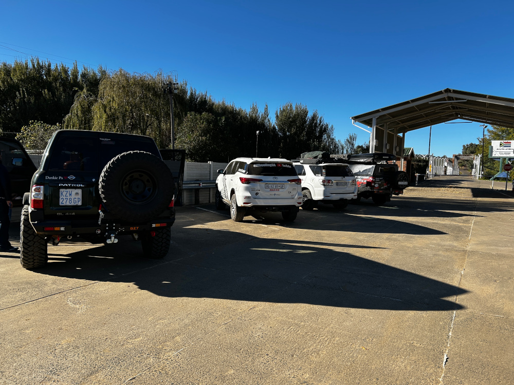
The convoy exploring Lesotho was made up of four vehicles:
Henk Bogaards: Behind the wheel of the GD6 Fortuner, kitted with upgrades ready for the highlands. The planner and storyteller, ever-ready with the camera to capture the magic of Lesotho. Watch Rivers of Lesotho ep.1
Ryan Otto: Driving his GD6 Hilux, the man behind the idea for this specific route, which turned the trip into a bigger, more adventurous expedition.
Dwayne Russell: In his trusty D4D Fortuner, always up for a challenge and quick with a helping hand when needed.
Douw & Marike Coetzee: Piloting the Nissan GU Patrol and bringing calm energy, good humour, and plenty of bush knowledge to the group.
Four vehicles, one shared passion for adventure and a lot of laughs along the way.

Hi, any possibilty of sharing the GPX or locations of the camping areas? Tx
Find the campsites here: Semonkong Lodge – https://tracks4africa.co.za/listings/item/w255704/semonkong-lodge-campsite/
Maletsunyane Falls (ask at Semonkong Lodge) – https://tracks4africa.co.za/listings/item/w174382/maletsunyane-falls-viewpoint/
Katse Dam (obtain permission at the visitor centre) – https://tracks4africa.co.za/listings/item/w174408/katse-dam-campsite/
Maloraneng/Mapoko Camp – https://tracks4africa.co.za/listings/item/w363221/maloraneng-lodge-chalets-and-campsite/
We lived in Lesotho from 1977-1981, working for Peace Corps, an American aid organization. At that time there was only about 100 kilometers of tarred road, all along the western lowlands. Everything else was either very rough 4×4 tracks (think Land Rover low range crawling over boulders) or horse & foot paths. The only way to get to Semonkong was to fly or walk. Our jobs were to supervise student teachers posted at isolated rural schools. I had a trusty Honda 125 and my wife rode a horse to get to her sites. As she approached a school for her visits a flock of small boys would charge out of the classroom vying for the privilege of caring for her pony. Since we learned Sesotho during our training and used it everyday we still cherish the many interesting encounters we had with the Basotho people. I remember taking long hiking trips to fish for trout in the rivers, listening to the whistling announcements from the herd boys tracking my progress as I moved through the mountains.
For a final adventure we rode our 3 horses for 5 days all across the country to deliver them to another volunteer site. On that trip we passed through remote roadless villages encountering herds of children, many of whom had never seen a Westerner before. I’ll never forget one older man who invited us into his house and gave us oranges, fruit which had been packed up there on a trader’s horse and undoubtedly sold for a pretty penny. We responded by offering to take his family’s picture with our “same time”, i.e. Polaroid camera. Everyone scrambled into the house, changed into their church clothes and regathered for their portrait.
We came back in 2015 to show our daughter where we lived. This time a Toyota Hi-Lux replaced the ponies and motorcycle of the past. I couldn’t believe how much Maseru had grown as well as the improved roads everywhere. While they made travel easier I’m really glad that we were able to experience the lesser developed country.
I look forward to reading about the rest of your journey.
Thank you for sharing these remarkable memories of Lesotho. What a special country it is.